How to get to Intermountain Health South Decatur Clinic by bus?
Click on the bus route to see step by step directions with maps, line arrival times and updated time schedules.
From Shark Reef Aquarium at Mandalay Bay, Paradise
54 minFrom Stewart Ave / Las Vegas Blvd N, Las Vegas
54 minFrom Oasis Express Lube, Paradise
66 minFrom The Animal Foundation (Lied Animal Shelter), Las Vegas
67 minFrom Summerlin Parkway & Town Center Drive, Las Vegas
80 minFrom S Hualapai Way / W Charleston Blvd, Las Vegas
43 minFrom Aria Receiving Dock, Paradise
59 minFrom Golden Nugget Hotel & Casino, Las Vegas
45 minFrom Pedro Yepez Complete Lawn Main, North Las Vegas
81 minFrom E Flamingo Rd / Pecos McLeod, Paradise
65 min
Bus stops near Intermountain Health South Decatur Clinic in Las Vegas
Bus lines to Intermountain Health South Decatur Clinic in Las Vegas
What are the closest stations to Intermountain Health South Decatur Clinic?
The closest stations to Intermountain Health South Decatur Clinic are:
- Wb Sahara After Arville is 264 yards away, 4 min walk.
- Nb Decatur After Sahara is 710 yards away, 9 min walk.
- Wb Charleston After Arville is 825 yards away, 10 min walk.
Which bus lines stop near Intermountain Health South Decatur Clinic?
These bus lines stop near Intermountain Health South Decatur Clinic: 103, 104, 206.
What’s the nearest bus station to Intermountain Health South Decatur Clinic in Las Vegas?
The nearest bus station to Intermountain Health South Decatur Clinic in Las Vegas is Wb Sahara After Arville. It’s a 4 min walk away.
What time is the first bus to Intermountain Health South Decatur Clinic in Las Vegas?
The 206 is the first bus that goes to Intermountain Health South Decatur Clinic in Las Vegas. It stops nearby at 3:02 AM.
What time is the last bus to Intermountain Health South Decatur Clinic in Las Vegas?
The 206 is the last bus that goes to Intermountain Health South Decatur Clinic in Las Vegas. It stops nearby at 3:46 AM.
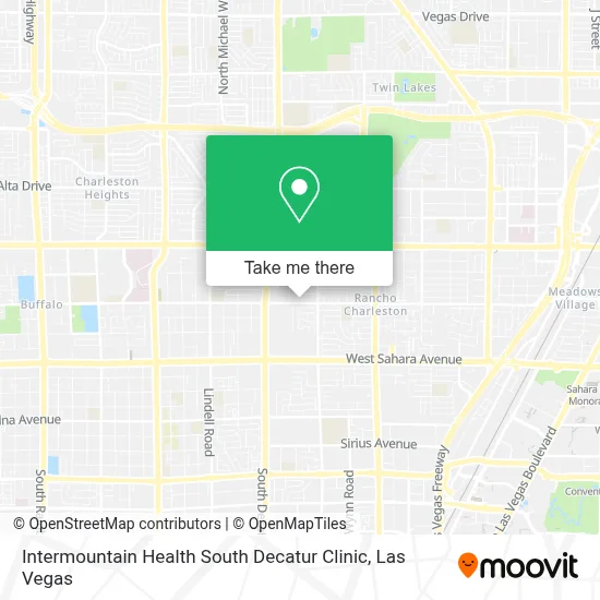
See Intermountain Health South Decatur Clinic, Las Vegas, on the map
Public Transit to Intermountain Health South Decatur Clinic in Las Vegas
Wondering how to get to Intermountain Health South Decatur Clinic in Las Vegas? Moovit helps you find the best way to get to Intermountain Health South Decatur Clinic with step-by-step directions from the nearest public transit station.
Moovit provides free maps and live directions to help you navigate through your city. View schedules, routes, timetables, and find out how long does it take to get to Intermountain Health South Decatur Clinic in real time.
Looking for the nearest stop or station to Intermountain Health South Decatur Clinic? Check out this list of stops closest to your destination: Wb Sahara After Arville; Nb Decatur After Sahara; Wb Charleston After Arville.
Bus: 103, 104, 206, SX.
Want to see if there’s another route that gets you there at an earlier time? Moovit helps you find alternative routes or times. Get directions from and directions to Intermountain Health South Decatur Clinic easily from the Moovit App or Website.
We make riding to Intermountain Health South Decatur Clinic easy, which is why over 1.7 million users, including users in Las Vegas, trust Moovit as the best app for public transit. You don’t need to download an individual bus app or train app, Moovit is your all-in-one transit app that helps you find the best bus time or train time available.
For information on prices of bus, costs and ride fares to Intermountain Health South Decatur Clinic, please check the Moovit app.
Use the app to navigate to popular places including to the airport, hospital, stadium, grocery store, mall, coffee shop, school, college, and university.
Intermountain Health South Decatur Clinic Address: 4500 W Oakey Blvd street in Las Vegas
- Tea Rapha,
- Cocos Locos E47a,
- Oakey Healthcare Center,
- S Decatur Blvd / W Oakey Blvd,
- Fantastic Indoor Swap Meet,
- Walmart Supercenter,
- Decatur & Oakey,
- Iglesia Cristiana Jehova Jireh,
- T.J. Maxx,
- Dd's Discounts,
- Walmart,
- Walmart Las Vegas - W Charleston Blvd,
- Blueberry Hill Family Restaurant,
- SKECHERS Factory Outlet,
- Ross,
- Octapharma Plasma,
- Ross Dress for Less,
- Goodwill,
- Trader Joe's,
- Sahara Pavilion North Shopping Center
Places Near Intermountain Health South Decatur Clinic (Las Vegas)
- Omega Mart, Las Vegas,
- Area15, Las Vegas,
- Gold & Silver Pawn Shop, Las Vegas,
- Trump International Hotel Las Vegas, Paradise,
- The Neon Museum, Las Vegas,
- Walmart, Las Vegas,
- Allegiant Stadium, Paradise,
- Zak Bagans Haunted Museum, Las Vegas,
- Walmart Supercenter, Las Vegas,
- The Deuce Bus Stop at Fremont St, Las Vegas,
- Arte Museum Las Vegas, Paradise,
- Lee Canyon, Las Vegas,
- Las Vegas North Premium Outlets, Las Vegas,
- Meow Wolf - Las Vegas (Meow Wolf's Omega Mart), Las Vegas,
- Town Square, Enterprise,
- Welcome To Fabulous Las Vegas Sign, Paradise,
- Las Vegas South Premium Outlets, Enterprise,
- The Palms Casino Resort, Paradise,
- Koolsville Tattoos, Las Vegas,
- Las Vegas Premium Outlets-North, Enterprise
How to get to popular places in Las Vegas with public transit
Get around Las Vegas by public transit!
Traveling around Las Vegas has never been so easy. See step by step directions as you travel to any attraction, street or major public transit station. View bus and train schedules, arrival times, service alerts and detailed routes on a map, so you know exactly how to get to anywhere in Las Vegas.
When traveling to any destination around Las Vegas use Moovit's Live Directions with Get Off Notifications to know exactly where and how far to walk, how long to wait for your line, and how many stops are left. Moovit will alert you when it's time to get off — no need to constantly re-check whether yours is the next stop.
Wondering how to use public transit in Las Vegas or how to pay for public transit in Las Vegas? Moovit public transit app can help you navigate your way with public transit easily, and at minimum cost. It includes public transit fees, ticket prices, and costs. Looking for a map of Las Vegas public transit lines? Moovit public transit app shows all public transit maps in Las Vegas with all Bus and Monorail routes and stops on an interactive map.
Las Vegas has 2 transit type(s), including: Bus and Monorail, operated by several transit agencies, including RTCSNV, City of Las Vegas, Alvand Transportation, Vegas Airporter, Las Vegas Monorail, FlixBus-us and Greyhound-us