Directions to International Christian School of Chaplaincy (Deerfield Beach) with public transportation
The following transit lines have routes that pass near International Christian School of Chaplaincy
 Bus: 31.
How to get to International Christian School of Chaplaincy by bus?
Click on the bus route to see step by step directions with maps, line arrival times and updated time schedules.
From Cam Transfer, Coral Springs-Margate
55 minFrom The Westin Fort Lauderdale, Fort Lauderdale
65 minFrom The Red Light District, Fort Lauderdale
86 minFrom Margate, FL, Coral Springs-Margate
51 minFrom Coral Square Mall Shopping Center, Coral Springs-Margate
77 minFrom Amerant Bank, Fort Lauderdale
66 minFrom Broward College North Campus Bldg. 48, Pompano Beach
23 minFrom JP Taravella High School, Coral Springs-Margate
76 minFrom Bepxxx, Fort Lauderdale
86 minFrom CCA Calvary Christian Academy, Fort Lauderdale
59 min
Bus stop near International Christian School of Chaplaincy in Deerfield Beach
- Lyons Road/Banyan Trails Drive - (Hilton Road), 8 min walk,VIEW
Bus lines to International Christian School of Chaplaincy in Deerfield Beach
- 31, Central Terminal Via Bc North,VIEW
What are the closest stations to International Christian School of Chaplaincy?
The closest stations to International Christian School of Chaplaincy are:
- Lyons Road/Banyan Trails Drive - (Hilton Road) is 615 yards away, 8 min walk.
Which bus line stops near International Christian School of Chaplaincy?
31 (Lyons - Hillsboro Via Bc North)
What’s the nearest bus station to International Christian School of Chaplaincy in Deerfield Beach?
The nearest bus station to International Christian School of Chaplaincy in Deerfield Beach is Lyons Road/Banyan Trails Drive - (Hilton Road). It’s a 8 min walk away.
What time is the first bus to International Christian School of Chaplaincy in Deerfield Beach?
The 31 is the first bus that goes to International Christian School of Chaplaincy in Deerfield Beach. It stops nearby at 6:10 AM.
What time is the last bus to International Christian School of Chaplaincy in Deerfield Beach?
The 31 is the last bus that goes to International Christian School of Chaplaincy in Deerfield Beach. It stops nearby at 12:12 AM.
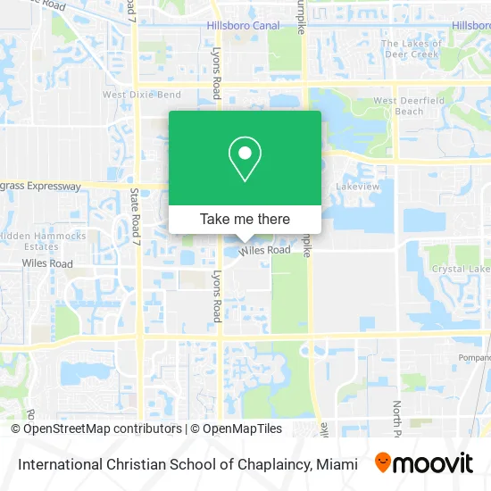
See International Christian School of Chaplaincy, Deerfield Beach, on the map
Public Transit to International Christian School of Chaplaincy in Deerfield Beach
Wondering how to get to International Christian School of Chaplaincy in Deerfield Beach? Moovit helps you find the best way to get to International Christian School of Chaplaincy with step-by-step directions from the nearest public transit station.
Moovit provides free maps and live directions to help you navigate through your city. View schedules, routes, timetables, and find out how long does it take to get to International Christian School of Chaplaincy in real time.
Looking for the nearest stop or station to International Christian School of Chaplaincy? Check out this list of stops closest to your destination: Lyons Road/Banyan Trails Drive - (Hilton Road).
Bus: 31.
Want to see if there’s another route that gets you there at an earlier time? Moovit helps you find alternative routes or times. Get directions from and directions to International Christian School of Chaplaincy easily from the Moovit App or Website.
We make riding to International Christian School of Chaplaincy easy, which is why over 1.5 million users, including users in Deerfield Beach, trust Moovit as the best app for public transit. You don’t need to download an individual bus app or train app, Moovit is your all-in-one transit app that helps you find the best bus time or train time available.
For information on prices of bus, costs and ride fares to International Christian School of Chaplaincy, please check the Moovit app.
Use the app to navigate to popular places including to the airport, hospital, stadium, grocery store, mall, coffee shop, school, college, and university.
International Christian School of Chaplaincy Address: 4667 St Simon Dr Pompano Beach, FL 33073 street in Deerfield Beach
- Spitfire Farm,
- Retina Eye Specialists,
- Dr Hugues Jean,
- Florida Endovascular A,
- Bannis Martial Arts,
- Luxe Pet Care - Shampoodles,
- JT's Cuts Barbershop,
- WING STOP,
- Mystical Spirits Wine & Liquor,
- Bright N Shine Delray,
- Green World Lawn & Landscaping,
- Medicus Medical Center,
- Excellent Retinologist Great Doctor Superb Person,
- bp,
- 4525 Wiles Rd Parking,
- Pompano Beach Fl,
- Jr Dr Ek Edwards,
- Abyssian Baptist Church of Christ,
- Max Home Services,
- Lyons Rd / Wiles Rd
Places Near International Christian School of Chaplaincy (Deerfield Beach)
- Dolphin Mall Bus, Miami,
- Brickell City Centre, Miami,
- Zoo Miami, Miami,
- Little Havana, Miami,
- Dolphin Mall, Miami,
- Aventura Mall, Miami,
- Port of Miami Cruise Terminal, Miami,
- Bayside Marketplace, Miami,
- Marlins Park, Miami,
- Hard Rock Stadium, Miami Gardens,
- Sawgrass Mall, Miami,
- Miami VA Hospital, Miami,
- Miami Freedom Park, Miami,
- Aventura Mall, Miami Beach,
- Keiser University Flagship Campus, West Palm Beach,
- Miami Design District, Miami,
- Richard E. Gerstein Justice Building, Miami,
- Wynwood, Miami,
- Sawgrass mall ( FL ), Miami Beach,
- Miami-Dade County Courthouse, Miami
How to get to popular places in Miami with public transit
Get around Deerfield Beach by public transit!
Traveling around Deerfield Beach has never been so easy. See step by step directions as you travel to any attraction, street or major public transit station. View bus and train schedules, arrival times, service alerts and detailed routes on a map, so you know exactly how to get to anywhere in Deerfield Beach.
When traveling to any destination around Deerfield Beach use Moovit's Live Directions with Get Off Notifications to know exactly where and how far to walk, how long to wait for your line, and how many stops are left. Moovit will alert you when it's time to get off — no need to constantly re-check whether yours is the next stop.
Wondering how to use public transit in Deerfield Beach or how to pay for public transit in Deerfield Beach? Moovit public transit app can help you navigate your way with public transit easily, and at minimum cost. It includes public transit fees, ticket prices, and costs. Looking for a map of Deerfield Beach public transit lines? Moovit public transit app shows all public transit maps in Deerfield Beach with all Bus, Train, Light Rail and Ferry routes and stops on an interactive map.
Miami has 4 transit type(s), including: Bus, Train, Light Rail and Ferry, operated by several transit agencies, including Broward County Transit, Miami-Dade Transit, Metrorail, Palm Tran, Tri-Rail, Brightline, MARTY, City of Homestead Trolley, Key West Transit, Treasure Coast Connector, GoLine IRT, Amtrak, Greyhound-us, FlixBus-us and Aventura Express Shuttle Bus