How to get to International Language School by bus?
Click on the bus route to see step by step directions with maps, line arrival times and updated time schedules.
From Fraccionamiento Sol Naciente, Aguascalientes
62 minFrom Avenida Ayuntamiento, Aguascalientes
47 minFrom Universidad Tecnológica Metropolitana De Aguascalientes, Aguascalientes
45 minFrom J. Guadalupe Peralta Gamez, Aguascalientes
48 minFrom Altaria, Aguascalientes
37 minFrom Sat, Aguascalientes
33 minFrom Fracc. Periodistas, Aguascalientes
56 minFrom Fracc. Lomas de Vista Bella, Aguascalientes
55 minFrom Tianguis de Lomas del Ajedrez, Aguascalientes
51 minFrom Periodistas, Aguascalientes
56 min
Bus stops near International Language School in Aguascalientes
Bus lines to International Language School in Aguascalientes
- RUTA 18, Uaa,VIEW
- RUTA 35, Uaa,VIEW
- RUTA 45, Valle De Los Cactus - Uaa,VIEW
- RUTA 40, Terminal Oriente - Terminal Oriente (N),VIEW
- RUTA 30, Martínez Dóminguez,VIEW
- RUTA 04, Mahatma Gandhi - Jesús María,VIEW
- RUTA 11, Mahatma Gandhi,VIEW
- RUTA 33, Jesús María,VIEW
- RUTA 38, Paso Blanco,VIEW
- RUTA 40, Terminal Oriente - Terminal Oriente (S),VIEW
What are the closest stations to International Language School?
The closest stations to International Language School are:
- Boulevard Luis Donaldo Colosio Murrieta, 1722(722) is 309 meters away, 5 min walk.
- Unidad Medica Didáctica Uaa is 629 meters away, 9 min walk.
- Avenida Aguascalientes Norte, 108 is 826 meters away, 11 min walk.
- Avenida Universidad, 1003 is 869 meters away, 11 min walk.
- Avenida Aguascalientes Norte, 216 is 1126 meters away, 15 min walk.
Which bus lines stop near International Language School?
These bus lines stop near International Language School: RUTA 11, RUTA 18, RUTA 30, RUTA 35.
What’s the nearest bus station to International Language School in Aguascalientes?
The nearest bus station to International Language School in Aguascalientes is Boulevard Luis Donaldo Colosio Murrieta, 1722(722). It’s a 5 min walk away.
What time is the first bus to International Language School in Aguascalientes?
The RUTA 40 is the first bus that goes to International Language School in Aguascalientes. It stops nearby at 6:03 AM.
What time is the last bus to International Language School in Aguascalientes?
The RUTA 45 is the last bus that goes to International Language School in Aguascalientes. It stops nearby at 10:07 PM.
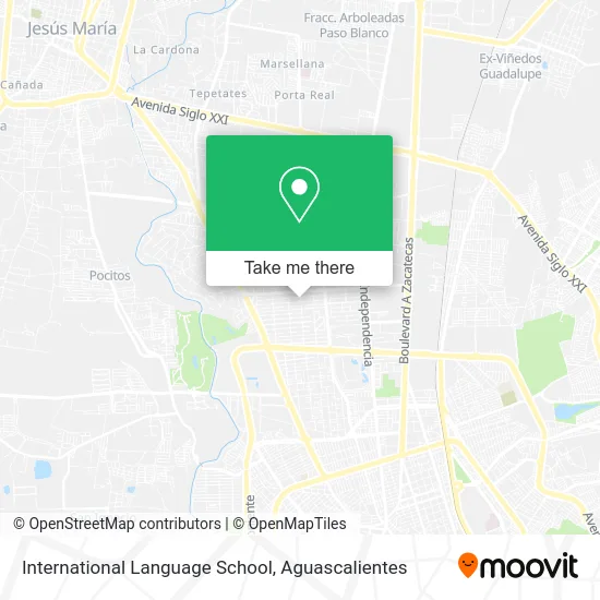
See International Language School, Aguascalientes, on the map
Public Transit to International Language School in Aguascalientes
Wondering how to get to International Language School in Aguascalientes? Moovit helps you find the best way to get to International Language School with step-by-step directions from the nearest public transit station.
Moovit provides free maps and live directions to help you navigate through your city. View schedules, routes, timetables, and find out how long does it take to get to International Language School in real time.
Looking for the nearest stop or station to International Language School? Check out this list of stops closest to your destination: Boulevard Luis Donaldo Colosio Murrieta; Unidad Medica Didáctica Uaa; Avenida Aguascalientes Norte; Avenida Universidad; Avenida Aguascalientes Norte.
Bus: RUTA 11, RUTA 18, RUTA 30, RUTA 35, RUTA 45, RUTA 40, RUTA 04, RUTA 33, RUTA 38, RUTA 40.
Want to see if there’s another route that gets you there at an earlier time? Moovit helps you find alternative routes or times. Get directions from and directions to International Language School easily from the Moovit App or Website.
We make riding to International Language School easy, which is why over 1.5 million users, including users in Aguascalientes, trust Moovit as the best app for public transit. You don’t need to download an individual bus app or train app, Moovit is your all-in-one transit app that helps you find the best bus time or train time available.
For information on prices of bus, costs and ride fares to International Language School, please check the Moovit app.
Use the app to navigate to popular places including to the airport, hospital, stadium, grocery store, mall, coffee shop, school, college, and university.
International Language School Address: Calle San Julián 902, Fracc Jardines de la Concepcion I, 20120 Aguascalientes, Aguascalientes street in Aguascalientes
- Fracc Jardines de la Concepcion I,
- TT Tower Business Center,
- Residencia Los Ángeles,
- Omeyocan Psicotrapia,
- Consultorio Psicológico,
- Consultorio Dental am Ortodoncia,
- Templo de Nuestra Señora de los Bosques,
- Mozione,
- Laboratorio Óptico Computarizado,
- Boulevard Luis Donaldo Colosio Murrieta,
- Rodriguez Figueroa Norma Cecilia,
- Oxxo Suc 50ado 2000 Agu,
- Colegio Bosques,
- Integradora Logística y Administrativa del Centro,
- Promotoria de Seguros,
- Descubriendo a Tiki,
- Decoraciones de Globos Deli,
- Bosques International School Kinder,
- Area de Juegos Parque Los Bosques Los Bosques Aguascalientes,
- Mr Tiky Burritos Norteños
Places Near International Language School (Aguascalientes)
- clinica 3 uaa, Aguascalientes,
- Jesús María, Aguascalientes,
- Agropecuario, Aguascalientes,
- Centro, Aguascalientes,
- La Isla San Marcos, Aguascalientes,
- Imss Clinica 1, Aguascalientes,
- Villas de Nuestra Señora de la Asunción, Aguascalientes,
- ESPACIOS, Aguascalientes,
- Ciudad industrial, Aguascalientes,
- Hospital Imss No. 3, Aguascalientes,
- Terminal De Combis, Aguascalientes,
- Isla San Marcos, Aguascalientes,
- Centro Comercial Altaria, Aguascalientes,
- Blvd. Luis Donaldo Colosio, Aguascalientes,
- Nuevo Hospital Hidalgo, Aguascalientes,
- Parque Las Tres Centurias, Aguascalientes,
- Villasuncion, Aguascalientes,
- Universidad Autónoma de Aguascalientes, Aguascalientes,
- Aeropuerto de Aguascalientes S.A. de C.V., Aguascalientes,
- Central De Autobuses, Aguascalientes
How to get to popular places in Aguascalientes with public transit
Get around Aguascalientes by public transit!
Traveling around Aguascalientes has never been so easy. See step by step directions as you travel to any attraction, street or major public transit station. View bus and train schedules, arrival times, service alerts and detailed routes on a map, so you know exactly how to get to anywhere in Aguascalientes.
When traveling to any destination around Aguascalientes use Moovit's Live Directions with Get Off Notifications to know exactly where and how far to walk, how long to wait for your line, and how many stops are left. Moovit will alert you when it's time to get off — no need to constantly re-check whether yours is the next stop.
Wondering how to use public transit in Aguascalientes or how to pay for public transit in Aguascalientes? Moovit public transit app can help you navigate your way with public transit easily, and at minimum cost. It includes public transit fees, ticket prices, and costs. Looking for a map of Aguascalientes public transit lines? Moovit public transit app shows all public transit maps in Aguascalientes with all bus routes and stops on an interactive map.
Aguascalientes has 1 transit type(s), including: bus, operated by several transit agencies, including Coordinación General de Movilidad