Directions to Internet Accuracy Solutions (Manzanares El Real) with public transportation
The following transit lines have routes that pass near Internet Accuracy Solutions
 Bus: 720, 724, AUTOBUSITO, 728, LANZADERA.
How to get to Internet Accuracy Solutions by bus?
Click on the bus route to see step by step directions with maps, line arrival times and updated time schedules.
From Heron City Madrid, Área Metropolitana De Madrid Y Corredor Del Henares
137 minFrom Hospital HM Universitario Torrelodones, Torrelodones
136 minFrom Piscinas Naturales Las Berceas, Cercedilla
96 minFrom Polígono P-29, Collado Villalba
58 minFrom The Style Outlets Las Rozas, Las Rozas De Madrid
138 minFrom Hospital De La Fuenfría., Cuenca Del Guadarrama
179 minFrom Hospital Público de Collado Villalba, Collado Villalba
37 minFrom Las Presillas, Rascafría
328 minFrom Tanatorio La Paz, Alcobendas
51 minFrom Centro Penitenciario Madrid V - Soto Del Real, Cuenca Alta Del Manzanares
70 min
Bus stops near Internet Accuracy Solutions in Manzanares El Real
Bus lines to Internet Accuracy Solutions in Manzanares El Real
What are the closest stations to Internet Accuracy Solutions?
The closest stations to Internet Accuracy Solutions are:
- C/ Panaderos Esquina Nº 48 is 51 meters away, 1 min walk.
- Manzanares El Real - Gta. El Montañero is 524 meters away, 7 min walk.
Which bus lines stop near Internet Accuracy Solutions?
These bus lines stop near Internet Accuracy Solutions: 720, 724.
What’s the nearest bus station to Internet Accuracy Solutions in Manzanares El Real?
The nearest bus station to Internet Accuracy Solutions in Manzanares El Real is C/ Panaderos Esquina Nº 48. It’s a 1 min walk away.
What time is the first bus to Internet Accuracy Solutions in Manzanares El Real?
The 724 is the first bus that goes to Internet Accuracy Solutions in Manzanares El Real. It stops nearby at 4:54 AM.
What time is the last bus to Internet Accuracy Solutions in Manzanares El Real?
The 724 is the last bus that goes to Internet Accuracy Solutions in Manzanares El Real. It stops nearby at 12:25 AM.
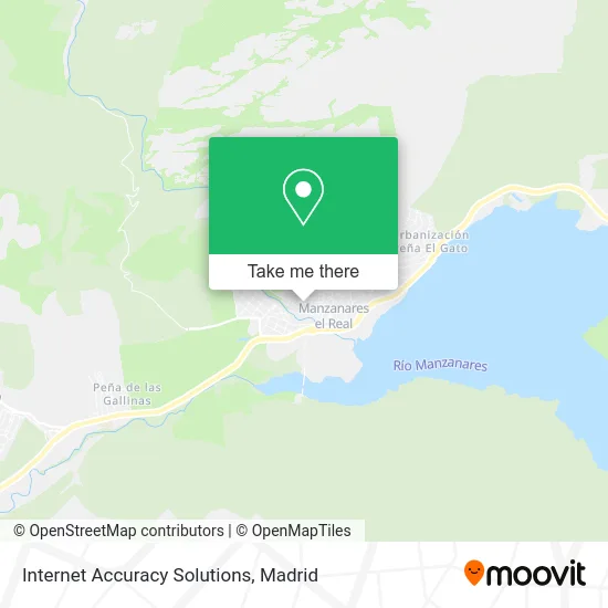
See Internet Accuracy Solutions, Manzanares El Real, on the map
Public Transit to Internet Accuracy Solutions in Manzanares El Real
Wondering how to get to Internet Accuracy Solutions in Manzanares El Real? Moovit helps you find the best way to get to Internet Accuracy Solutions with step-by-step directions from the nearest public transit station.
Moovit provides free maps and live directions to help you navigate through your city. View schedules, routes, timetables, and find out how long does it take to get to Internet Accuracy Solutions in real time.
Looking for the nearest stop or station to Internet Accuracy Solutions? Check out this list of stops closest to your destination: C/ Panaderos Esquina Nº 48; Manzanares El Real - Gta. El Montañero.
Bus: 720, 724, AUTOBUSITO, 728, LANZADERA.
Want to see if there’s another route that gets you there at an earlier time? Moovit helps you find alternative routes or times. Get directions from and directions to Internet Accuracy Solutions easily from the Moovit App or Website.
We make riding to Internet Accuracy Solutions easy, which is why over 1.5 million users, including users in Manzanares El Real, trust Moovit as the best app for public transit. You don’t need to download an individual bus app or train app, Moovit is your all-in-one transit app that helps you find the best bus time or train time available.
For information on prices of bus and train, costs and ride fares to Internet Accuracy Solutions, please check the Moovit app.
Use the app to navigate to popular places including to the airport, hospital, stadium, grocery store, mall, coffee shop, school, college, and university.
Internet Accuracy Solutions Address: Calle Mirasierra, 28410 Manzanares el Real street in Manzanares El Real
- Casages,
- Eco-Rep,
- Jorge Jiménez Cruz,
- Mlv Manzanares,
- Bochinche Food Drink,
- José Bocanegra Reformas,
- Bocanegra Vazquez José,
- Verde es Vida Jardiner,
- Panneo,
- El Nido,
- Electrohogar,
- Agt Pinturas,
- Construcciones de Madera J. Alonso,
- Julio Soto Pérez,
- Kokónimó,
- Nacex,
- Luis Carlos Blanco,
- Profoton Soluciones Energeticas,
- Lazaro Madrigal Raquel,
- Discoteca 13 - 58
Places Near Internet Accuracy Solutions (Manzanares El Real)
- Mendez Alvaro, Madrid,
- Centro Comercial La Gavia, Área Metropolitana De Madrid Y Corredor Del Henares,
- Tres Aguas, Alcorcón,
- Centro Comercial La Vaguada, Área Metropolitana De Madrid Y Corredor Del Henares,
- Hospital Clínico Universitario San Carlos, Madrid,
- Mercadillo de Majadahonda, Majadahonda,
- Estacion de Chamartin, Madrid,
- Wizink Center, Madrid,
- Hospital Universitario La Paz, Madrid,
- Centro Comercial Islazul, Área Metropolitana De Madrid Y Corredor Del Henares,
- Centro Comercial Oasiz Madrid, Área Metropolitana De Madrid Y Corredor Del Henares,
- Rastro De Madrid, Área Metropolitana De Madrid Y Corredor Del Henares,
- Calle de López de Hoyos 169, Madrid,
- Palacio De Vistalegre, Área Metropolitana De Madrid Y Corredor Del Henares,
- Estadio Wanda Metropolitano, Área Metropolitana De Madrid Y Corredor Del Henares,
- Sala La Riviera, Madrid,
- Plenilunio, Área Metropolitana De Madrid Y Corredor Del Henares,
- Nassica, Área Metropolitana De Madrid Y Corredor Del Henares,
- Hospital Universitario Ramón y Cajal, Madrid,
- Plaza Mayor, Madrid
How to get to popular places in Madrid with public transit
Get around Manzanares El Real by public transit!
Traveling around Manzanares El Real has never been so easy. See step by step directions as you travel to any attraction, street or major public transit station. View bus and train schedules, arrival times, service alerts and detailed routes on a map, so you know exactly how to get to anywhere in Manzanares El Real.
When traveling to any destination around Manzanares El Real use Moovit's Live Directions with Get Off Notifications to know exactly where and how far to walk, how long to wait for your line, and how many stops are left. Moovit will alert you when it's time to get off — no need to constantly re-check whether yours is the next stop.
Wondering how to use public transit in Manzanares El Real or how to pay for public transit in Manzanares El Real? Moovit public transit app can help you navigate your way with public transit easily, and at minimum cost. It includes public transit fees, ticket prices, and costs. Looking for a map of Manzanares El Real public transit lines? Moovit public transit app shows all public transit maps in Manzanares El Real with all Bus, Train, Metro and Light Rail routes and stops on an interactive map.
Madrid has 4 transit type(s), including: Bus, Train, Metro and Light Rail, operated by several transit agencies, including Metro de Madrid, Metro Ligero, Tranvía de Parla, Renfe Cercanías - Servicios de Autobús especiales, Renfe Cercanias, Renfe Cercanías, EMT, Interurbanos, Urbanos de Alcalá de Henares, Urbanos de Alcobendas, Urbanos de Alcorcón, Urbanos de Algete, Urbanos de Aranjuez, Urbanos de Arganda del Rey and Urbanos de Arroyomolinos