How to get to Internet Professionals Network by bus?
Click on the bus route to see step by step directions with maps, line arrival times and updated time schedules.
From Emerson & Raymond, Indianapolis City (Balance)
49 minFrom Goodwill Outlet Store, Indianapolis City (Balance)
34 minFrom Fountain Square, Indianapolis City (Balance)
32 minFrom Letha Anne Tetrick, do, Indianapolis City (Balance)
76 minFrom FedEx, Indianapolis City (Balance)
45 minFrom Indiana Discount Mall, Indianapolis
51 minFrom Walmart Supercenter, Indianapolis City (Balance)
48 minFrom Kitley Warehouse, Indianapolis City (Balance)
67 minFrom 465 And Rockville Rd, Indianapolis City (Balance)
68 min
Bus stops near Internet Professionals Network in Indianapolis City (Balance)
Bus lines to Internet Professionals Network in Indianapolis City (Balance)
What are the closest stations to Internet Professionals Network?
The closest stations to Internet Professionals Network are:
- Dr. Mlk Jr. St & 25th St is 375 yards away, 5 min walk.
- 29th St & Ethel Ave is 571 yards away, 7 min walk.
- Meridian St & Fall Creek/Ivy Tech Statio is 799 yards away, 10 min walk.
Which bus lines stop near Internet Professionals Network?
These bus lines stop near Internet Professionals Network: 30, 34, 90, 92.
What’s the nearest bus station to Internet Professionals Network in Indianapolis City (Balance)?
The nearest bus station to Internet Professionals Network in Indianapolis City (Balance) is Dr. Mlk Jr. St & 25th St. It’s a 5 min walk away.
What time is the first bus to Internet Professionals Network in Indianapolis City (Balance)?
The 92 is the first bus that goes to Internet Professionals Network in Indianapolis City (Balance). It stops nearby at 4:49 AM.
What time is the last bus to Internet Professionals Network in Indianapolis City (Balance)?
The 90 is the last bus that goes to Internet Professionals Network in Indianapolis City (Balance). It stops nearby at 12:51 AM.
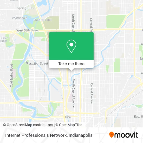
See Internet Professionals Network, Indianapolis City (Balance), on the map
Public Transit to Internet Professionals Network in Indianapolis City (Balance)
Wondering how to get to Internet Professionals Network in Indianapolis City (Balance)? Moovit helps you find the best way to get to Internet Professionals Network with step-by-step directions from the nearest public transit station.
Moovit provides free maps and live directions to help you navigate through your city. View schedules, routes, timetables, and find out how long does it take to get to Internet Professionals Network in real time.
Looking for the nearest stop or station to Internet Professionals Network? Check out this list of stops closest to your destination: Dr. Mlk Jr. St & 25th St; 29th St & Ethel Ave; Meridian St & Fall Creek/Ivy Tech Statio.
Bus: 30, 34, 90, 92, 15.
Want to see if there’s another route that gets you there at an earlier time? Moovit helps you find alternative routes or times. Get directions from and directions to Internet Professionals Network easily from the Moovit App or Website.
We make riding to Internet Professionals Network easy, which is why over 1.5 million users, including users in Indianapolis City (Balance), trust Moovit as the best app for public transit. You don’t need to download an individual bus app or train app, Moovit is your all-in-one transit app that helps you find the best bus time or train time available.
For information on prices of bus, costs and ride fares to Internet Professionals Network, please check the Moovit app.
Use the app to navigate to popular places including to the airport, hospital, stadium, grocery store, mall, coffee shop, school, college, and university.
Internet Professionals Network Address: 2540 Boulevard Pl Indianapolis, IN 46208 street in Indianapolis City (Balance)
- Tonia Bears Child Care,
- Geo Foundation,
- Top Museum / Art Gallery,
- Fall Creek Greenway - Indy Parks and Recreation,
- Ivy Tech CC Marion Bookstore,
- Dee Wilson the Barber,
- The Flea Market,
- Touch of Kaii,
- Serenity Tabernacle of Faith,
- Vera Bradley,
- Ivy Tech Community College,
- Julia M Carson Resourse Learning Center,
- Twenty-Fifth Street Sunday Stream,
- Fall Creek Parkway Church Of Christ,
- Love To Learn Academy,
- Glick Technology Center,
- Fresenius Kidney Care,
- Fathers and Families Center,
- Indianapolis Public Library Foundation,
- Indy Pies and Pints with Arts 4 Learning
Places Near Internet Professionals Network (Indianapolis City (Balance))
- I U Health Methodist Hospital, Indianapolis City (Balance),
- St. Vincent entrance #1, Indianapolis City (Balance),
- Gainbridge Fieldhouse, Indianapolis City (Balance),
- Jersey Barn, Indianapolis City (Balance),
- Indianapolis Motor Speedway, Speedway,
- 119 W 19th St Parking, Indianapolis City (Balance),
- I-465 / I-65 Interchange, Indianapolis City (Balance),
- St. Vincent Hospital - Indianapolis, Indianapolis City (Balance),
- Eskenazi Hospital, Indianapolis City (Balance),
- Train Ride At Castleton Mall, Indianapolis City (Balance),
- Cotter's Massage Parlor With Happy Endings, Indianapolis City (Balance),
- Plainfield, IN, Plainfield,
- Indianapolis Airport Zone 2, Indianapolis City (Balance),
- Lilly Corporate Center (Eli Lilly & Co), Indianapolis City (Balance),
- Indiana, Indianapolis City (Balance),
- Lucas Oil Stadium, Indianapolis City (Balance),
- Castleton Square Mall, Indianapolis,
- Methodist Hospital of Indianapolis, Indianapolis City (Balance),
- THE BALT, Indianapolis City (Balance),
- Indiana Convention Center, Indianapolis City (Balance)
How to get to popular places in Indianapolis with public transit
Get around Indianapolis City (Balance) by public transit!
Traveling around Indianapolis City (Balance) has never been so easy. See step by step directions as you travel to any attraction, street or major public transit station. View bus and train schedules, arrival times, service alerts and detailed routes on a map, so you know exactly how to get to anywhere in Indianapolis City (Balance).
When traveling to any destination around Indianapolis City (Balance) use Moovit's Live Directions with Get Off Notifications to know exactly where and how far to walk, how long to wait for your line, and how many stops are left. Moovit will alert you when it's time to get off — no need to constantly re-check whether yours is the next stop.
Wondering how to use public transit in Indianapolis City (Balance) or how to pay for public transit in Indianapolis City (Balance)? Moovit public transit app can help you navigate your way with public transit easily, and at minimum cost. It includes public transit fees, ticket prices, and costs. Looking for a map of Indianapolis City (Balance) public transit lines? Moovit public transit app shows all public transit maps in Indianapolis City (Balance) with all bus routes and stops on an interactive map.
Indianapolis has 1 transit type(s), including: bus, operated by several transit agencies, including IndyGo, FlixBus-us and Greyhound-us