How to get to Internet Service Provider by bus?
Click on the bus route to see step by step directions with maps, line arrival times and updated time schedules.
From Intercounty Connector (ICC)/MD 200, Montgomery County
46 minFrom Intelligence Community Campus—Bethesda, Montgomery County
50 minFrom Bullis School, Montgomery County
42 minFrom Georgia Ave & Icc Park & Ride Lot, Montgomery County
52 minFrom Suburban Hospital, Montgomery County
48 minFrom Kentlands, Montgomery County
52 minFrom Astrazeneca HQ, Montgomery County
60 minFrom I-270 Exit 10 (Clopper Rd. / West Diamond Ave.), Montgomery County
68 minFrom Montgomery County Fairgrounds, Montgomery County
55 min
How to get to Internet Service Provider by metro?
Click on the metro route to see step by step directions with maps, line arrival times and updated time schedules.
Bus stops near Internet Service Provider in Montgomery County
Metro station near Internet Service Provider in Montgomery County
- Rockville, 57 min walk,VIEW
Bus lines to Internet Service Provider in Montgomery County
What are the closest stations to Internet Service Provider?
The closest stations to Internet Service Provider are:
- Tower Oaks Blvd & @3203 is 59 yards away, 1 min walk.
- Montrose Rd & North Farm Ln is 470 yards away, 6 min walk.
- Cadbury Ave & Linda View Ln is 1774 yards away, 21 min walk.
- Rockville is 4885 yards away, 57 min walk.
Which bus lines stop near Internet Service Provider?
These bus lines stop near Internet Service Provider: 42, 81.
Which metro line stops near Internet Service Provider?
RED (Shady Grove)
What’s the nearest bus station to Internet Service Provider in Montgomery County?
The nearest bus station to Internet Service Provider in Montgomery County is Tower Oaks Blvd & @3203. It’s a 1 min walk away.
What time is the first metro to Internet Service Provider in Montgomery County?
The RED is the first metro that goes to Internet Service Provider in Montgomery County. It stops nearby at 5:04 AM.
What time is the last metro to Internet Service Provider in Montgomery County?
The RED is the last metro that goes to Internet Service Provider in Montgomery County. It stops nearby at 12:38 AM.
What time is the first train to Internet Service Provider in Montgomery County?
The MARC is the first train that goes to Internet Service Provider in Montgomery County. It stops nearby at 5:39 AM.
What time is the last train to Internet Service Provider in Montgomery County?
The MARC is the last train that goes to Internet Service Provider in Montgomery County. It stops nearby at 7:50 PM.
What time is the first bus to Internet Service Provider in Montgomery County?
The 42 is the first bus that goes to Internet Service Provider in Montgomery County. It stops nearby at 5:21 AM.
What time is the last bus to Internet Service Provider in Montgomery County?
The 47 is the last bus that goes to Internet Service Provider in Montgomery County. It stops nearby at 11:18 PM.
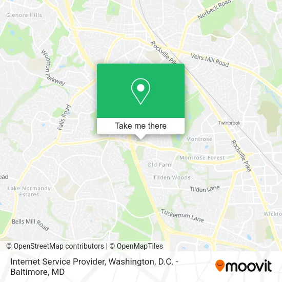
See Internet Service Provider, Montgomery County, on the map
Public Transit to Internet Service Provider in Montgomery County
Wondering how to get to Internet Service Provider in Montgomery County? Moovit helps you find the best way to get to Internet Service Provider with step-by-step directions from the nearest public transit station.
Moovit provides free maps and live directions to help you navigate through your city. View schedules, routes, timetables, and find out how long does it take to get to Internet Service Provider in real time.
Looking for the nearest stop or station to Internet Service Provider? Check out this list of stops closest to your destination: Tower Oaks Blvd & @3203; Montrose Rd & North Farm Ln; Cadbury Ave & Linda View Ln; Rockville.
Bus: 42, 81, 47.Metro: RED.
Want to see if there’s another route that gets you there at an earlier time? Moovit helps you find alternative routes or times. Get directions from and directions to Internet Service Provider easily from the Moovit App or Website.
We make riding to Internet Service Provider easy, which is why over 1.5 million users, including users in Montgomery County, trust Moovit as the best app for public transit. You don’t need to download an individual bus app or train app, Moovit is your all-in-one transit app that helps you find the best bus time or train time available.
For information on prices of bus and metro, costs and ride fares to Internet Service Provider, please check the Moovit app.
Use the app to navigate to popular places including to the airport, hospital, stadium, grocery store, mall, coffee shop, school, college, and university.
Internet Service Provider Address: 3203 Tower Oaks Blvd Rockville, MD 20852 street in Montgomery County
- Salome Masghati, MD,
- Jennifer Gularson, Pa-C, Ifmcp,
- Valerie Callender Dr,
- Dr Paul Mackoul, MD,
- Miracle Thai Massage Stretch & Spa,
- Washington Brain and Spine Institute,
- Arco Iris Somos,
- Early Intervention Associates,
- Meyers Hurvitz Abrahams LLC,
- Rockville Hauling,
- FedEx,
- Center for Vision Development,
- Natural Dentist Associates,
- Medstar Health Radiology,
- Tower Surgical Partners,
- Kadin Family Chiroprac,
- Rockville Landscaping,
- Oluyemisi O Famuyiwa MD,
- Rockville Hvac,
- 3202 Tower Oaks
Places Near Internet Service Provider (Montgomery County)
- National Zoo, Washington,
- PG Mall, Prince George's County,
- Pennsylvania Ave NW (3rd st and pennsylvania), Washington,
- Washington DC VA Medical Center, Washington,
- M&T Bank Stadium, Baltimore,
- Camden Yards, Baltimore,
- Basilica of the National Shrine, Washington,
- National Museum of African American History and Culture, Washington,
- Warner Theatre, Washington,
- The Anthem, Washington,
- Washington National Cathedral, Washington,
- Museum Of The Bible, Washington,
- National Theatre, Washington,
- Rock Creek Tennis Center, Washington,
- Capital One Arena, Washington,
- Marriott Marquis Washington, DC, Washington,
- Georgetown, Washington,
- Sibley Memorial Hospital, Washington,
- Westfield Montgomery Mall, Montgomery County,
- Amazon Hq2, Arlington County
How to get to popular places in Washington, D.C. - Baltimore, MD with public transit
Get around Montgomery County by public transit!
Traveling around Montgomery County has never been so easy. See step by step directions as you travel to any attraction, street or major public transit station. View bus and train schedules, arrival times, service alerts and detailed routes on a map, so you know exactly how to get to anywhere in Montgomery County.
When traveling to any destination around Montgomery County use Moovit's Live Directions with Get Off Notifications to know exactly where and how far to walk, how long to wait for your line, and how many stops are left. Moovit will alert you when it's time to get off — no need to constantly re-check whether yours is the next stop.
Wondering how to use public transit in Montgomery County or how to pay for public transit in Montgomery County? Moovit public transit app can help you navigate your way with public transit easily, and at minimum cost. It includes public transit fees, ticket prices, and costs. Looking for a map of Montgomery County public transit lines? Moovit public transit app shows all public transit maps in Montgomery County with all Bus, Train, Metro, Light Rail and Ferry routes and stops on an interactive map.
Washington, D.C. - Baltimore, MD has 5 transit type(s), including: Bus, Train, Metro, Light Rail and Ferry, operated by several transit agencies, including WMATA, Montgomery County Ride On, Fairfax Connector, TheBus, PRTC, DASH - Alexandria, Arlington Transit (ART), RTA of Central Maryland, MDOT MTA, MDOT MTA Light RailLink, MDOT MTA Commuter Bus, MDOT MTA Local Bus, FXBGO!, Virginia Railway Express (VRE) and MARC