How to get to Intex by bus?
Click on the bus route to see step by step directions with maps, line arrival times and updated time schedules.
From Calle Maldonado, Madrid
79 minFrom Calle Paseo De Los Pontones, Madrid
41 minFrom Plaza de Toros, Madrid
59 minFrom Calle General Pardiñas, Madrid
78 minFrom Calle Juan Álvarez Mendizábal, Madrid
60 minFrom Calle Cea Bermúdez, Madrid
62 minFrom Campus de Vicálvaro (URJC), Madrid
55 minFrom Plaza Don Antonio de Andrés 18, Madrid
58 minFrom Primark, Madrid
56 minFrom Sala Galileo Galilei, Área Metropolitana De Madrid Y Corredor Del Henares
68 min
How to get to Intex by train?
Click on the train route to see step by step directions with maps, line arrival times and updated time schedules.
From Calle Maldonado, Madrid
55 minFrom Calle Paseo De Los Pontones, Madrid
36 minFrom Calle General Pardiñas, Madrid
57 minFrom Calle Juan Álvarez Mendizábal, Madrid
41 minFrom Calle Cea Bermúdez, Madrid
54 minFrom Campus de Vicálvaro (URJC), Madrid
62 minFrom Plaza Don Antonio de Andrés 18, Madrid
56 minFrom Primark, Madrid
43 min
How to get to Intex by metro?
Click on the metro route to see step by step directions with maps, line arrival times and updated time schedules.
From Calle Maldonado, Madrid
44 minFrom Calle Paseo De Los Pontones, Madrid
44 minFrom Plaza de Toros, Madrid
45 minFrom Calle General Pardiñas, Madrid
43 minFrom Calle Juan Álvarez Mendizábal, Madrid
42 minFrom Calle Cea Bermúdez, Madrid
48 minFrom Campus de Vicálvaro (URJC), Madrid
54 minFrom Plaza Don Antonio de Andrés 18, Madrid
57 minFrom Primark, Madrid
37 minFrom Sala Galileo Galilei, Área Metropolitana De Madrid Y Corredor Del Henares
52 min
Bus stops near Intex in Madrid
Train station near Intex in Madrid
- Villaverde Alto, 8 min walk,VIEW
Metro station near Intex in Madrid
- Villaverde Alto, 8 min walk,VIEW
Bus lines to Intex in Madrid
- 432, Madrid (Villaverde Bajo - Cruce) - Leganés,VIEW
- 448, Madrid (Legazpi) - Getafe (por Villaverde),VIEW
- 22, Plaza de Legazpi - Villaverde Alto,VIEW
- 86, Estacion de Atocha - Villaverde Alto,VIEW
- 130, Villaverde Alto - Vicalvaro,VIEW
- N14, Plaza de Cibeles - Villaverde Alto,VIEW
- 18, Plaza Mayor - Villaverde Cruce,VIEW
- 116, Glorieta de Embajadores - Villaverde Cruce,VIEW
- 76, Plaza Beata,VIEW
- 131, Villaverde Alto,VIEW
- 79, Legazpi,VIEW
What are the closest stations to Intex?
The closest stations to Intex are:
- Alcocer - Paseo Talleres is 280 meters away, 4 min walk.
- Alcocer - Virgen Desamparados is 385 meters away, 6 min walk.
- Puente Alcocer is 431 meters away, 6 min walk.
- Doctor Pérez Domínguez is 582 meters away, 8 min walk.
- Villaverde Alto is 612 meters away, 8 min walk.
Which bus lines stop near Intex?
These bus lines stop near Intex: 130, 18, 423, 432, 86.
Which train line stops near Intex?
C5 (Humanes)
Which metro line stops near Intex?
M-3 (El Casar)
What’s the nearest metro station to Intex in Madrid?
The nearest metro station to Intex in Madrid is Villaverde Alto. It’s a 8 min walk away.
What’s the nearest train station to Intex in Madrid?
The nearest train station to Intex in Madrid is Villaverde Alto. It’s a 8 min walk away.
What’s the nearest bus station to Intex in Madrid?
The nearest bus station to Intex in Madrid is Alcocer - Paseo Talleres. It’s a 4 min walk away.
What time is the first metro to Intex in Madrid?
The M-3 is the first metro that goes to Intex in Madrid. It stops nearby at 6:05 AM.
What time is the last metro to Intex in Madrid?
The M-3 is the last metro that goes to Intex in Madrid. It stops nearby at 2:01 AM.
What time is the first train to Intex in Madrid?
The C4 is the first train that goes to Intex in Madrid. It stops nearby at 5:18 AM.
What time is the last train to Intex in Madrid?
The C5 is the last train that goes to Intex in Madrid. It stops nearby at 12:23 AM.
What time is the first bus to Intex in Madrid?
The 432 is the first bus that goes to Intex in Madrid. It stops nearby at 6:03 AM.
What time is the last bus to Intex in Madrid?
The N14 is the last bus that goes to Intex in Madrid. It stops nearby at 3:32 AM.
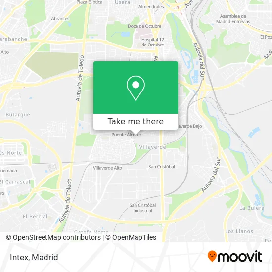
See Intex, Madrid, on the map
Public Transit to Intex in Madrid
Wondering how to get to Intex in Madrid? Moovit helps you find the best way to get to Intex with step-by-step directions from the nearest public transit station.
Moovit provides free maps and live directions to help you navigate through your city. View schedules, routes, timetables, and find out how long does it take to get to Intex in real time.
Looking for the nearest stop or station to Intex? Check out this list of stops closest to your destination: Alcocer - Paseo Talleres; Alcocer - Virgen Desamparados; Puente Alcocer; Doctor Pérez Domínguez; Villaverde Alto.
Bus: 130, 18, 423, 432, 86, 448, 22, 116, 76, 131.Train: C5, C4, C4A, C4B.Metro: M-3.
Want to see if there’s another route that gets you there at an earlier time? Moovit helps you find alternative routes or times. Get directions from and directions to Intex easily from the Moovit App or Website.
We make riding to Intex easy, which is why over 1.5 million users, including users in Madrid, trust Moovit as the best app for public transit. You don’t need to download an individual bus app or train app, Moovit is your all-in-one transit app that helps you find the best bus time or train time available.
For information on prices of metro, train and bus, costs and ride fares to Intex, please check the Moovit app.
Use the app to navigate to popular places including to the airport, hospital, stadium, grocery store, mall, coffee shop, school, college, and university.
Intex Address: Calle del Arroyo Bueno, 2 28021 Villaverde Alto, C.H. de Villaverde Madrid street in Madrid
- Imprenta Dosiprint,
- CONFORT auto,
- El Asador De Enrique,
- Asador Enrique,
- Arroyo Bueno 2,
- Talleres La Bancada,
- Taller Silvacardan, ASETRA,
- Lavadero Chino,
- Exclusivas del Confort,
- In & Out Moda Íntima,
- Taller Willys Garage,
- Paseo Talleres 3,
- Ivelma Auto,
- Calle de San Jenaro, 15,
- Sala Avenencia,
- Taller Jumauto,
- MERCADONA,
- Futuro Mercadona Alcocer,
- Peña Wasichay,
- Peña Francia
Places Near Intex (Madrid)
- Mercadillo de Majadahonda, Majadahonda,
- Tres Aguas, Alcorcón,
- Centro Comercial La Vaguada, Área Metropolitana De Madrid Y Corredor Del Henares,
- Estacion de Chamartin, Madrid,
- Mendez Alvaro, Madrid,
- Centro Comercial Islazul, Área Metropolitana De Madrid Y Corredor Del Henares,
- Calle de López de Hoyos 169, Madrid,
- Centro Comercial La Gavia, Área Metropolitana De Madrid Y Corredor Del Henares,
- Palacio De Vistalegre, Área Metropolitana De Madrid Y Corredor Del Henares,
- Plaza Mayor, Madrid,
- Sala La Riviera, Madrid,
- Nassica, Área Metropolitana De Madrid Y Corredor Del Henares,
- Plenilunio, Área Metropolitana De Madrid Y Corredor Del Henares,
- Estadio Wanda Metropolitano, Área Metropolitana De Madrid Y Corredor Del Henares,
- Rastro De Madrid, Área Metropolitana De Madrid Y Corredor Del Henares,
- Hospital Clínico Universitario San Carlos, Madrid,
- Wizink Center, Madrid,
- Hospital Universitario Ramón y Cajal, Madrid,
- Centro Comercial Oasiz Madrid, Área Metropolitana De Madrid Y Corredor Del Henares,
- Hospital Universitario La Paz, Madrid
How to get to popular places in Madrid with public transit
Get around Madrid by public transit!
Traveling around Madrid has never been so easy. See step by step directions as you travel to any attraction, street or major public transit station. View bus and train schedules, arrival times, service alerts and detailed routes on a map, so you know exactly how to get to anywhere in Madrid.
When traveling to any destination around Madrid use Moovit's Live Directions with Get Off Notifications to know exactly where and how far to walk, how long to wait for your line, and how many stops are left. Moovit will alert you when it's time to get off — no need to constantly re-check whether yours is the next stop.
Wondering how to use public transit in Madrid or how to pay for public transit in Madrid? Moovit public transit app can help you navigate your way with public transit easily, and at minimum cost. It includes public transit fees, ticket prices, and costs. Looking for a map of Madrid public transit lines? Moovit public transit app shows all public transit maps in Madrid with all Bus, Train, Metro and Light Rail routes and stops on an interactive map.
Madrid has 4 transit type(s), including: Bus, Train, Metro and Light Rail, operated by several transit agencies, including Metro de Madrid, Metro Ligero, Tranvía de Parla, Renfe Cercanías - Servicios de Autobús especiales, Renfe Cercanias, Renfe Cercanías, EMT, Interurbanos, Urbanos de Alcalá de Henares, Urbanos de Alcobendas, Urbanos de Alcorcón, Urbanos de Algete, Urbanos de Aranjuez, Urbanos de Arganda del Rey and Urbanos de Arroyomolinos