How to get to Intnt by bus?
Click on the bus route to see step by step directions with maps, line arrival times and updated time schedules.
From Westchester Mall, White Plains
41 minFrom White Plains, NY, White Plains
40 minFrom Empire City Casino, Yonkers
81 minFrom New Rochelle, NY, New Rochelle
50 minFrom Cross County Mall, Yonkers
92 minFrom Cross County Shopping Center, Yonkers
92 minFrom Mamaroneck NY, Mamaroneck
32 minFrom Ridge Hill Mall, Yonkers
125 minFrom GFFF, Stamford
95 minFrom NBC Sports Shuttle, Stamford
108 min
How to get to Intnt by train?
Click on the train route to see step by step directions with maps, line arrival times and updated time schedules.
Bus stops near Intnt in Rye
Train station near Intnt in Rye
- Rye, 41 min walk,VIEW
What are the closest stations to Intnt?
The closest stations to Intnt are:
- Rye Railroad Station is 150 yards away, 3 min walk.
- Purchase St @ Theodore Fremd Ave is 211 yards away, 3 min walk.
- Rye is 3496 yards away, 41 min walk.
Which bus lines stop near Intnt?
These bus lines stop near Intnt: 13, 61.
Which train line stops near Intnt?
3 (1312#| Stamford)
What’s the nearest bus station to Intnt in Rye?
The nearest bus stations to Intnt in Rye are Rye Railroad Station and Purchase St @ Theodore Fremd Ave. The closest one is a 3 min walk away.
What time is the first train to Intnt in Rye?
The 3 is the first train that goes to Intnt in Rye. It stops nearby at 4:54 AM.
What time is the last train to Intnt in Rye?
The 3 is the last train that goes to Intnt in Rye. It stops nearby at 2:42 AM.
What time is the first bus to Intnt in Rye?
The 61 is the first bus that goes to Intnt in Rye. It stops nearby at 6:20 AM.
What time is the last bus to Intnt in Rye?
The 61 is the last bus that goes to Intnt in Rye. It stops nearby at 7:40 PM.
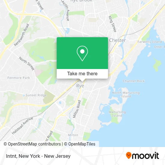
See Intnt, Rye, on the map
Public Transit to Intnt in Rye
Wondering how to get to Intnt in Rye? Moovit helps you find the best way to get to Intnt with step-by-step directions from the nearest public transit station.
Moovit provides free maps and live directions to help you navigate through your city. View schedules, routes, timetables, and find out how long does it take to get to Intnt in real time.
Looking for the nearest stop or station to Intnt? Check out this list of stops closest to your destination: Rye Railroad Station; Purchase St @ Theodore Fremd Ave; Rye.
Bus: 13, 61.Train: 3, 4.
Want to see if there’s another route that gets you there at an earlier time? Moovit helps you find alternative routes or times. Get directions from and directions to Intnt easily from the Moovit App or Website.
We make riding to Intnt easy, which is why over 1.5 million users, including users in Rye, trust Moovit as the best app for public transit. You don’t need to download an individual bus app or train app, Moovit is your all-in-one transit app that helps you find the best bus time or train time available.
For information on prices of bus and train, costs and ride fares to Intnt, please check the Moovit app.
Use the app to navigate to popular places including to the airport, hospital, stadium, grocery store, mall, coffee shop, school, college, and university.
Intnt Address: 41 Purdy Ave street in Rye
- Legal Transactional Services,
- Post Office,
- High Quality Home Therapy,
- Byte Sized Computing,
- Hi-Five Sports Metro,
- Michele Flood Homes,
- Karen Hios,
- Peggy B. Jackson Westchester Real Estate,
- Vivian Portillo,
- Jean Lipman,
- Grace Dipalermo, Coldwell Banker Realty,
- Peter Topping,
- Antonina D'Anna,
- Luciana Digiacomo,
- Jose Avelar Real Estate,
- Donna Mitchell Scragg Real Estate,
- Diana Hellman,
- Sula Pearlman Realtor,
- Edward J Ferraro Realty,
- Jim Rice, Coldwell Banker Realty, Rye
Places Near Intnt (Rye)
- 26 Federal Plaza, Manhattan,
- 911 Memorial, Manhattan,
- 376 Hudson Street, Manhattan,
- Pier 83, Manhattan,
- Queens Center Mall, Queens,
- qqqq, Manhattan,
- SoHo, Manhattan,
- Mountainside Hospital, Glen Ridge,
- Rockefeller Center, Manhattan,
- Times Square, Manhattan,
- 66 John Street, Manhattan,
- 111 Centre New York City Supreme Court, Manhattan,
- Bellevue Hospital, Manhattan,
- Hudson Yards, Manhattan,
- Chinatown, Manhattan,
- Katz's Deli, Manhattan,
- 1 Police Plaza, Manhattan,
- Wall Street, Manhattan,
- San Gennaro Feast, Manhattan,
- 3 Stone St, Manhattan
How to get to popular places in New York - New Jersey with public transit
Get around Rye by public transit!
Traveling around Rye has never been so easy. See step by step directions as you travel to any attraction, street or major public transit station. View bus and train schedules, arrival times, service alerts and detailed routes on a map, so you know exactly how to get to anywhere in Rye.
When traveling to any destination around Rye use Moovit's Live Directions with Get Off Notifications to know exactly where and how far to walk, how long to wait for your line, and how many stops are left. Moovit will alert you when it's time to get off — no need to constantly re-check whether yours is the next stop.
Wondering how to use public transit in Rye or how to pay for public transit in Rye? Moovit public transit app can help you navigate your way with public transit easily, and at minimum cost. It includes public transit fees, ticket prices, and costs. Looking for a map of Rye public transit lines? Moovit public transit app shows all public transit maps in Rye with all Bus, Train, Subway, Light Rail, Ferry and Cable Car routes and stops on an interactive map.
New York - New Jersey has 6 transit type(s), including: Bus, Train, Subway, Light Rail, Ferry and Cable Car, operated by several transit agencies, including MTA Subway, Metro-North Railroad, LIRR, PATH, MTA New York City Transit - Express routes, MTA Bus, NJ Transit, NYC Ferry, NICE bus, Bee-Line Bus, NJ Transit Rail, Norwalk Transit District, Hartford Line, River Valley Transit and HART