How to get to Intoxalock Ignition Interlock by bus?
Click on the bus route to see step by step directions with maps, line arrival times and updated time schedules.
From Lakeland Bus Stop, Parsippany-Troy Hills
356 minFrom Community Coach 77 Bus Stop, Livingston
338 minFrom MMNJ, Parsippany-Troy Hills
384 minFrom Mountain Creek Waterpark, West Milford
391 minFrom Parsippany, NJ, Parsippany-Troy Hills
368 minFrom Plainfield, NJ, Plainfield
415 minFrom Wayne, NJ, Wayne
384 min
Bus stops near Intoxalock Ignition Interlock in New York - New Jersey
Bus lines to Intoxalock Ignition Interlock in New York - New Jersey
What are the closest stations to Intoxalock Ignition Interlock?
The closest stations to Intoxalock Ignition Interlock are:
- Hanover and Church I is 89 yards away, 2 min walk.
- Old River Road and Beekman St O is 581 yards away, 7 min walk.
Which bus lines stop near Intoxalock Ignition Interlock?
These bus lines stop near Intoxalock Ignition Interlock: 15, 17.
What’s the nearest bus station to Intoxalock Ignition Interlock in New York - New Jersey?
The nearest bus station to Intoxalock Ignition Interlock in New York - New Jersey is Hanover and Church I. It’s a 2 min walk away.
What time is the first bus to Intoxalock Ignition Interlock in New York - New Jersey?
The 14 is the first bus that goes to Intoxalock Ignition Interlock in New York - New Jersey. It stops nearby at 5:04 AM.
What time is the last bus to Intoxalock Ignition Interlock in New York - New Jersey?
The 14 is the last bus that goes to Intoxalock Ignition Interlock in New York - New Jersey. It stops nearby at 10:44 PM.
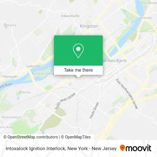
See Intoxalock Ignition Interlock, New York - New Jersey, on the map
Public Transit to Intoxalock Ignition Interlock in New York - New Jersey
Wondering how to get to Intoxalock Ignition Interlock in New York - New Jersey? Moovit helps you find the best way to get to Intoxalock Ignition Interlock with step-by-step directions from the nearest public transit station.
Moovit provides free maps and live directions to help you navigate through your city. View schedules, routes, timetables, and find out how long does it take to get to Intoxalock Ignition Interlock in real time.
Looking for the nearest stop or station to Intoxalock Ignition Interlock? Check out this list of stops closest to your destination: Hanover and Church I; Old River Road and Beekman St O.
Bus: 15, 17, 14, 22.
Want to see if there’s another route that gets you there at an earlier time? Moovit helps you find alternative routes or times. Get directions from and directions to Intoxalock Ignition Interlock easily from the Moovit App or Website.
We make riding to Intoxalock Ignition Interlock easy, which is why over 1.5 million users, including users in New York - New Jersey, trust Moovit as the best app for public transit. You don’t need to download an individual bus app or train app, Moovit is your all-in-one transit app that helps you find the best bus time or train time available.
For information on prices of bus and train, costs and ride fares to Intoxalock Ignition Interlock, please check the Moovit app.
Use the app to navigate to popular places including to the airport, hospital, stadium, grocery store, mall, coffee shop, school, college, and university.
Intoxalock Ignition Interlock Address: 206 Carey Ave Wilkes-Barre, PA 18702 street in New York - New Jersey
- Henry's Auto World,
- The Border Mexican Bar & Grill,
- La Piazza Bella,
- Joel Wheels and Tires,
- O'Donnell Family Eye Care,
- Davis Powersports,
- Health Street,
- Wic State Agency,
- Independent Living Llc,
- Raymond J Joseph Md Llc,
- Raymond Joseph,
- Joseph Raymond,
- Tnt's Southern Food,
- ATM,
- Rockitcoin Bitcoin Atm,
- Princess Hair Braiding & Beauty Salon,
- Soonie's Salon,
- Krafchin Ira Charles MD Facs,
- Dollar General,
- Outta Da Blue
Places Near Intoxalock Ignition Interlock (New York - New Jersey)
- Queens Center Mall, Queens,
- 911 Memorial, Manhattan,
- 3 Stone St, Manhattan,
- Bellevue Hospital, Manhattan,
- Rockefeller Center, Manhattan,
- 1 Police Plaza, Manhattan,
- Hudson Yards, Manhattan,
- SoHo, Manhattan,
- Pier 83, Manhattan,
- Wall Street, Manhattan,
- qqqq, Manhattan,
- 376 Hudson Street, Manhattan,
- Times Square, Manhattan,
- San Gennaro Feast, Manhattan,
- Chinatown, Manhattan,
- Katz's Deli, Manhattan,
- 111 Centre New York City Supreme Court, Manhattan,
- Mountainside Hospital, Glen Ridge,
- 26 Federal Plaza, Manhattan,
- 66 John Street, Manhattan
How to get to popular places in New York - New Jersey with public transit
Get around New York - New Jersey by public transit!
Traveling around New York - New Jersey has never been so easy. See step by step directions as you travel to any attraction, street or major public transit station. View bus and train schedules, arrival times, service alerts and detailed routes on a map, so you know exactly how to get to anywhere in New York - New Jersey.
When traveling to any destination around New York - New Jersey use Moovit's Live Directions with Get Off Notifications to know exactly where and how far to walk, how long to wait for your line, and how many stops are left. Moovit will alert you when it's time to get off — no need to constantly re-check whether yours is the next stop.
Wondering how to use public transit in New York - New Jersey or how to pay for public transit in New York - New Jersey? Moovit public transit app can help you navigate your way with public transit easily, and at minimum cost. It includes public transit fees, ticket prices, and costs. Looking for a map of New York - New Jersey public transit lines? Moovit public transit app shows all public transit maps in New York - New Jersey with all Bus, Train, Subway, Light Rail, Ferry and Cable Car routes and stops on an interactive map.
New York - New Jersey has 6 transit type(s), including: Bus, Train, Subway, Light Rail, Ferry and Cable Car, operated by several transit agencies, including MTA Subway, Metro-North Railroad, LIRR, PATH, MTA New York City Transit - Express routes, MTA Bus, NJ Transit, NYC Ferry, NICE bus, Bee-Line Bus, NJ Transit Rail, Norwalk Transit District, Hartford Line, River Valley Transit and HART