How to get to Intoxalock Ignition Interlock by bus?
Click on the bus route to see step by step directions with maps, line arrival times and updated time schedules.
From Baltimore VA Medical Center, Baltimore
49 minFrom Towson Town Center, Baltimore County
42 minFrom Enoch Pratt Free Library - Central Library, Baltimore
51 minFrom Inner Harbor, Baltimore
53 minFrom Baltimore Soundstage, Baltimore
51 minFrom Power Plant Live, Baltimore
52 minFrom Inner Harbor, Baltimore
50 minFrom M&T Bank Stadium, Baltimore
64 minFrom Hilton Baltimore, Baltimore
49 minFrom I-695 @ Exit 17 (Security Blvd/MD 122), Baltimore County
52 min
How to get to Intoxalock Ignition Interlock by metro?
Click on the metro route to see step by step directions with maps, line arrival times and updated time schedules.
From Power Plant Live, Baltimore
28 minFrom Baltimore VA Medical Center, Baltimore
30 minFrom Inner Harbor, Baltimore
36 minFrom Hilton Baltimore, Baltimore
32 minFrom Inner Harbor, Baltimore
33 minFrom Enoch Pratt Free Library - Central Library, Baltimore
32 minFrom Baltimore Soundstage, Baltimore
30 minFrom M&T Bank Stadium, Baltimore
47 min
Bus stops near Intoxalock Ignition Interlock in Baltimore
Metro station near Intoxalock Ignition Interlock in Baltimore
- Rogers Ave Metro, 23 min walk,VIEW
Light Rail stations near Intoxalock Ignition Interlock in Baltimore
- Cold Spring Lane, 58 min walk,VIEW
Bus lines to Intoxalock Ignition Interlock in Baltimore
What are the closest stations to Intoxalock Ignition Interlock?
The closest stations to Intoxalock Ignition Interlock are:
- Reisterstown Rd & Primrose Ave FS is 153 yards away, 3 min walk.
- Reisterstown Rd & Northern Pkwy Nb is 243 yards away, 4 min walk.
- Rogers Ave Metro Station is 801 yards away, 10 min walk.
- Rogers Ave Metro Station Bay 5 is 857 yards away, 11 min walk.
- Rogers Ave Metro is 1907 yards away, 23 min walk.
- Cold Spring Lane is 4969 yards away, 58 min walk.
Which bus lines stop near Intoxalock Ignition Interlock?
These bus lines stop near Intoxalock Ignition Interlock: 30, 80, 83.
Which metro line stops near Intoxalock Ignition Interlock?
METRO (Towards Owing Mills)
What’s the nearest metro station to Intoxalock Ignition Interlock in Baltimore?
The nearest metro station to Intoxalock Ignition Interlock in Baltimore is Rogers Ave Metro. It’s a 23 min walk away.
What’s the nearest bus station to Intoxalock Ignition Interlock in Baltimore?
The nearest bus station to Intoxalock Ignition Interlock in Baltimore is Reisterstown Rd & Primrose Ave FS. It’s a 3 min walk away.
What time is the first light rail to Intoxalock Ignition Interlock in Baltimore?
The LIGHT RAILLINK is the first light rail that goes to Intoxalock Ignition Interlock in Baltimore. It stops nearby at 4:28 AM.
What time is the last light rail to Intoxalock Ignition Interlock in Baltimore?
The LIGHT RAILLINK is the last light rail that goes to Intoxalock Ignition Interlock in Baltimore. It stops nearby at 12:45 AM.
What time is the first metro to Intoxalock Ignition Interlock in Baltimore?
The METRO is the first metro that goes to Intoxalock Ignition Interlock in Baltimore. It stops nearby at 3:45 AM.
What time is the last metro to Intoxalock Ignition Interlock in Baltimore?
The METRO is the last metro that goes to Intoxalock Ignition Interlock in Baltimore. It stops nearby at 12:23 AM.
What time is the first bus to Intoxalock Ignition Interlock in Baltimore?
The 31 is the first bus that goes to Intoxalock Ignition Interlock in Baltimore. It stops nearby at 3:49 AM.
What time is the last bus to Intoxalock Ignition Interlock in Baltimore?
The 83 is the last bus that goes to Intoxalock Ignition Interlock in Baltimore. It stops nearby at 2:08 AM.
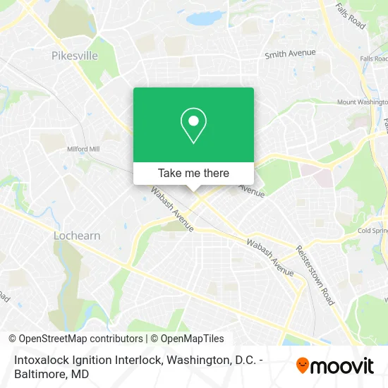
See Intoxalock Ignition Interlock, Baltimore, on the map
Public Transit to Intoxalock Ignition Interlock in Baltimore
Wondering how to get to Intoxalock Ignition Interlock in Baltimore? Moovit helps you find the best way to get to Intoxalock Ignition Interlock with step-by-step directions from the nearest public transit station.
Moovit provides free maps and live directions to help you navigate through your city. View schedules, routes, timetables, and find out how long does it take to get to Intoxalock Ignition Interlock in real time.
Looking for the nearest stop or station to Intoxalock Ignition Interlock? Check out this list of stops closest to your destination: Reisterstown Rd & Primrose Ave FS; Reisterstown Rd & Northern Pkwy Nb; Rogers Ave Metro Station; Rogers Ave Metro Station Bay 5; Rogers Ave Metro; Cold Spring Lane.
Bus: 30, 80, 83, 89, 34, 31, 82.Metro: METRO.
Want to see if there’s another route that gets you there at an earlier time? Moovit helps you find alternative routes or times. Get directions from and directions to Intoxalock Ignition Interlock easily from the Moovit App or Website.
We make riding to Intoxalock Ignition Interlock easy, which is why over 1.5 million users, including users in Baltimore, trust Moovit as the best app for public transit. You don’t need to download an individual bus app or train app, Moovit is your all-in-one transit app that helps you find the best bus time or train time available.
For information on prices of bus, metro and light rail, costs and ride fares to Intoxalock Ignition Interlock, please check the Moovit app.
Use the app to navigate to popular places including to the airport, hospital, stadium, grocery store, mall, coffee shop, school, college, and university.
Intoxalock Ignition Interlock Address: 4130 Emmart Ave Baltimore, MD 21215 street in Baltimore
- Roadguard Ignition Interlock,
- Drager- Baltimore,
- Easterns Automotive Group,
- Plumbing Drain Cleaning,
- Tla,
- Dabney's 5 Star Beauty Salon,
- Mavis Discount Tire,
- Homejoy Carpet Cleaning Carpet Cleaning,
- DUNKIN',
- Tiger Mart,
- Paris Apparel,
- The Advertising Specialty Institute,
- Dick's Sporting,
- Caliber Auto Glass,
- Reisterstown Rd & Northern Pkwy,
- W Northern Pkwy (reisterstown road and W Northern Pkwy),
- Enterprise,
- Citgo/SUBWAY,
- Baltimore City,
- Capfin Tax Maryland
Places Near Intoxalock Ignition Interlock (Baltimore)
- Sibley Memorial Hospital, Washington,
- National Museum of African American History and Culture, Washington,
- Amazon Hq2, Arlington County,
- National Zoo, Washington,
- Marriott Marquis Washington, DC, Washington,
- Camden Yards, Baltimore,
- National Mall, Washington,
- Museum Of The Bible, Washington,
- PG Mall, Prince George's County,
- Warner Theatre, Washington,
- Pennsylvania Ave NW (3rd st and pennsylvania), Washington,
- Basilica of the National Shrine, Washington,
- Westfield Montgomery Mall, Montgomery County,
- Washington National Cathedral, Washington,
- Capital One Arena, Washington,
- Rock Creek Tennis Center, Washington,
- M&T Bank Stadium, Baltimore,
- Washington DC VA Medical Center, Washington,
- Georgetown, Washington,
- The Anthem, Washington
How to get to popular places in Washington, D.C. - Baltimore, MD with public transit
Get around Baltimore by public transit!
Traveling around Baltimore has never been so easy. See step by step directions as you travel to any attraction, street or major public transit station. View bus and train schedules, arrival times, service alerts and detailed routes on a map, so you know exactly how to get to anywhere in Baltimore.
When traveling to any destination around Baltimore use Moovit's Live Directions with Get Off Notifications to know exactly where and how far to walk, how long to wait for your line, and how many stops are left. Moovit will alert you when it's time to get off — no need to constantly re-check whether yours is the next stop.
Wondering how to use public transit in Baltimore or how to pay for public transit in Baltimore? Moovit public transit app can help you navigate your way with public transit easily, and at minimum cost. It includes public transit fees, ticket prices, and costs. Looking for a map of Baltimore public transit lines? Moovit public transit app shows all public transit maps in Baltimore with all Bus, Train, Metro, Light Rail and Ferry routes and stops on an interactive map.
Washington, D.C. - Baltimore, MD has 5 transit type(s), including: Bus, Train, Metro, Light Rail and Ferry, operated by several transit agencies, including WMATA, Montgomery County Ride On, Fairfax Connector, TheBus, PRTC, DASH - Alexandria, Arlington Transit (ART), RTA of Central Maryland, MDOT MTA, MDOT MTA Light RailLink, MDOT MTA Commuter Bus, MDOT MTA Local Bus, FXBGO!, Virginia Railway Express (VRE) and MARC