Directions to Intoxalock Ignition Interlock (Wichita) with public transportation
The following transit lines have routes that pass near Intoxalock Ignition Interlock
How to get to Intoxalock Ignition Interlock by bus?
Click on the bus route to see step by step directions with maps, line arrival times and updated time schedules.
Bus stops near Intoxalock Ignition Interlock in Wichita
Bus lines to Intoxalock Ignition Interlock in Wichita
What are the closest stations to Intoxalock Ignition Interlock?
The closest stations to Intoxalock Ignition Interlock are:
- Cleveland And Central Ib is 496 yards away, 7 min walk.
- Central And Hydraulic Ob is 506 yards away, 7 min walk.
- Douglas And Kansas Ib is 572 yards away, 7 min walk.
Which bus lines stop near Intoxalock Ignition Interlock?
These bus lines stop near Intoxalock Ignition Interlock: Q-LINE CLIFTON T, ROUTE21: DOUGLAS, ROUTE25: E CENTR.
What’s the nearest bus station to Intoxalock Ignition Interlock in Wichita?
The nearest bus stations to Intoxalock Ignition Interlock in Wichita are Cleveland And Central Ib, Central And Hydraulic Ob and Douglas And Kansas Ib. The closest one is a 7 min walk away.
What time is the first bus to Intoxalock Ignition Interlock in Wichita?
The ROUTE21: DOUGLAS is the first bus that goes to Intoxalock Ignition Interlock in Wichita. It stops nearby at 4:43 AM.
What time is the last bus to Intoxalock Ignition Interlock in Wichita?
The ROUTE21: DOUGLAS is the last bus that goes to Intoxalock Ignition Interlock in Wichita. It stops nearby at 10:27 PM.
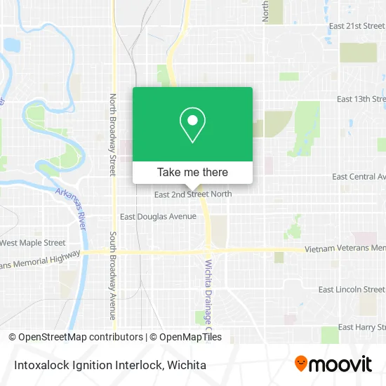
See Intoxalock Ignition Interlock, Wichita, on the map
Public Transit to Intoxalock Ignition Interlock in Wichita
Wondering how to get to Intoxalock Ignition Interlock in Wichita? Moovit helps you find the best way to get to Intoxalock Ignition Interlock with step-by-step directions from the nearest public transit station.
Moovit provides free maps and live directions to help you navigate through your city. View schedules, routes, timetables, and find out how long does it take to get to Intoxalock Ignition Interlock in real time.
Looking for the nearest stop or station to Intoxalock Ignition Interlock? Check out this list of stops closest to your destination: Cleveland And Central Ib; Central And Hydraulic Ob; Douglas And Kansas Ib.
Bus: Q-LINE CLIFTON T, ROUTE21: DOUGLAS, ROUTE25: E CENTR, ROUTE28: KU MED-, EAST HIGH SCHOOL.
Want to see if there’s another route that gets you there at an earlier time? Moovit helps you find alternative routes or times. Get directions from and directions to Intoxalock Ignition Interlock easily from the Moovit App or Website.
We make riding to Intoxalock Ignition Interlock easy, which is why over 1.5 million users, including users in Wichita, trust Moovit as the best app for public transit. You don’t need to download an individual bus app or train app, Moovit is your all-in-one transit app that helps you find the best bus time or train time available.
For information on prices of bus, costs and ride fares to Intoxalock Ignition Interlock, please check the Moovit app.
Use the app to navigate to popular places including to the airport, hospital, stadium, grocery store, mall, coffee shop, school, college, and university.
Intoxalock Ignition Interlock Address: 1722 E 2nd St N Wichita, KS 67214 street in Wichita
- Wichita TRANSIT Rental,
- Guthridge Property Mai,
- Gladiator Roofing,
- Whitetail Remodeling,
- PM Services,
- Creative Bliss Therapy,
- Zeep : 'z-Āyp,
- Roger's Auto Sales,
- Creative Styles,
- Class Alpha Services,
- Cab Comm,
- N New York Ave,
- Mark T Schoenhofer Attorney at Law,
- Seckman Music School,
- Whip Appeal TX,
- Mid America Exteriors,
- Titan Mechanical,
- Snap Restyling,
- 74's Clothing,
- Ann's Asian Food Carry Out
Places Near Intoxalock Ignition Interlock (Wichita)
- Towne East Mall, Wichita,
- McConnell Air Force Base, Mcconnell Afb,
- 21st & Maize, Wichita,
- Four Corners Cafe @ Wesley Medical Center, Wichita,
- Spirit Aerosystems,
- Total Card Solutions, Wichita,
- Westside Athletic Field (Friends University Baseball Field), Wichita,
- Paige Place Apartments, Wichita,
- East 21st Street North and Webb Road, Wichita,
- North High School, Wichita,
- Wichita Dwight D. Eisenhower National Airport (ICT) (Wichita Eisenhower National Airport), Wichita,
- Bmer Tech Automotive, Wichita,
- Hubb's glory hole, Wichita,
- Spirit AeroSystems, Bldg 2-280J (Section 9),
- Sena African Hair Braiding LLC, Wichita,
- Ascencion Via Christi Hospital St Francis, Wichita,
- Spirit Aerosystems Inc, Building 1-198D,
- Ratcliff Auto and Truck Repair, Wichita,
- Lopez Services, Wichita,
- Afghan Halal Market, Wichita
How to get to popular places in Wichita with public transit
Get around Wichita by public transit!
Traveling around Wichita has never been so easy. See step by step directions as you travel to any attraction, street or major public transit station. View bus and train schedules, arrival times, service alerts and detailed routes on a map, so you know exactly how to get to anywhere in Wichita.
When traveling to any destination around Wichita use Moovit's Live Directions with Get Off Notifications to know exactly where and how far to walk, how long to wait for your line, and how many stops are left. Moovit will alert you when it's time to get off — no need to constantly re-check whether yours is the next stop.
Wondering how to use public transit in Wichita or how to pay for public transit in Wichita? Moovit public transit app can help you navigate your way with public transit easily, and at minimum cost. It includes public transit fees, ticket prices, and costs. Looking for a map of Wichita public transit lines? Moovit public transit app shows all public transit maps in Wichita with all bus routes and stops on an interactive map.
Wichita has 1 transit type(s), including: bus, operated by several transit agencies, including Wichita Transit, Greyhound-us and FlixBus-us