Directions to Intrust (Wichita) with public transportation
The following transit lines have routes that pass near Intrust
How to get to Intrust by bus?
Click on the bus route to see step by step directions with maps, line arrival times and updated time schedules.
From Sola Salon Studios (Dba Sola Salons), Wichita
32 minFrom VA, Wichita
20 minFrom Kansas Medical Associates Wellness MD Spa, Wichita
47 minFrom Asian Wok, Wichita
63 minFrom Wichita Coring & Cutting, Wichita
55 minFrom Amazon Locker-Maisie, Wichita
35 minFrom Here To Help, Wichita
36 minFrom Dold Foods, Wichita
45 minFrom Midwest Kansas, Wichita
43 minFrom Hawthorn Suites by Wyndham-Hawthorn Extended Stay by Wyndham Wichita, Wichita
50 min
Bus stops near Intrust in Wichita
Bus lines to Intrust in Wichita
What are the closest stations to Intrust?
The closest stations to Intrust are:
- Douglas And Wichita Ob is 128 yards away, 2 min walk.
- Douglas And Wichita Ib is 168 yards away, 3 min walk.
- Waterman And Market Ib is 194 yards away, 3 min walk.
- 2nd And Waco Outbound is 375 yards away, 5 min walk.
- Main And 2nd St is 696 yards away, 9 min walk.
Which bus lines stop near Intrust?
These bus lines stop near Intrust: Q-LINE CLIFTON T, ROUTE11: MAPLE-R, ROUTE12: DOUGLAS, ROUTE15: DOUGLAS, ROUTE21: DOUGLAS, ROUTE22: S BDWY-, ROUTE28: KU MED-, ROUTE29: HYDRAUL.
What’s the nearest bus station to Intrust in Wichita?
The nearest bus station to Intrust in Wichita is Douglas And Wichita Ob. It’s a 2 min walk away.
What time is the first bus to Intrust in Wichita?
The ROUTE15: DOUGLAS is the first bus that goes to Intrust in Wichita. It stops nearby at 5:05 AM.
What time is the last bus to Intrust in Wichita?
The Q-LINE CLIFTON T is the last bus that goes to Intrust in Wichita. It stops nearby at 10:26 PM.
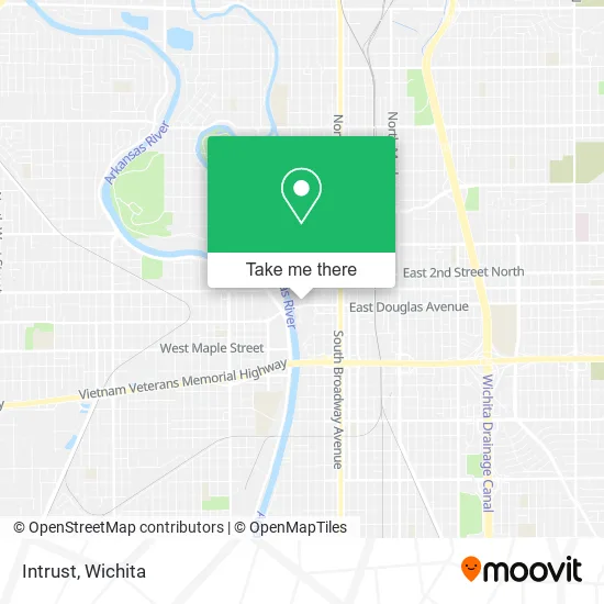
See Intrust, Wichita, on the map
Public Transit to Intrust in Wichita
Wondering how to get to Intrust in Wichita? Moovit helps you find the best way to get to Intrust with step-by-step directions from the nearest public transit station.
Moovit provides free maps and live directions to help you navigate through your city. View schedules, routes, timetables, and find out how long does it take to get to Intrust in real time.
Looking for the nearest stop or station to Intrust? Check out this list of stops closest to your destination: Douglas And Wichita Ob; Douglas And Wichita Ib; Waterman And Market Ib; 2nd And Waco Outbound; Main And 2nd St.
Bus: Q-LINE CLIFTON T, ROUTE11: MAPLE-R, ROUTE12: DOUGLAS, ROUTE15: DOUGLAS, ROUTE21: DOUGLAS, ROUTE22: S BDWY-, ROUTE28: KU MED-, ROUTE29: HYDRAUL, ROUTE14: DOUGLAS, ROUTE17: RIVERSI.
Want to see if there’s another route that gets you there at an earlier time? Moovit helps you find alternative routes or times. Get directions from and directions to Intrust easily from the Moovit App or Website.
We make riding to Intrust easy, which is why over 1.5 million users, including users in Wichita, trust Moovit as the best app for public transit. You don’t need to download an individual bus app or train app, Moovit is your all-in-one transit app that helps you find the best bus time or train time available.
For information on prices of bus, costs and ride fares to Intrust, please check the Moovit app.
Use the app to navigate to popular places including to the airport, hospital, stadium, grocery store, mall, coffee shop, school, college, and university.
Intrust Address: 350 W Douglas Ave Wichita, KS 67202 street in Wichita
- Wichita Hispanic Chamber of Commerce,
- 130 S Waco St Parking,
- Law Offices of Donald C,
- The next Chapter,
- Next Chapter,
- Regier Carr & Monroe Cpas-Kansas,
- Raymond James Financial Services,
- Shawn Elliott,
- Prime Employment Solutions,
- Family Law Wichita,
- HJH Investments,
- Futurity First Insurance Group,
- Federal District Court for the District of Kansas,
- Paragon's Desingn,
- Speth & King,
- Petroleum,
- Barkley Solar,
- State Banking Department,
- The Douglas Firm LLC,
- Hawthorne Hardwood Floors
Places Near Intrust (Wichita)
- 21st & Maize, Wichita,
- Ascencion Via Christi Hospital St Francis, Wichita,
- Four Corners Cafe @ Wesley Medical Center, Wichita,
- Lopez Services, Wichita,
- North High School, Wichita,
- Ratcliff Auto and Truck Repair, Wichita,
- Hubb's glory hole, Wichita,
- Bmer Tech Automotive, Wichita,
- Sena African Hair Braiding LLC, Wichita,
- Wichita Dwight D. Eisenhower National Airport (ICT) (Wichita Eisenhower National Airport), Wichita,
- Paige Place Apartments, Wichita,
- McConnell Air Force Base, Mcconnell Afb,
- Total Card Solutions, Wichita,
- Spirit Aerosystems,
- Towne East Mall, Wichita,
- Spirit Aerosystems Inc, Building 1-198D,
- Afghan Halal Market, Wichita,
- Spirit AeroSystems, Bldg 2-280J (Section 9),
- Westside Athletic Field (Friends University Baseball Field), Wichita,
- East 21st Street North and Webb Road, Wichita
How to get to popular places in Wichita with public transit
Get around Wichita by public transit!
Traveling around Wichita has never been so easy. See step by step directions as you travel to any attraction, street or major public transit station. View bus and train schedules, arrival times, service alerts and detailed routes on a map, so you know exactly how to get to anywhere in Wichita.
When traveling to any destination around Wichita use Moovit's Live Directions with Get Off Notifications to know exactly where and how far to walk, how long to wait for your line, and how many stops are left. Moovit will alert you when it's time to get off — no need to constantly re-check whether yours is the next stop.
Wondering how to use public transit in Wichita or how to pay for public transit in Wichita? Moovit public transit app can help you navigate your way with public transit easily, and at minimum cost. It includes public transit fees, ticket prices, and costs. Looking for a map of Wichita public transit lines? Moovit public transit app shows all public transit maps in Wichita with all bus routes and stops on an interactive map.
Wichita has 1 transit type(s), including: bus, operated by several transit agencies, including Wichita Transit, Greyhound-us and FlixBus-us