Directions to Inverness, FL with public transportation
The following transit lines have routes that pass near Inverness, FL
 Bus: RED.
How to get to Inverness, FL by bus?
Click on the bus route to see step by step directions with maps, line arrival times and updated time schedules.
Bus stop near Inverness, FL
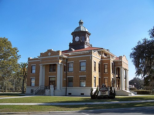
- Courthouse, Old Courthous Square, East Side, 3 min walk,
Bus lines to Inverness, FL
- RED, Loop,
What are the closest stations to Inverness, FL?
The closest stations to Inverness, FL are:
- Courthouse, Old Courthous Square, East Side stop is 238 yards away, 3 min walk.
Which bus line stops near Inverness, FL?
RED (Loop)
What’s the nearest bus station to Inverness, FL?
The nearest bus station to Inverness, FL is Courthouse, Old Courthous Square, East Side. It’s a 3 min walk away.
What time is the first bus to Inverness, FL?
The RED is the first bus that goes to Inverness, FL. It stops nearby at 6:27 AM.
What time is the last bus to Inverness, FL?
The RED is the last bus that goes to Inverness, FL. It stops nearby at 4:44 PM.
See Inverness, FL on the map
Public Transportation to Inverness, FL
Wondering how to get to Inverness, FL? Moovit helps you find the best way to get to Inverness, FL with step-by-step directions from the nearest public transit station.
Moovit provides free maps and live directions to help you navigate through your city. View schedules, routes, timetables, and find out how long does it take to get to Inverness, FL in real time.
Looking for the nearest stop or station to Inverness, FL? Check out this list of stops closest to your destination: Courthouse.
Bus: RED.
Want to see if there’s another route that gets you there at an earlier time? Moovit helps you find alternative routes or times. Get directions from and directions to Inverness, FL easily from the Moovit App or Website.
We make riding to Inverness, FL easy, which is why over 1.7 billion users, including users in Inverness, trust Moovit as the best app for public transit. You don’t need to download an individual bus app or train app, Moovit is your all-in-one transit app that helps you find the best bus time or train time available.
For information on prices of bus, costs and ride fares to Inverness, FL, please check the Moovit app.
Use the app to navigate to popular places including to the airport, hospital, stadium, grocery store, mall, coffee shop, school, college, and university.
Location: Inverness, Citrus County
Popular routes to Inverness, FL
- From Crystal River Plaza,
- From Ventura Village Apartments / Hernando,
- From Crystal River City Hall,
- From Floral City Library,
- From College Of Central Florida / Lecanto,
- From Homosassa Regional Shopping Center,
- From Walgreens,
- From E Apex Ln / 200 Sr,
- From Lakes Region Library,
- From Beall's Westbound / Inverness
- My Florida Probate,
- Citrus Counseling,
- Only Way Realty Citrus,
- The Holloway Group,
- The Studio Downtown - Inverness, FL,
- Inner Alchemy Bodywork,
- Masonic Ballroom,
- The Bistro Too Pizza Kitchen,
- Salt Therapy,
- Schmaltalk Speech Therapy,
- Sonshine Boutique And Workshop,
- Sherri Rutledge Realtor,
- Michele Rose - Keller Williams,
- Keller Williams Elite Partners II,
- Jess Stone,
- Melisa L. Militello,
- Enchant Glamour,
- Baby Bargains,
- Screenin Demon Llc,
- Purina Lifestyle Product Specialist Kelly Harper
Places Near Inverness, FL
- Inverness, FL, Inverness,
- Citrus Stampede Rodeo,
- Greyhound, Crystal River,
- Natural Healing Center on Kingsbay, Crystal River,
- Hernando Beach, Hernando,
- Homosassa Springs, FL, Homosassa,
- Steves Key Shop,
- Homosassa, FL, Homosassa Springs,
- Seadaddys Dive Center, Crystal River,
- Beverly Hills, FL, Beverly Hills,
- 491 and 486, Pine Ridge,
- Colbury Pools, Crystal River,
- Floral City, FL, Floral City,
- Bright House Spectrum, Hernando,
- Greyhound Bus Lines, Crystal River,
- Inverness FL USA, Inverness,
- Crystal Vision Psychic, Crystal River,
- Hernando, FL, Hernando,
- Cowboy Junction Flea Market, Lecanto,
- Coinstar
How to get to popular places in Citrus County with public transit
Get around Inverness by public transit!
Traveling around Inverness has never been so easy. See step by step directions as you travel to any attraction, street or major public transit station. View bus and train schedules, arrival times, service alerts and detailed routes on a map, so you know exactly how to get to anywhere in Inverness.
When traveling to any destination around Inverness use Moovit's Live Directions with Get Off Notifications to know exactly where and how far to walk, how long to wait for your line, and how many stops are left. Moovit will alert you when it's time to get off — no need to constantly re-check whether yours is the next stop.
Wondering how to use public transit in Inverness or how to pay for public transit in Inverness? Moovit public transit app can help you navigate your way with public transit easily, and at minimum cost. It includes public transit fees, ticket prices, and costs. Looking for a map of Inverness public transit lines? Moovit public transit app shows all public transit maps in Inverness with all bus routes and stops on an interactive map.
Citrus County has 1 transit type(s), including: bus, operated by several transit agencies, including Orange Line