Directions to Invesco (Manhattan) with public transportation
The following transit lines have routes that pass near Invesco
 Bus: 120, BXM18, QM11, X28, DOWNTOWN CONNECTION.
- Train: GRE, RED.
- Subway: 2, 3, 4, E, R.
- Ferry: EDGEWATER - BROOKFIELD PLACE, HOBOKEN / NJ TRANSIT TERMINAL - BROOKFIELD PLACE, PAULUS HOOK - BROOKFIELD PLACE, PORT IMPERIAL - BROOKFIELD PLACE, SOUTH AMBOY - PIER 11/WALL ST..
How to get to Invesco by bus?
Click on the bus route to see step by step directions with maps, line arrival times and updated time schedules.
From The Metropolitan Museum of Art (Metropolitan Museum of Art), Manhattan
45 minFrom Maspeth, Queens
69 minFrom The Morgan Library & Museum, Manhattan
32 minFrom 5 East 98th Street, Manhattan
45 minFrom Mt Sinai, Manhattan
46 minFrom Metropolitan Hospital, Manhattan
56 minFrom Saint Patrick’S Cathedral, Manhattan
40 minFrom West New York, NJ, West New York
66 minFrom Bayonne, NJ, Bayonne
56 min
How to get to Invesco by train?
Click on the train route to see step by step directions with maps, line arrival times and updated time schedules.
How to get to Invesco by subway?
Click on the subway route to see step by step directions with maps, line arrival times and updated time schedules.
Train station near Invesco in Manhattan
- World Trade Center, 3 min walk,VIEW
Subway stations near Invesco in Manhattan
Bus stops near Invesco in Manhattan
Ferry stations near Invesco in Manhattan
Bus lines to Invesco in Manhattan
- DOWNTOWN CONNECTION, Chambers Street,VIEW
- SIM7, Eltvlle Trans Ctr Via Hylan Via Richmond,VIEW
- SIM9, Eltingville Via F Cap Via Hylan Bl,VIEW
- SIM33, Mariners Harbor Via N Gannon Av,VIEW
- M9, Kips Bay 1 Av - 26 St Via Avenue C,VIEW
- M20, Lincoln Center 66 St Via 8 Av,VIEW
- M22, Battery Pk Cty Vesey St,VIEW
- X27, Bay Ridge - Manhattan Express,VIEW
- X28, Sea Gate / Bensonhurst - Manhattan Express,VIEW
What are the closest stations to Invesco?
The closest stations to Invesco are:
- World Trade Center is 139 yards away, 3 min walk.
- Wtc Cortlandt is 145 yards away, 3 min walk.
- South End Ave & Albany St is 162 yards away, 3 min walk.
- Vesey St/West St is 206 yards away, 3 min walk.
- South End Av/Albany St is 207 yards away, 3 min walk.
- Vesey St/North End Av is 287 yards away, 4 min walk.
- Cortlandt St is 293 yards away, 5 min walk.
- Brookfield Place/Battery Park City is 505 yards away, 7 min walk.
- Church St/Liberty St is 538 yards away, 7 min walk.
- Battery Park City/Vesey St. is 541 yards away, 7 min walk.
Which bus lines stop near Invesco?
These bus lines stop near Invesco: 120, BXM18, QM11, X28.
Which train lines stop near Invesco?
These train lines stop near Invesco: GRE, RED.
Which subway lines stop near Invesco?
These subway lines stop near Invesco: 2, 3, 4, E, R.
What’s the nearest subway station to Invesco in Manhattan?
The nearest subway station to Invesco in Manhattan is Wtc Cortlandt. It’s a 3 min walk away.
What’s the nearest train station to Invesco in Manhattan?
The nearest train station to Invesco in Manhattan is World Trade Center. It’s a 3 min walk away.
What’s the nearest bus station to Invesco in Manhattan?
The nearest bus stations to Invesco in Manhattan are South End Ave & Albany St, Vesey St/West St and South End Av/Albany St. The closest one is a 3 min walk away.
What’s the nearest ferry station to Invesco in Manhattan?
The nearest ferry stations to Invesco in Manhattan are Brookfield Place/Battery Park City and Battery Park City/Vesey St.. The closest one is a 7 min walk away.
What time is the first subway to Invesco in Manhattan?
The N is the first subway that goes to Invesco in Manhattan. It stops nearby at 3:05 AM.
What time is the last subway to Invesco in Manhattan?
The N is the last subway that goes to Invesco in Manhattan. It stops nearby at 3:46 AM.
What time is the first train to Invesco in Manhattan?
The RED is the first train that goes to Invesco in Manhattan. It stops nearby at 3:10 AM.
What time is the last train to Invesco in Manhattan?
The RED is the last train that goes to Invesco in Manhattan. It stops nearby at 2:55 AM.
What time is the first bus to Invesco in Manhattan?
The M22 is the first bus that goes to Invesco in Manhattan. It stops nearby at 5:00 AM.
What time is the last bus to Invesco in Manhattan?
The M22 is the last bus that goes to Invesco in Manhattan. It stops nearby at 1:18 AM.
What time is the first ferry to Invesco in Manhattan?
The PAULUS HOOK - BROOKFIELD PLACE is the first ferry that goes to Invesco in Manhattan. It stops nearby at 6:07 AM.
What time is the last ferry to Invesco in Manhattan?
The PAULUS HOOK - BROOKFIELD PLACE is the last ferry that goes to Invesco in Manhattan. It stops nearby at 10:52 PM.
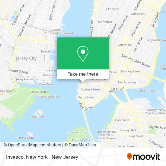
See Invesco, Manhattan, on the map
Public Transit to Invesco in Manhattan
Wondering how to get to Invesco in Manhattan? Moovit helps you find the best way to get to Invesco with step-by-step directions from the nearest public transit station.
Moovit provides free maps and live directions to help you navigate through your city. View schedules, routes, timetables, and find out how long does it take to get to Invesco in real time.
Looking for the nearest stop or station to Invesco? Check out this list of stops closest to your destination: World Trade Center; Wtc Cortlandt; South End Ave & Albany St; Vesey St/West St; South End Av/Albany St; Vesey St/North End Av; Cortlandt St; Brookfield Place/Battery Park City; Church St/Liberty St; Battery Park City/Vesey St..
Bus: 120, BXM18, QM11, X28, DOWNTOWN CONNECTION, M9, M20.Train: GRE, RED.Subway: 2, 3, 4, E, R, 1, N, Q, W.Ferry: EDGEWATER - BROOKFIELD PLACE, HOBOKEN / NJ TRANSIT TERMINAL - BROOKFIELD PLACE, PAULUS HOOK - BROOKFIELD PLACE, PORT IMPERIAL - BROOKFIELD PLACE, SOUTH AMBOY - PIER 11/WALL ST..
Want to see if there’s another route that gets you there at an earlier time? Moovit helps you find alternative routes or times. Get directions from and directions to Invesco easily from the Moovit App or Website.
We make riding to Invesco easy, which is why over 1.5 million users, including users in Manhattan, trust Moovit as the best app for public transit. You don’t need to download an individual bus app or train app, Moovit is your all-in-one transit app that helps you find the best bus time or train time available.
For information on prices of bus, subway and train, costs and ride fares to Invesco, please check the Moovit app.
Use the app to navigate to popular places including to the airport, hospital, stadium, grocery store, mall, coffee shop, school, college, and university.
Invesco Address: 225 Liberty St street in Manhattan
- Convene at 225 Liberty Street,
- Commerzbank Ag,
- People En Español,
- Virtusa Corporation,
- HBC Saks Fifth Avenue Corporate Offices,
- The Foundry,
- Sports Illustrated,
- Louis Vuitton,
- Merrill Lynch Financial Advisor Ryan Feldman,
- South Food Truck Court,
- Jck Magazine,
- Maesa,
- Rauxa,
- People Inc.,
- For Five Coffee @ Brookfield Place,
- Recover Funds Ltd,
- Ar Data Lab,
- Meredith Corporation,
- Daily Provisions - Brookfield Place,
- Clean Market
Places Near Invesco (Manhattan)
- 66 John Street, Manhattan,
- SoHo, Manhattan,
- Bellevue Hospital, Manhattan,
- Wall Street, Manhattan,
- 376 Hudson Street, Manhattan,
- 26 Federal Plaza, Manhattan,
- 3 Stone St, Manhattan,
- Rockefeller Center, Manhattan,
- Times Square, Manhattan,
- Chinatown, Manhattan,
- qqqq, Manhattan,
- 111 Centre New York City Supreme Court, Manhattan,
- 911 Memorial, Manhattan,
- Pier 83, Manhattan,
- Queens Center Mall, Queens,
- Mountainside Hospital, Glen Ridge,
- San Gennaro Feast, Manhattan,
- Hudson Yards, Manhattan,
- 1 Police Plaza, Manhattan,
- Katz's Deli, Manhattan
How to get to popular places in New York - New Jersey with public transit
Get around Manhattan by public transit!
Traveling around Manhattan has never been so easy. See step by step directions as you travel to any attraction, street or major public transit station. View bus and train schedules, arrival times, service alerts and detailed routes on a map, so you know exactly how to get to anywhere in Manhattan.
When traveling to any destination around Manhattan use Moovit's Live Directions with Get Off Notifications to know exactly where and how far to walk, how long to wait for your line, and how many stops are left. Moovit will alert you when it's time to get off — no need to constantly re-check whether yours is the next stop.
Wondering how to use public transit in Manhattan or how to pay for public transit in Manhattan? Moovit public transit app can help you navigate your way with public transit easily, and at minimum cost. It includes public transit fees, ticket prices, and costs. Looking for a map of Manhattan public transit lines? Moovit public transit app shows all public transit maps in Manhattan with all Bus, Train, Subway, Light Rail, Ferry and Cable Car routes and stops on an interactive map.
New York - New Jersey has 6 transit type(s), including: Bus, Train, Subway, Light Rail, Ferry and Cable Car, operated by several transit agencies, including MTA Subway, Metro-North Railroad, LIRR, PATH, MTA New York City Transit - Express routes, MTA Bus, NJ Transit, NYC Ferry, NICE bus, Bee-Line Bus, NJ Transit Rail, Norwalk Transit District, Hartford Line, River Valley Transit and HART
Public transit lines with stations closest to Invesco in Manhattan
Subway lines with stations closest to Invesco in Manhattan
Train lines with stations closest to Invesco in Manhattan
Bus lines with stations closest to Invesco in Manhattan
Ferry lines with stations closest to Invesco in Manhattan
Brookfield Place/Battery Park City
- EDGEWATER - BROOKFIELD PLACEEdgewater - Brookfield Place
- HOBOKEN / NJ TRANSIT TERMINAL - BROOKFIELD PLACEHoboken / NJ Transit Terminal - Brookfield Place
- PAULUS HOOK - BROOKFIELD PLACEPaulus Hook - Brookfield Place
- PORT IMPERIAL - BROOKFIELD PLACEPort Imperial - Brookfield Place
- SOUTH AMBOY - PIER 11/WALL ST.South Amboy - Pier 11/Wall St.