Directions to Iolanda (Boa Vista) with public transportation
The following transit lines have routes that pass near Iolanda
How to get to Iolanda by bus?
Click on the bus route to see step by step directions with maps, line arrival times and updated time schedules.
From Rua Desembargador Westphalen, Rebouças
31 minFrom Estação Tubo Petit Carneiro, Água Verde
38 minFrom Seminário, Seminário
47 minFrom Avenida Senador Souza Naves, Alto Da Rua XV
32 minFrom Rua General Mário Tourinho 1804, Seminário
49 minFrom Rua Almirante Tamandaré 1000, Colombo
46 minFrom centro colombo, Colombo
48 minFrom Hospital Universitário Evangélico Mackenzie, Bigorrilho
46 minFrom Bosque São Cristóvão, Santa Felicidade
66 minFrom Rua Iapó 1408, Prado Velho
47 min
Bus stops near Iolanda in Boa Vista
Bus lines to Iolanda in Boa Vista
- 224 CASSIOPÉIA, Terminal Boa Vista ↺ Cassiopéia (Circular),VIEW
- 203 SANTA CÂNDIDA / CAPÃO RASO, Terminal Santa Cândida → Terminal Capão Raso,VIEW
- 209 MAD. SANTA CÂNDIDA / CAPÃO RASO, Terminal Santa Cândida → Terminal Capão Raso (via Praça Rui Barbosa),VIEW
- S01 ROÇA GRANDE / GUADALUPE (VIA SANTA CÂNDIDA), ROÇA GRANDE / GUADALUPE (VIA SANTA CÂNDIDA),VIEW
- B72 COLOMBO / GUADALUPE (VIA T. ROÇA GRANDE), COLOMBO / GUADALUPE (via T. ROÇA GRANDE),VIEW
- B73 JARDIM OSASCO / GUADALUPE, JARDIM OSASCO / GUADALUPE,VIEW
- B76 SÃO SEBASTIÃO / GUADALUPE, SÃO SEBASTIÃO / GUADALUPE,VIEW
- B78 SÃO GABRIEL / GUADALUPE, SÃO GABRIEL / GUADALUPE,VIEW
- S89 SÃO SEBASTIÃO / GUADALUPE (VIA SÃO GABRIEL), SÃO SEBASTIÃO / GUADALUPE (via SÃO GABRIEL),VIEW
- 229 MAD. PENHA / FERNANDO DE NORONHA, Terminal Boa Vista ↺ Fernando De Noronha (Circular),VIEW
- 280 NOSSA SENHORA DE NAZARÉ, Nossa Senhora de Nazaré → Praça Tiradentes,VIEW
What are the closest stations to Iolanda?
The closest stations to Iolanda are:
- Rua Desembargador Antônio Leopoldo Dos Santos, 233-359 is 218 meters away, 4 min walk.
- Antônio Lago is 402 meters away, 6 min walk.
- Av. Paraná, 3301 is 406 meters away, 6 min walk.
- R. Canadá, 1866 is 451 meters away, 6 min walk.
- R. Nossa Senhora de Nazaré, 2142 is 922 meters away, 12 min walk.
Which bus lines stop near Iolanda?
These bus lines stop near Iolanda: 203 SANTA CÂNDIDA / CAPÃO RASO, B72 COLOMBO / GUADALUPE (VIA T. ROÇA GRANDE).
What’s the nearest bus station to Iolanda in Boa Vista?
The nearest bus station to Iolanda in Boa Vista is Rua Desembargador Antônio Leopoldo Dos Santos, 233-359. It’s a 4 min walk away.
What time is the first bus to Iolanda in Boa Vista?
The 209 MAD. SANTA CÂNDIDA / CAPÃO RASO is the first bus that goes to Iolanda in Boa Vista. It stops nearby at 3:08 AM.
What time is the last bus to Iolanda in Boa Vista?
The 209 MAD. SANTA CÂNDIDA / CAPÃO RASO is the last bus that goes to Iolanda in Boa Vista. It stops nearby at 3:08 AM.
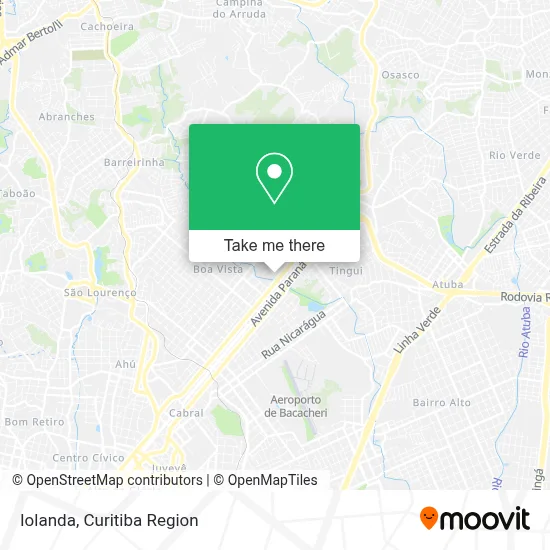
See Iolanda, Boa Vista, on the map
Public Transit to Iolanda in Boa Vista
Wondering how to get to Iolanda in Boa Vista? Moovit helps you find the best way to get to Iolanda with step-by-step directions from the nearest public transit station.
Moovit provides free maps and live directions to help you navigate through your city. View schedules, routes, timetables, and find out how long does it take to get to Iolanda in real time.
Looking for the nearest stop or station to Iolanda? Check out this list of stops closest to your destination: Rua Desembargador Antônio Leopoldo Dos Santos; Antônio Lago; Av. Paraná; R. Canadá; R. Nossa Senhora de Nazaré.
Bus: 203 SANTA CÂNDIDA / CAPÃO RASO, B72 COLOMBO / GUADALUPE (VIA T. ROÇA GRANDE), 224 CASSIOPÉIA, 209 MAD. SANTA CÂNDIDA / CAPÃO RASO, S01 ROÇA GRANDE / GUADALUPE (VIA SANTA CÂNDIDA), B73 JARDIM OSASCO / GUADALUPE, B76 SÃO SEBASTIÃO / GUADALUPE, B78 SÃO GABRIEL / GUADALUPE, 229 MAD. PENHA / FERNANDO DE NORONHA, 280 NOSSA SENHORA DE NAZARÉ.
Want to see if there’s another route that gets you there at an earlier time? Moovit helps you find alternative routes or times. Get directions from and directions to Iolanda easily from the Moovit App or Website.
We make riding to Iolanda easy, which is why over 1.5 million users, including users in Boa Vista, trust Moovit as the best app for public transit. You don’t need to download an individual bus app or train app, Moovit is your all-in-one transit app that helps you find the best bus time or train time available.
For information on prices of bus, costs and ride fares to Iolanda, please check the Moovit app.
Use the app to navigate to popular places including to the airport, hospital, stadium, grocery store, mall, coffee shop, school, college, and university.
Iolanda Address: Rua Des. Antônio Leopoldo dos Santos, 92 Boa Vista Curitiba-PR 82560-580 street in Boa Vista
- Maria da Luz,
- Empty Studio,
- Apericheese Co,
- Viana Gestão e Tecnologia,
- Cdt Cara da Ti,
- Delft Chocolates,
- Bárbara Borio,
- Yeshua Construções,
- Tfk Psicológia,
- Alessandra Moretao,
- Stella Viagens e Eventos,
- Hotel Lizon,
- Linhares Representações,
- Rsp Comércio,
- Letícia dos Santos Pontes,
- Thiago Cruz da Silva Cruz,
- Delivery Cosmetic,
- Motorenz,
- Raquel Furquim Educação e Saude,
- Lucia Cosméticos
Places Near Iolanda (Boa Vista)
- Hospital Madalena Sofia, Bairro Alto,
- Park Shopping Barigüi, Mossunguê,
- Shopping Palladium, Portão,
- Hospital Erasto Gaertner, Jardim Das Américas,
- Rua Martim Afonso 558, Mercês,
- Shopping Estação, Rebouças,
- Jardim Botânico de Curitiba PR, Centro,
- Hospital Universitário Evangélico de Curitiba, Bigorrilho,
- Jockey Plaza Shopping Center, Tarumã,
- Hospital de Clínicas (HC - UFPR), Centro,
- Hospital do Rocio, Campo,
- Hospital Nossa Senhora Das Graças, Mercês,
- Campo Largo, Campo,
- Parque Barigui, Mercês,
- Rua General Mário Tourinho, Campina Do Siqueira,
- Hospital Angelina Caron, Campina Grande Do Sul,
- Pontifícia Universidade Católica do Paraná (PUCPR), Prado Velho,
- Hospital Da Cruz Vermelha, Batel,
- Hhhhh, Fazendinha,
- Arena Da Baixada - Curitiba
How to get to popular places in Curitiba Region with public transit
Get around Boa Vista by public transit!
Traveling around Boa Vista has never been so easy. See step by step directions as you travel to any attraction, street or major public transit station. View bus and train schedules, arrival times, service alerts and detailed routes on a map, so you know exactly how to get to anywhere in Boa Vista.
When traveling to any destination around Boa Vista use Moovit's Live Directions with Get Off Notifications to know exactly where and how far to walk, how long to wait for your line, and how many stops are left. Moovit will alert you when it's time to get off — no need to constantly re-check whether yours is the next stop.
Wondering how to use public transit in Boa Vista or how to pay for public transit in Boa Vista? Moovit public transit app can help you navigate your way with public transit easily, and at minimum cost. It includes public transit fees, ticket prices, and costs. Looking for a map of Boa Vista public transit lines? Moovit public transit app shows all public transit maps in Boa Vista with all Bus and Cable Car routes and stops on an interactive map.
Curitiba Region has 2 transit type(s), including: Bus and Cable Car, operated by several transit agencies, including Sistema Integrado de Mobilidade (URBS), Sistema Integrado de Mobilidade (AMEP), URBS (Cartões bancários e Dinheiro), URBS (Cartões bancários / Cartão URBS), AMEP (Cartões bancários / Cartão MetroCard), AMEP (Cartões bancários / Cartão MetroCard / Dinheiro), Viação Colombo (Dinheiro), TRIAR (Cartão TRIAR / Dinheiro), Empresa Curitiba Cerro Azul (Dinheiro), Expresso Nossa Senhora da Penha (Dinheiro), Empresa Campo Alto Tijucas (Dinheiro), Auto Viação São José (Cartão VEM / Dinheiro), BRT S/A (Cartão VEM / Dinheiro), TransPiedade (Cartão Cidadão / Dinheiro) and Oceânica Sul (Cartão Transporte / Dinheiro)
Public transit lines with stations closest to Iolanda in Boa Vista
Bus lines with stations closest to Iolanda in Boa Vista
R. Canadá, 1866
 S01 ROÇA GRANDE / GUADALUPE (VIA SANTA CÂNDIDA)ROÇA GRANDE / GUADALUPE (VIA SANTA CÂNDIDA)
- B72 COLOMBO / GUADALUPE (VIA T. ROÇA GRANDE)COLOMBO / GUADALUPE (via T. ROÇA GRANDE)
- B73 JARDIM OSASCO / GUADALUPEJARDIM OSASCO / GUADALUPE
- B76 SÃO SEBASTIÃO / GUADALUPESÃO SEBASTIÃO / GUADALUPE
- B78 SÃO GABRIEL / GUADALUPESÃO GABRIEL / GUADALUPE