How to get to IP Dorofeeva N.P. by bus?
Click on the bus route to see step by step directions with maps, line arrival times and updated time schedules.
From Marshal Zhukov Avenue, Sovetsky District
65 minFrom Fairy Tale Park, Sovetsky District
56 minFrom Levoberezhaya Street, 94, Proletarsky District
66 minFrom Dovatora Street 148, Sovetsky District
77 minFrom Le-Man, Sovetsky District
56 minFrom 29th Line Street, Proletarsky District
50 minFrom Taganrogskaya Street, 161/2, Oktyabrsky District
40 minFrom Dolomanovsky Lane, 70, Leninsky District
30 minFrom St. George Church of Great Martyr George the Victorious, Sovetsky District
55 minFrom Republican Street, Leninsky District
45 min
Bus stops near IP Dorofeeva N.P. in Voroshilovsky District
Shuttle station near IP Dorofeeva N.P. in Voroshilovsky District
- Narimanova St., 15 min walk,VIEW
Bus lines to IP Dorofeeva N.P. in Voroshilovsky District
- 2, Skifskaya Street,VIEW
- 6, Central Market - Korolev Avenue,VIEW
- 21, Startovaya - Main Bus Station,VIEW
- 22, Upper Temernik - Central Market,VIEW
- 25, GPZ-10 - Upper Temernik,VIEW
- 33, Upper Temernik - Main Bus Station,VIEW
- 45, Startovaya - Central Market,VIEW
- 45, Startovaya - Bauman,VIEW
- 46, Dobrovolsky Square - Central Market,VIEW
- 47, Startovaya - Central Market,VIEW
- 47, Startovaya - Turgenevskaya,VIEW
- 56, GPZ-10 - Upper Temernik,VIEW
- 63, Alexandrovka - Service Institute,VIEW
- 63, Service Institute - Selmash,VIEW
- 65, Service Institute - Central Market,VIEW
- 65, Oborony Street - Service Institute,VIEW
- 66, Startovaya - Alexandrovka,VIEW
- 77, Oborony Street - Orbitalnaya Street 20,VIEW
- 77, Pokrovsky Church - Central Market,VIEW
- 78, Upper Temernik - Central Market,VIEW
What are the closest stations to IP Dorofeeva N.P.?
The closest stations to IP Dorofeeva N.P. are:
- Tibet Street is 137 meters away, 2 min walk.
- Narimanova St. is 704 meters away, 10 min walk.
- Mikhail Nagibin Ave. is 786 meters away, 11 min walk.
Which bus lines stop near IP Dorofeeva N.P.?
These bus lines stop near IP Dorofeeva N.P.: 18L, 21, 22, 33, 45, 47, 90.
Which shuttle lines stop near IP Dorofeeva N.P.?
These shuttle lines stop near IP Dorofeeva N.P.: 21, 56, 66, 90.
What’s the nearest bus station to IP Dorofeeva N.P. in Voroshilovsky District?
The nearest bus station to IP Dorofeeva N.P. in Voroshilovsky District is Tibet Street. It’s a 2 min walk away.
What’s the nearest shuttle station to IP Dorofeeva N.P. in Voroshilovsky District?
The nearest shuttle station to IP Dorofeeva N.P. in Voroshilovsky District is Narimanova St.. It’s a 15 min walk away.
What time is the first bus to IP Dorofeeva N.P. in Voroshilovsky District?
The 45 is the first bus that goes to IP Dorofeeva N.P. in Voroshilovsky District. It stops nearby at 5:08 AM.
What time is the last bus to IP Dorofeeva N.P. in Voroshilovsky District?
The 65 is the last bus that goes to IP Dorofeeva N.P. in Voroshilovsky District. It stops nearby at 11:38 PM.
What time is the first Trolleybus to IP Dorofeeva N.P. in Voroshilovsky District?
The 6 is the first Trolleybus that goes to IP Dorofeeva N.P. in Voroshilovsky District. It stops nearby at 5:58 AM.
What time is the last Trolleybus to IP Dorofeeva N.P. in Voroshilovsky District?
The 6 is the last Trolleybus that goes to IP Dorofeeva N.P. in Voroshilovsky District. It stops nearby at 8:37 PM.
What time is the first shuttle to IP Dorofeeva N.P. in Voroshilovsky District?
The 66 is the first shuttle that goes to IP Dorofeeva N.P. in Voroshilovsky District. It stops nearby at 5:40 AM.
What time is the last shuttle to IP Dorofeeva N.P. in Voroshilovsky District?
The 21 is the last shuttle that goes to IP Dorofeeva N.P. in Voroshilovsky District. It stops nearby at 11:29 PM.
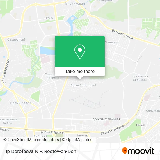
See IP Dorofeeva N.P., Voroshilovsky District, on the map
Public Transit to IP Dorofeeva N.P. in Voroshilovsky District
Wondering how to get to IP Dorofeeva N.P. in Voroshilovsky District? Moovit helps you find the best way to get to IP Dorofeeva N.P. with step-by-step directions from the nearest public transit station.
Moovit provides free maps and live directions to help you navigate through your city. View schedules, routes, timetables, and find out how long does it take to get to IP Dorofeeva N.P. in real time.
Looking for the nearest stop or station to IP Dorofeeva N.P.? Check out this list of stops closest to your destination: Tibet Street; Narimanova St.; Mikhail Nagibin Ave..
Bus: 18L, 21, 22, 33, 45, 47, 90, 2, 6, 25, 83, 18R.Shuttle: 21, 56, 66, 90, 38.
Want to see if there’s another route that gets you there at an earlier time? Moovit helps you find alternative routes or times. Get directions from and directions to IP Dorofeeva N.P. easily from the Moovit App or Website.
We make riding to IP Dorofeeva N.P. easy, which is why over 1.5 million users, including users in Voroshilovsky District, trust Moovit as the best app for public transit. You don’t need to download an individual bus app or train app, Moovit is your all-in-one transit app that helps you find the best bus time or train time available.
For information on prices of shuttle, bus and light rail, costs and ride fares to IP Dorofeeva N.P., please check the Moovit app.
Use the app to navigate to popular places including to the airport, hospital, stadium, grocery store, mall, coffee shop, school, college, and university.
IP Dorofeeva N.P. Address: Ip Dorofeeva N P, Ростов-на-Дону, Россия, 344068 street in Voroshilovsky District
- Artzoloto,
- Horizon Residential Complex,
- Horizon Residential Complex in Rostov-on-Don,
- Falke Gorizont,
- Izmail Lane,
- Nagibina 40,
- Izmailsky,
- Chester Shop,
- IP Orlova I.V.,
- Russian Hunting,
- Izmailovsky Park Residential Complex,
- Mikhail Nagibin Avenue 40,
- Electroapparat,
- Energosbyt-Don,
- SKA Rostov-on-Don,
- Izmailsky Lane, 41,
- Electroapparat Factory Square,
- 41 Izmailsky,
- Kindergarten #48 of Voroshilovsky District,
- Lemon Joe
Places Near IP Dorofeeva N.P. (Voroshilovsky District)
- Pervomayskaya Station, Sovetsky District,
- 14 Line Street 63, Proletarsky District,
- Gaidara Street, Leninsky District,
- Regional Clinical Hospital #2, Pervomaisky District,
- Sholokhov Avenue,
- Regional Hospital #2,
- Shopping Center "Horizon", Voroshilovsky District,
- Rostov Regional Clinical Hospital, Sovetsky District,
- Sailors Hospital, Pervomaisky District,
- Rostov-on-Don Embankment,
- UFPS Military Unit 71609, Pervomaisky District,
- Rostov Zoo, Oktyabrsky District,
- CDC "Health", Pervomaisky District,
- Temernik Market, Pervomaisky District,
- Pushkinskaya Street, 174, Kirovsky District,
- Rostov Research Oncology Institute, Proletarsky District,
- Central Market,
- BSMP-2, Voroshilovsky District,
- Blagodatnaya Street 170, Sovetsky District,
- City Clinical Hospital #20, Sovetsky District
How to get to popular places in Rostov-on-Don with public transit
Get around Voroshilovsky District by public transit!
Traveling around Voroshilovsky District has never been so easy. See step by step directions as you travel to any attraction, street or major public transit station. View bus and train schedules, arrival times, service alerts and detailed routes on a map, so you know exactly how to get to anywhere in Voroshilovsky District.
When traveling to any destination around Voroshilovsky District use Moovit's Live Directions with Get Off Notifications to know exactly where and how far to walk, how long to wait for your line, and how many stops are left. Moovit will alert you when it's time to get off — no need to constantly re-check whether yours is the next stop.
Wondering how to use public transit in Voroshilovsky District or how to pay for public transit in Voroshilovsky District? Moovit public transit app can help you navigate your way with public transit easily, and at minimum cost. It includes public transit fees, ticket prices, and costs. Looking for a map of Voroshilovsky District public transit lines? Moovit public transit app shows all public transit maps in Voroshilovsky District with all Bus, Light Rail, Trolleybus and Shuttle routes and stops on an interactive map.
Rostov-on-Don has 4 transit type(s), including: Bus, Light Rail, Trolleybus and Shuttle, operated by several transit agencies, including MUP MTK Rostovpassazhirtrans, MUP RTK, LLC RTK Ruseltrans and Minibuses