Directions to Iron Pen Web Design & Printing Service (Washington, D.C. - Baltimore, MD) with public transportation
The following transit lines have routes that pass near Iron Pen Web Design & Printing Service
 Bus: 1, FLIXBUS N2601, 2, 5, 6.
- Train: NORTHEAST REGIONAL.
How to get to Iron Pen Web Design & Printing Service by bus?
Click on the bus route to see step by step directions with maps, line arrival times and updated time schedules.
From Busch Gardens Williamsburg (Employee Parking Lot), James City County
36 minFrom Lorton, VA - Amtrak Auto Train Station (LOR), Fairfax County
560 minFrom Potomac Mills Mall, Prince William County
545 minFrom Rose Gaming Resort, Prince William County
570 minFrom Lorton, VA, Fairfax County
554 minFrom Hampton University, Hampton
191 minFrom Woodbridge, VA, Prince William County
484 minFrom Amazon Fulfillment Center-Ric3, Richmond
159 min
How to get to Iron Pen Web Design & Printing Service by train?
Click on the train route to see step by step directions with maps, line arrival times and updated time schedules.
Bus stops near Iron Pen Web Design & Printing Service in Washington, D.C. - Baltimore, MD
Train station near Iron Pen Web Design & Printing Service in Washington, D.C. - Baltimore, MD
- Williamsburg Amtrak Station, 40 min walk,VIEW
Bus lines to Iron Pen Web Design & Printing Service in Washington, D.C. - Baltimore, MD
What are the closest stations to Iron Pen Web Design & Printing Service?
The closest stations to Iron Pen Web Design & Printing Service are:
- N Boundary St at Merchant Square is 125 yards away, 2 min walk.
- Merchant's Square Ticket Office is 215 yards away, 3 min walk.
- N Boundary St at Williamsburg Tc is 727 yards away, 9 min walk.
- Williamsburg Bus Stop is 3351 yards away, 40 min walk.
- Boundary & Armistead is 3352 yards away, 40 min walk.
- Williamsburg Amtrak Station is 3357 yards away, 40 min walk.
Which bus lines stop near Iron Pen Web Design & Printing Service?
These bus lines stop near Iron Pen Web Design & Printing Service: 1, FLIXBUS N2601.
Which train line stops near Iron Pen Web Design & Printing Service?
NORTHEAST REGIONAL (Newport News)
What’s the nearest bus station to Iron Pen Web Design & Printing Service in Washington, D.C. - Baltimore, MD?
The nearest bus station to Iron Pen Web Design & Printing Service in Washington, D.C. - Baltimore, MD is N Boundary St at Merchant Square. It’s a 2 min walk away.
What time is the first train to Iron Pen Web Design & Printing Service in Washington, D.C. - Baltimore, MD?
The NORTHEAST REGIONAL is the first train that goes to Iron Pen Web Design & Printing Service in Washington, D.C. - Baltimore, MD. It stops nearby at 4:24 AM.
What time is the last train to Iron Pen Web Design & Printing Service in Washington, D.C. - Baltimore, MD?
The NORTHEAST REGIONAL is the last train that goes to Iron Pen Web Design & Printing Service in Washington, D.C. - Baltimore, MD. It stops nearby at 7:44 PM.
What time is the first bus to Iron Pen Web Design & Printing Service in Washington, D.C. - Baltimore, MD?
The 921 is the first bus that goes to Iron Pen Web Design & Printing Service in Washington, D.C. - Baltimore, MD. It stops nearby at 3:35 AM.
What time is the last bus to Iron Pen Web Design & Printing Service in Washington, D.C. - Baltimore, MD?
The FLIXBUS N2601 is the last bus that goes to Iron Pen Web Design & Printing Service in Washington, D.C. - Baltimore, MD. It stops nearby at 8:45 AM.
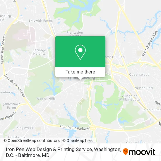
See Iron Pen Web Design & Printing Service, Washington, D.C. - Baltimore, MD, on the map
Public Transit to Iron Pen Web Design & Printing Service in Washington, D.C. - Baltimore, MD
Wondering how to get to Iron Pen Web Design & Printing Service in Washington, D.C. - Baltimore, MD? Moovit helps you find the best way to get to Iron Pen Web Design & Printing Service with step-by-step directions from the nearest public transit station.
Moovit provides free maps and live directions to help you navigate through your city. View schedules, routes, timetables, and find out how long does it take to get to Iron Pen Web Design & Printing Service in real time.
Looking for the nearest stop or station to Iron Pen Web Design & Printing Service? Check out this list of stops closest to your destination: N Boundary St at Merchant Square; Merchant's Square Ticket Office; N Boundary St at Williamsburg Tc; Williamsburg Bus Stop; Boundary & Armistead; Williamsburg Amtrak Station.
Bus: 1, FLIXBUS N2601, 2, 5, 6, 12, 12A, 1000, 3, 7, 921.Train: NORTHEAST REGIONAL.
Want to see if there’s another route that gets you there at an earlier time? Moovit helps you find alternative routes or times. Get directions from and directions to Iron Pen Web Design & Printing Service easily from the Moovit App or Website.
We make riding to Iron Pen Web Design & Printing Service easy, which is why over 1.5 million users, including users in Washington, D.C. - Baltimore, MD, trust Moovit as the best app for public transit. You don’t need to download an individual bus app or train app, Moovit is your all-in-one transit app that helps you find the best bus time or train time available.
For information on prices of bus and train, costs and ride fares to Iron Pen Web Design & Printing Service, please check the Moovit app.
Use the app to navigate to popular places including to the airport, hospital, stadium, grocery store, mall, coffee shop, school, college, and university.
Iron Pen Web Design & Printing Service Address: Williamsburg, VA 23185 street in Washington, D.C. - Baltimore, MD
- Mike's Towing & Recovery,
- Williamsburg Convention & Visitors Bureau,
- Ciao: Colonial Italian American Organization,
- Williamsburg Inn,
- Netsenses,
- Oleta Tour & Travel,
- Williamsburg Coffee & Tea Company,
- Traveling Notary,
- Triangle Taxi,
- Colonial Pro Wash,
- Creek Car Creative,
- Colonial Blinds and Shutters,
- Level Research Group,
- Bread and Butter Jamz,
- New Beginning Lawn Care,
- Holland Custom Exteriors,
- Big Fella Fitness,
- Belle Cleaning Concepts,
- Argo Media Collective,
- Mema's Cleaning Services
Places Near Iron Pen Web Design & Printing Service (Washington, D.C. - Baltimore, MD)
- Georgetown, Washington,
- Museum Of The Bible, Washington,
- Amazon Hq2, Arlington County,
- Washington DC VA Medical Center, Washington,
- Washington National Cathedral, Washington,
- National Zoo, Washington,
- Westfield Montgomery Mall, Montgomery County,
- PG Mall, Prince George's County,
- Warner Theatre, Washington,
- Camden Yards, Baltimore,
- Pennsylvania Ave NW (3rd st and pennsylvania), Washington,
- Sibley Memorial Hospital, Washington,
- M&T Bank Stadium, Baltimore,
- The Anthem, Washington,
- Capital One Arena, Washington,
- Basilica of the National Shrine, Washington,
- National Mall, Washington,
- National Museum of African American History and Culture, Washington,
- Marriott Marquis Washington, DC, Washington,
- Rock Creek Tennis Center, Washington
How to get to popular places in Washington, D.C. - Baltimore, MD with public transit
Get around Washington, D.C. - Baltimore, MD by public transit!
Traveling around Washington, D.C. - Baltimore, MD has never been so easy. See step by step directions as you travel to any attraction, street or major public transit station. View bus and train schedules, arrival times, service alerts and detailed routes on a map, so you know exactly how to get to anywhere in Washington, D.C. - Baltimore, MD.
When traveling to any destination around Washington, D.C. - Baltimore, MD use Moovit's Live Directions with Get Off Notifications to know exactly where and how far to walk, how long to wait for your line, and how many stops are left. Moovit will alert you when it's time to get off — no need to constantly re-check whether yours is the next stop.
Wondering how to use public transit in Washington, D.C. - Baltimore, MD or how to pay for public transit in Washington, D.C. - Baltimore, MD? Moovit public transit app can help you navigate your way with public transit easily, and at minimum cost. It includes public transit fees, ticket prices, and costs. Looking for a map of Washington, D.C. - Baltimore, MD public transit lines? Moovit public transit app shows all public transit maps in Washington, D.C. - Baltimore, MD with all Bus, Train, Metro, Light Rail and Ferry routes and stops on an interactive map.
Washington, D.C. - Baltimore, MD has 5 transit type(s), including: Bus, Train, Metro, Light Rail and Ferry, operated by several transit agencies, including WMATA, Montgomery County Ride On, Fairfax Connector, TheBus, PRTC, DASH - Alexandria, Arlington Transit (ART), RTA of Central Maryland, MDOT MTA, MDOT MTA Light RailLink, MDOT MTA Commuter Bus, MDOT MTA Local Bus, FXBGO!, Virginia Railway Express (VRE) and MARC