How to get to Ironhack US by bus?
Click on the bus route to see step by step directions with maps, line arrival times and updated time schedules.
From The Palms Hotel & Spa, Miami Beach
62 minFrom Little Haiti, Miami
54 minFrom Lincoln Road, Miami Beach (South Beach), Miami Beach
53 minFrom Generator Miami, Miami Beach
61 minFrom Macy's- Dadeland Mall, Miami
64 minFrom Hotel Riu Plaza, Miami Beach
62 minFrom Lincoln Road, Miami Beach
59 minFrom Hialeah Hospital Emergency Room, Hialeah
74 minFrom Tuuci, Hialeah
59 minFrom Hotel Riu Plaza Miami Beach, Miami Beach
61 min
How to get to Ironhack US by train?
Click on the train route to see step by step directions with maps, line arrival times and updated time schedules.
Bus stops near Ironhack US in Miami
Train station near Ironhack US in Miami
- Santa Clara, 30 min walk,VIEW
Bus lines to Ironhack US in Miami
What are the closest stations to Ironhack US?
The closest stations to Ironhack US are:
- Marlins Stadium is 202 yards away, 4 min walk.
- Nw 7 St & Nw 14 Av is 293 yards away, 5 min walk.
- Nw 17 Av & Nw 7 St is 428 yards away, 7 min walk.
- Nw 12 Av @ Nw 5 St is 650 yards away, 9 min walk.
- Santa Clara is 2510 yards away, 30 min walk.
Which bus lines stop near Ironhack US?
These bus lines stop near Ironhack US: 11, 12, 17, 7, MIASTA.
Which train lines stop near Ironhack US?
These train lines stop near Ironhack US: GREEN, ORANGE.
What’s the nearest train station to Ironhack US in Miami?
The nearest train station to Ironhack US in Miami is Santa Clara. It’s a 30 min walk away.
What’s the nearest bus station to Ironhack US in Miami?
The nearest bus station to Ironhack US in Miami is Marlins Stadium. It’s a 4 min walk away.
What time is the first train to Ironhack US in Miami?
The ORANGE is the first train that goes to Ironhack US in Miami. It stops nearby at 5:12 AM.
What time is the last train to Ironhack US in Miami?
The GREEN is the last train that goes to Ironhack US in Miami. It stops nearby at 12:44 AM.
What time is the first bus to Ironhack US in Miami?
The 17 is the first bus that goes to Ironhack US in Miami. It stops nearby at 4:10 AM.
What time is the last bus to Ironhack US in Miami?
The 17 is the last bus that goes to Ironhack US in Miami. It stops nearby at 1:32 AM.
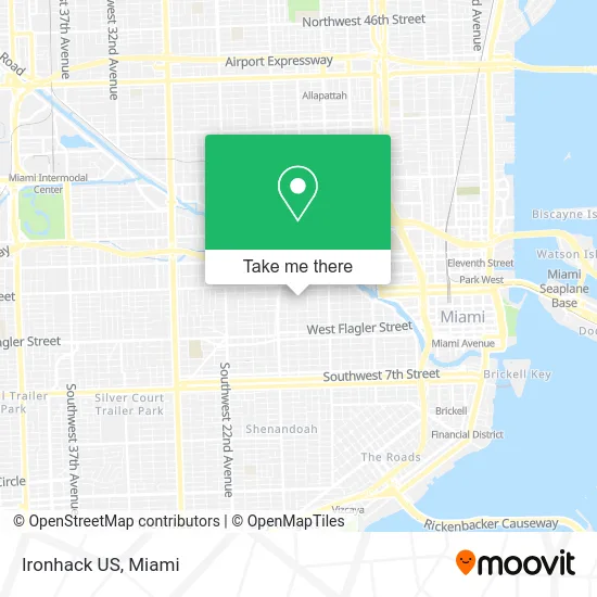
See Ironhack US, Miami, on the map
Public Transit to Ironhack US in Miami
Wondering how to get to Ironhack US in Miami? Moovit helps you find the best way to get to Ironhack US with step-by-step directions from the nearest public transit station.
Moovit provides free maps and live directions to help you navigate through your city. View schedules, routes, timetables, and find out how long does it take to get to Ironhack US in real time.
Looking for the nearest stop or station to Ironhack US? Check out this list of stops closest to your destination: Marlins Stadium; Nw 7 St & Nw 14 Av; Nw 17 Av & Nw 7 St; Nw 12 Av @ Nw 5 St; Santa Clara.
Bus: 11, 12, 17, 7, MIASTA.Train: GREEN, ORANGE.
Want to see if there’s another route that gets you there at an earlier time? Moovit helps you find alternative routes or times. Get directions from and directions to Ironhack US easily from the Moovit App or Website.
We make riding to Ironhack US easy, which is why over 1.5 million users, including users in Miami, trust Moovit as the best app for public transit. You don’t need to download an individual bus app or train app, Moovit is your all-in-one transit app that helps you find the best bus time or train time available.
For information on prices of bus and train, costs and ride fares to Ironhack US, please check the Moovit app.
Use the app to navigate to popular places including to the airport, hospital, stadium, grocery store, mall, coffee shop, school, college, and university.
Ironhack US Address: 501 Marlins Way Miami, FL 33125 street in Miami
- Miami Orange Bowl,
- La Baguette,
- PNC Club at Loandepot Park,
- Pincho Marlins Park,
- Miami Marlins,
- Recess Sports Lounge,
- Marlins Park,
- Ice Cream Portable,
- Miami Mex,
- Magic City Barbecue Bites de la Calle,
- 05 11 04 Prime Burger,
- 5 09 03 Rincon Habana & Bar,
- Levy Premium Foodservice Limited Partnership,
- 03 41 01 Sweets,
- Goya Arepa,
- Miami Marlins Baseball 3rd Base Dugout Club,
- Metropcs at Marlins Stadium,
- Miami Marlins Metrorail Express Shuttle,
- Northwest 7th Street & Northwest 15th Avenue,
- S & A General Painting
Places Near Ironhack US (Miami)
- Zoo Miami, Miami,
- Dolphin Mall Bus, Miami,
- Bayside Marketplace, Miami,
- Hard Rock Stadium, Miami Gardens,
- Dolphin Mall, Miami,
- Miami VA Hospital, Miami,
- Miami-Dade County Courthouse, Miami,
- Port of Miami Cruise Terminal, Miami,
- Sawgrass Mall, Miami,
- Aventura Mall, Miami Beach,
- Brickell City Centre, Miami,
- Marlins Park, Miami,
- Keiser University Flagship Campus, West Palm Beach,
- Little Havana, Miami,
- Richard E. Gerstein Justice Building, Miami,
- Sawgrass mall ( FL ), Miami Beach,
- Miami Freedom Park, Miami,
- Aventura Mall, Miami,
- Wynwood, Miami,
- Miami Design District, Miami
How to get to popular places in Miami with public transit
Get around Miami by public transit!
Traveling around Miami has never been so easy. See step by step directions as you travel to any attraction, street or major public transit station. View bus and train schedules, arrival times, service alerts and detailed routes on a map, so you know exactly how to get to anywhere in Miami.
When traveling to any destination around Miami use Moovit's Live Directions with Get Off Notifications to know exactly where and how far to walk, how long to wait for your line, and how many stops are left. Moovit will alert you when it's time to get off — no need to constantly re-check whether yours is the next stop.
Wondering how to use public transit in Miami or how to pay for public transit in Miami? Moovit public transit app can help you navigate your way with public transit easily, and at minimum cost. It includes public transit fees, ticket prices, and costs. Looking for a map of Miami public transit lines? Moovit public transit app shows all public transit maps in Miami with all Bus, Train, Light Rail and Ferry routes and stops on an interactive map.
Miami has 4 transit type(s), including: Bus, Train, Light Rail and Ferry, operated by several transit agencies, including Broward County Transit, Miami-Dade Transit, Metrorail, Palm Tran, Tri-Rail, Brightline, MARTY, City of Homestead Trolley, Key West Transit, Treasure Coast Connector, GoLine IRT, Amtrak, Greyhound-us, FlixBus-us and Aventura Express Shuttle Bus