Directions to Irvan Cell (Bandung) with public transportation
The following transit lines have routes that pass near Irvan Cell
How to get to Irvan Cell by bus?
Click on the bus route to see step by step directions with maps, line arrival times and updated time schedules.
From Radio Cakra 90.5 FM, Bandung
59 minFrom Area Parkir Savoy Homann Bidakara Hotel, Bandung
44 minFrom Gd. Kemuning lantai 1 RSHS. Bandung, Kota Bandung
51 minFrom GOR KONI KOTA BANDUNG, Kota Bandung
63 minFrom RSU Hermina Pasteur, Kota Bandung
69 minFrom Banjaran, Bandung
56 minFrom Cihampelas Walk, Kota Bandung
56 minFrom Kiara Artha Park, Kota Bandung
63 minFrom Jl. Gegerkalong Hilir no.47 Bandung Telkom Learning Center, Kota Bandung
72 minFrom Masjid Salman ITB, Kota Bandung
56 min
Bus stops near Irvan Cell in Bandung
Bus lines to Irvan Cell in Bandung
What are the closest stations to Irvan Cell?
The closest stations to Irvan Cell are:
- Jalan Manglid, 42 is 643 meters away, 9 min walk.
- Jalan Terusan Kopo-Soreang 300 is 936 meters away, 13 min walk.
Which bus line stops near Irvan Cell?
SOREANG-LW.PANJANG (Soreang)
What’s the nearest bus station to Irvan Cell in Bandung?
The nearest bus station to Irvan Cell in Bandung is Jalan Manglid, 42. It’s a 9 min walk away.
What time is the first bus to Irvan Cell in Bandung?
The SOREANG-LW.PANJANG is the first bus that goes to Irvan Cell in Bandung. It stops nearby at 3:00 AM.
What time is the last bus to Irvan Cell in Bandung?
The SOREANG-LW.PANJANG is the last bus that goes to Irvan Cell in Bandung. It stops nearby at 3:05 AM.
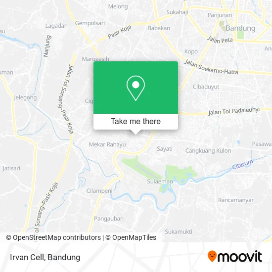
See Irvan Cell, Bandung, on the map
Public Transit to Irvan Cell in Bandung
Wondering how to get to Irvan Cell in Bandung? Moovit helps you find the best way to get to Irvan Cell with step-by-step directions from the nearest public transit station.
Moovit provides free maps and live directions to help you navigate through your city. View schedules, routes, timetables, and find out how long does it take to get to Irvan Cell in real time.
Looking for the nearest stop or station to Irvan Cell? Check out this list of stops closest to your destination: Jalan Manglid; Jalan Terusan Kopo-Soreang 300.
Bus: SOREANG-LW.PANJANG, CARINGIN - SOREANG, LEUWIPANJANG-CIWIDEY.
Want to see if there’s another route that gets you there at an earlier time? Moovit helps you find alternative routes or times. Get directions from and directions to Irvan Cell easily from the Moovit App or Website.
We make riding to Irvan Cell easy, which is why over 1.5 million users, including users in Bandung, trust Moovit as the best app for public transit. You don’t need to download an individual bus app or train app, Moovit is your all-in-one transit app that helps you find the best bus time or train time available.
For information on prices of bus, costs and ride fares to Irvan Cell, please check the Moovit app.
Use the app to navigate to popular places including to the airport, hospital, stadium, grocery store, mall, coffee shop, school, college, and university.
Irvan Cell Address: Jalan Margahayu Kencana Raya Bandung Kabupaten 40352 street in Bandung
- Bk Roti Bakar Kukus,
- Fc Rizka,
- Galon Depo Air Minum,
- Kelapa Muda Segeeerr,
- Marsa Juice,
- Pabrik Konveksi,
- Zaman Barber Shop,
- Marken,
- Kursus Menjahit Yani 30,
- Endsall Collection,
- Toko Beras Sari Wangi Lestari,
- pt. teisar cipta sarana,
- Halida Toys,
- 22 3 Coffee,
- Krenchise,
- Fanya Motor,
- Benning Food,
- Warung Nasi Ungu,
- Ibu Sarno,
- Toko Rangga
Places Near Irvan Cell (Bandung)
- Jl.L.L.R.E.Martadinata no.47,Bandung Regency, Bandung,
- Rumah Sakit Hasan Sadikin, Kota Bandung,
- Cililin, Kab. Bandung Barat, Bandung,
- Universitas Pendidikan Indonesia (UPI), Kota Bandung,
- Taman Hutan Raya (TAHURA), Kota Bandung,
- Rs Hasan Sadikin, Kota Bandung,
- bus damri “Dago - Leuwi panjang”, Kota Bandung,
- Subang, Kota Bandung,
- Trans Studio Mall (TSM), Kota Bandung,
- Summarecon Mall Bandung, Kota Bandung,
- RSUP Dr. Hasan Sadikin (RSHS), Kota Bandung,
- YYY, Kota Bandung,
- Bus Damri Dipati Ukur-Jatinangor, Bandung,
- Pasteur, Kota Bandung,
- 23 Paskal Shopping Mall, Kota Bandung,
- Braga, Kota Bandung,
- Stadion Gelora Bandung Lautan Api (GBLA), Kota Bandung,
- Pantai Santolo - Pameungpeuk Garut, Bandung,
- Batujajar, Bandung,
- Warung bokep, Bandung
How to get to popular places in Bandung with public transit
Get around Bandung by public transit!
Traveling around Bandung has never been so easy. See step by step directions as you travel to any attraction, street or major public transit station. View bus and train schedules, arrival times, service alerts and detailed routes on a map, so you know exactly how to get to anywhere in Bandung.
When traveling to any destination around Bandung use Moovit's Live Directions with Get Off Notifications to know exactly where and how far to walk, how long to wait for your line, and how many stops are left. Moovit will alert you when it's time to get off — no need to constantly re-check whether yours is the next stop.
Wondering how to use public transit in Bandung or how to pay for public transit in Bandung? Moovit public transit app can help you navigate your way with public transit easily, and at minimum cost. It includes public transit fees, ticket prices, and costs. Looking for a map of Bandung public transit lines? Moovit public transit app shows all public transit maps in Bandung with all Bus and Train routes and stops on an interactive map.
Bandung has 2 transit type(s), including: Bus and Train, operated by several transit agencies, including Trans Metro Bandung, Trans Metro Pasundan - Teman Bus, Angkutan Antarkota Dalam Provinsi, DAMRI, KAI Commuter, Angkutan Kota Bandung, Angkutan Kabupaten Bandung, Kobanter Baru, Bus Wisata DISHUB Kota Bandung, Bus Sekolah DISHUB Kota Bandung and Dinas Perhubungan Provinsi Jawa Barat