Directions to Isf (Piracicaba) with public transportation
The following transit lines have routes that pass near Isf
How to get to Isf by bus?
Click on the bus route to see step by step directions with maps, line arrival times and updated time schedules.
From Santa Rosa Ipes, Piracicaba
57 minFrom Chácara Gran Park MS Brasil, Piracicaba
64 minFrom DISTRITO INDUSTRIAL UNINORTE, Piracicaba
49 minFrom frigorifico angelelli, Santa Teresinha De Piracicaba
52 minFrom Tectextil, Piracicaba
48 minFrom Mefsa, Santa Teresinha De Piracicaba
79 minFrom CJ do Brasil, Artemis
59 minFrom Estrada Velha Tupi/Piracicaba, Km 15 S/N, Piracicaba
62 minFrom Tectextil Embalagens Têxteis Ltda, Piracicaba
47 minFrom Lef Cerâmica, Piracicaba
48 min
Bus stops near Isf in Piracicaba
Bus lines to Isf in Piracicaba
- 335 JARDIM MONTE CRISTO / TCI / TPA, Jardim Monte Cristo / TCI / TPA,VIEW
- 801 SÃO JORGE / TCI VIA PRAÇA TAKAKI, São Jorge / TCI via Praça Takaki,VIEW
- 1200 PAULICÉIA / SÔNIA, Paulicéia / Sônia,VIEW
- 315 JARAGUÁ /TCI, Terminal Central de Integração ,VIEW
- 802 SÃO JORGE / TCI VIA JARDIM PLANALTO, Terminal Central De Integração,VIEW
What are the closest stations to Isf?
The closest stations to Isf are:
- Praça Takaki is 85 meters away, 2 min walk.
- Avenida Dona Jane Conceição, 1285-1311 is 124 meters away, 3 min walk.
- Avenida Nove De Julho, 1396 is 455 meters away, 7 min walk.
Which bus lines stop near Isf?
These bus lines stop near Isf: 1200 PAULICÉIA / SÔNIA, 801 SÃO JORGE / TCI VIA PRAÇA TAKAKI.
What’s the nearest bus station to Isf in Piracicaba?
The nearest bus station to Isf in Piracicaba is Praça Takaki. It’s a 2 min walk away.
What time is the first bus to Isf in Piracicaba?
The 801 SÃO JORGE / TCI VIA PRAÇA TAKAKI is the first bus that goes to Isf in Piracicaba. It stops nearby at 4:51 AM.
What time is the last bus to Isf in Piracicaba?
The 801 SÃO JORGE / TCI VIA PRAÇA TAKAKI is the last bus that goes to Isf in Piracicaba. It stops nearby at 11:52 PM.
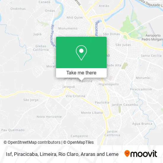
See Isf, Piracicaba, on the map
Public Transit to Isf in Piracicaba
Wondering how to get to Isf in Piracicaba? Moovit helps you find the best way to get to Isf with step-by-step directions from the nearest public transit station.
Moovit provides free maps and live directions to help you navigate through your city. View schedules, routes, timetables, and find out how long does it take to get to Isf in real time.
Looking for the nearest stop or station to Isf? Check out this list of stops closest to your destination: Praça Takaki; Avenida Dona Jane Conceição; Avenida Nove De Julho.
Bus: 1200 PAULICÉIA / SÔNIA, 801 SÃO JORGE / TCI VIA PRAÇA TAKAKI, 335 JARDIM MONTE CRISTO / TCI / TPA, 315 JARAGUÁ /TCI, 802 SÃO JORGE / TCI VIA JARDIM PLANALTO.
Want to see if there’s another route that gets you there at an earlier time? Moovit helps you find alternative routes or times. Get directions from and directions to Isf easily from the Moovit App or Website.
We make riding to Isf easy, which is why over 1.5 million users, including users in Piracicaba, trust Moovit as the best app for public transit. You don’t need to download an individual bus app or train app, Moovit is your all-in-one transit app that helps you find the best bus time or train time available.
For information on prices of bus, costs and ride fares to Isf, please check the Moovit app.
Use the app to navigate to popular places including to the airport, hospital, stadium, grocery store, mall, coffee shop, school, college, and university.
Isf Address: Avenida Madre Maria Teodora, 156 Paulista Piracicaba-SP 13403-000 street in Piracicaba
- Bueno Casa e Construção,
- G. Balan,
- Emporio Nordestino,
- Bella Cosmeticos,
- Sorridentes Piracicaba,
- Arroba,
- Don Grassos,
- Itau Praça Takaki,
- Sac Computadores,
- Rastrek Soluções Em Rastreamento,
- Ipiranga,
- Chistofoletti Odontologia Especializada,
- Patuskada Lanches,
- Marcela Andrade,
- Chá Verde Farmacia de Manipulacao,
- Padaria e Confeitaria Takaki Ltda,
- Manipulações Papoula Ltda Epp,
- Companhia do Video,
- Frutos do Pomar,
- Arroba Embalagens Eireli
Places Near Isf (Piracicaba)
- Casa Do Caralho, Lazer Alternativo Noturno, Piracicaba,
- Rua Silva Jardim 1700, Piracicaba,
- Rua Saldanha Marinho, Piracicaba,
- ESALQ, Piracicaba,
- Residencial Alto Dos Laranjais, Limeira,
- Jardim Sao Francisco, Piracicaba,
- Jardim Asturias, Piracicaba,
- Monte Branco, Piracicaba,
- Av Independência, Piracicaba,
- Consultorio Dr. Ricardo Mandetta, Araras,
- Rodovia Cornélio Pires SP 127 Km 43,5 S / n, Piracicaba,
- Faculdade Anhanguera de Piracicaba, Piracicaba,
- Rua do Rosario, piracicaba, Piracicaba,
- Rua do Porto - Piracicaba/SP, Piracicaba,
- HAVAN, Piracicaba,
- Santa Casa de Piracicaba, Piracicaba,
- Shopping Piracicaba, Piracicaba,
- Hospital Regional De Piracicaba, Piracicaba,
- Jardim Caxambu, Piracicaba,
- Shopping Center Limeira, Limeira
How to get to popular places in Piracicaba, Limeira, Rio Claro, Araras and Leme with public transit
Get around Piracicaba by public transit!
Traveling around Piracicaba has never been so easy. See step by step directions as you travel to any attraction, street or major public transit station. View bus and train schedules, arrival times, service alerts and detailed routes on a map, so you know exactly how to get to anywhere in Piracicaba.
When traveling to any destination around Piracicaba use Moovit's Live Directions with Get Off Notifications to know exactly where and how far to walk, how long to wait for your line, and how many stops are left. Moovit will alert you when it's time to get off — no need to constantly re-check whether yours is the next stop.
Wondering how to use public transit in Piracicaba or how to pay for public transit in Piracicaba? Moovit public transit app can help you navigate your way with public transit easily, and at minimum cost. It includes public transit fees, ticket prices, and costs. Looking for a map of Piracicaba public transit lines? Moovit public transit app shows all public transit maps in Piracicaba with all bus routes and stops on an interactive map.
Piracicaba, Limeira, Rio Claro, Araras and Leme has 1 transit type(s), including: bus, operated by several transit agencies, including SOU Limeira, SOU Rio Claro , Viação Itaqueri, Auto Viação i9, Suburbano (VB Transportes), Suburbano (Via Sol), Lima Turismo Ltda, SMTCA and Pira Mobilidade