How to get to Isil Moda Evi by bus?
Click on the bus route to see step by step directions with maps, line arrival times and updated time schedules.
From Polis Okulu Minibus Duragi, Yıldırım
29 minFrom İsabey Minibüs durağı, Yıldırım
43 minFrom H/3 Bursa Şehir Hastanesi Küçük Sanayii Durağı, Nilüfer
38 minFrom Yunuseli Cuma Pazarı, Osmangazi
44 minFrom Cumalıkızık - Değirmenönü Metro İstasyonu, Yıldırım
32 minFrom Nilüfer Nikahevi, Nilüfer
28 minFrom Bursa Valiliği İl Göç İdaresi Müdürlüğü, Yıldırım
29 minFrom Işık Tepe Organize Sanayi Bölgesi, Nilüfer
51 minFrom Bursa-Demirci, Nilüfer
54 minFrom Nilüfer Evlendirme Dairesi, Nilüfer
28 min
How to get to Isil Moda Evi by metro?
Click on the metro route to see step by step directions with maps, line arrival times and updated time schedules.
From Polis Okulu Minibus Duragi, Yıldırım
45 minFrom İsabey Minibüs durağı, Yıldırım
43 minFrom H/3 Bursa Şehir Hastanesi Küçük Sanayii Durağı, Nilüfer
43 minFrom Cumalıkızık - Değirmenönü Metro İstasyonu, Yıldırım
33 minFrom Nilüfer Nikahevi, Nilüfer
43 minFrom Bursa Valiliği İl Göç İdaresi Müdürlüğü, Yıldırım
39 minFrom Işık Tepe Organize Sanayi Bölgesi, Nilüfer
59 minFrom Nilüfer Evlendirme Dairesi, Nilüfer
43 min
Bus stops near Isil Moda Evi in Osmangazi
- Timurtaşpaşa 6, 2 min walk,VIEW
- Timurtaşpaşa, 2 min walk,VIEW
- Timurtaşpaşa 5, 2 min walk,VIEW
- Timurtaşpaşa 7, 2 min walk,VIEW
- Timurtaşpaşa 8, 2 min walk,VIEW
- Timurtaşpaşa 4, 2 min walk,VIEW
- Timurtaşpaşa 3, 2 min walk,VIEW
- Timurtaşpaşa 2, 2 min walk,VIEW
- Timurtaşpaşa 1, 2 min walk,VIEW
- Temiz Cd., 3 min walk,VIEW
- Şehadet Cami, 3 min walk,VIEW
Light Rail stations near Isil Moda Evi in Osmangazi
Cable Car station near Isil Moda Evi in Osmangazi
- Tophane, 29 min walk,VIEW
Bus lines to Isil Moda Evi in Osmangazi
- B2D, B2d - Fatih Mah. Ring,VIEW
- B2K, B2k - Fatih Mah. - Ring,VIEW
- G2, Kestanelik Mh. - Ring,VIEW
- D3, Zafer (Ring,VIEW
- G3, G3 - Mollafenari Ring,VIEW
- 6F, Üçevler Mh. - Ring,VIEW
- 17A, Panayır Mh. - Ring,VIEW
- 19B, İsmetiye - Ring,VIEW
- 38D, Terminal - Ring,VIEW
- 38G, Terminal - Ring,VIEW
- B39, Bursaspor Acemler İst. - Ring,VIEW
- B39K, Acemler Bursaspor İst. Ring,VIEW
- 38B2, Görükle-Terminal,VIEW
- 6FD, Demirci Mh. - Ring,VIEW
- 38B, Terminal - Ring,VIEW
- 35C, Şehreküstü İst. - Ring,VIEW
- 38, Terminal - Ring,VIEW
- H4, Timurtaşpaşa - Bursa Şehir Hastanesi,VIEW
- 17D, Timurtaş Paşa - Demirtaş Barbaros Tel Altı,VIEW
- 6A, Altınşehir - Derebahçe,VIEW
What are the closest stations to Isil Moda Evi?
The closest stations to Isil Moda Evi are:
- Timurtaşpaşa 6 is 105 meters away, 2 min walk.
- Timurtaşpaşa is 108 meters away, 2 min walk.
- Timurtaşpaşa 5 is 111 meters away, 2 min walk.
- Timurtaşpaşa 7 is 112 meters away, 2 min walk.
- Timurtaşpaşa 8 is 113 meters away, 2 min walk.
- Timurtaşpaşa 4 is 119 meters away, 2 min walk.
- Timurtaşpaşa 3 is 126 meters away, 2 min walk.
- Timurtaşpaşa 2 is 133 meters away, 2 min walk.
- Timurtaşpaşa 1 is 140 meters away, 2 min walk.
- Temiz Cd. is 154 meters away, 3 min walk.
- Şehadet Cami is 176 meters away, 3 min walk.
- Kozahan is 565 meters away, 8 min walk.
- Tophane is 2124 meters away, 29 min walk.
Which bus lines stop near Isil Moda Evi?
These bus lines stop near Isil Moda Evi: 21C, 24B, 3C, 6FD, 9D, 9PA, B25, D10, E12.
Which metro lines stop near Isil Moda Evi?
These metro lines stop near Isil Moda Evi: 1, 2, 3.
What’s the nearest light rail station to Isil Moda Evi in Osmangazi?
The nearest light rail station to Isil Moda Evi in Osmangazi is Kozahan. It’s a 8 min walk away.
What’s the nearest bus station to Isil Moda Evi in Osmangazi?
The nearest bus stations to Isil Moda Evi in Osmangazi are Timurtaşpaşa 6, Timurtaşpaşa, Timurtaşpaşa 5, Timurtaşpaşa 7, Timurtaşpaşa 8, Timurtaşpaşa 4, Timurtaşpaşa 3, Timurtaşpaşa 2 and Timurtaşpaşa 1. The closest one is a 2 min walk away.
What’s the nearest cable car station to Isil Moda Evi in Osmangazi?
The nearest cable car station to Isil Moda Evi in Osmangazi is Tophane. It’s a 29 min walk away.
What time is the first light rail to Isil Moda Evi in Osmangazi?
The T1 is the first light rail that goes to Isil Moda Evi in Osmangazi. It stops nearby at 6:36 AM.
What time is the last light rail to Isil Moda Evi in Osmangazi?
The T3 is the last light rail that goes to Isil Moda Evi in Osmangazi. It stops nearby at 11:17 PM.
What time is the first bus to Isil Moda Evi in Osmangazi?
The 38B is the first bus that goes to Isil Moda Evi in Osmangazi. It stops nearby at 3:00 AM.
What time is the last bus to Isil Moda Evi in Osmangazi?
The 38B is the last bus that goes to Isil Moda Evi in Osmangazi. It stops nearby at 4:03 AM.
What time is the first cable car to Isil Moda Evi in Osmangazi?
The TOPHANE - ULUDAĞ is the first cable car that goes to Isil Moda Evi in Osmangazi. It stops nearby at 7:30 AM.
What time is the last cable car to Isil Moda Evi in Osmangazi?
The TOPHANE - ULUDAĞ is the last cable car that goes to Isil Moda Evi in Osmangazi. It stops nearby at 8:08 PM.
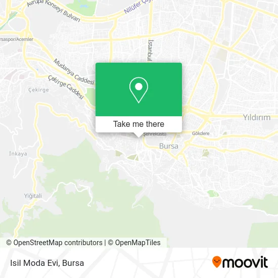
See Isil Moda Evi, Osmangazi, on the map
Public Transit to Isil Moda Evi in Osmangazi
Wondering how to get to Isil Moda Evi in Osmangazi? Moovit helps you find the best way to get to Isil Moda Evi with step-by-step directions from the nearest public transit station.
Moovit provides free maps and live directions to help you navigate through your city. View schedules, routes, timetables, and find out how long does it take to get to Isil Moda Evi in real time.
Looking for the nearest stop or station to Isil Moda Evi? Check out this list of stops closest to your destination: Timurtaşpaşa 6; Timurtaşpaşa; Timurtaşpaşa 5; Timurtaşpaşa 7; Timurtaşpaşa 8; Timurtaşpaşa 4; Timurtaşpaşa 3; Timurtaşpaşa 2; Timurtaşpaşa 1; Temiz Cd.; Şehadet Cami; Kozahan; Tophane.
Bus: 21C, 24B, 3C, 6FD, 9D, 9PA, B25, D10, E12, B2D, B2K, G2, D3, G3, 35C, 38, H4, 17D, 6A, 6E, 16S, 19İ, 6K1, 1A, 2E, 18, 40H, 5A, 15H, 16A, 19A.Metro: 1, 2, 3.Cable Car: TOPHANE - ULUDAĞ.
Want to see if there’s another route that gets you there at an earlier time? Moovit helps you find alternative routes or times. Get directions from and directions to Isil Moda Evi easily from the Moovit App or Website.
We make riding to Isil Moda Evi easy, which is why over 1.5 million users, including users in Osmangazi, trust Moovit as the best app for public transit. You don’t need to download an individual bus app or train app, Moovit is your all-in-one transit app that helps you find the best bus time or train time available.
For information on prices of bus and metro, costs and ride fares to Isil Moda Evi, please check the Moovit app.
Use the app to navigate to popular places including to the airport, hospital, stadium, grocery store, mall, coffee shop, school, college, and university.
Isil Moda Evi Address: Ortapazar Caddesi, 16020 Osmangazi Mahallesi, Osmangazi street in Osmangazi
- Metro Eczanesi,
- Red Lıne,
- Bahar Çiçekçilik,
- Marmara Kestane Şekeri,
- Saltanat Büfe Çay ve Tost Evi,
- Orhangazi Kent Konseyi,
- Sur Kuruyemis,
- Nilüfer Hatun,
- Saltanat Çay Ocağı,
- Okçubaba Döner Izgara,
- Saltanat Kapısı,
- Gold Hotel 1,
- Şehadet Kuran Kursu,
- Bursa şehir turu otobüsü,
- Sini Saltanat Kebap,
- Hisar Nefis Et Döner,
- Elnuay Tasarim,
- Tuğçe Müzik Market,
- burbak Osmangazi Caddesi Otoparkı,
- Gülşah Kuaför
Places Near Isil Moda Evi (Osmangazi)
- Nilüfer Ağız ve Diş Sağlığı Merkezi, Nilüfer,
- Şevket Yılmaz Eğitim ve Araştırma Hastanesi, Yıldırım,
- Dörtçelik Çocuk Hastanesi, Nilüfer,
- Bursa Terminal, Nilüfer,
- Sur Yapı Marka Avm, Osmangazi,
- FSM Bulvarı, Nilüfer,
- Bursa Teleferik, Yıldırım,
- Çekirge Devlet Hastanesi Otobüs Durağı, Osmangazi,
- ÖzdilekPark Bursa Nilüfer, Nilüfer,
- Bursa Cumalıkızık Köyü, Osmangazi,
- Bursa, Osmangazi,
- Sur Yapı Marka, Nilüfer,
- Şehir Hastanesi, Nilüfer,
- Podyum Park, Nilüfer,
- bursa mudanya, Mudanya,
- Mustafakemalpaşa Karacabey Dolmuş Durağı, Mustafakemalpaşa,
- Ali Osman Sönmez Onkoloji Hastanesi, Osmangazi,
- Bursa Yüksek İhtisas Eğitim ve Araştırma Hastanesi Nilüfer Ek Binası, Nilüfer,
- Millet Mahallesi,
- Bursa Hayvanat Bahçesi, Osmangazi
How to get to popular places in Bursa with public transit
Get around Osmangazi by public transit!
Traveling around Osmangazi has never been so easy. See step by step directions as you travel to any attraction, street or major public transit station. View bus and train schedules, arrival times, service alerts and detailed routes on a map, so you know exactly how to get to anywhere in Osmangazi.
When traveling to any destination around Osmangazi use Moovit's Live Directions with Get Off Notifications to know exactly where and how far to walk, how long to wait for your line, and how many stops are left. Moovit will alert you when it's time to get off — no need to constantly re-check whether yours is the next stop.
Wondering how to use public transit in Osmangazi or how to pay for public transit in Osmangazi? Moovit public transit app can help you navigate your way with public transit easily, and at minimum cost. It includes public transit fees, ticket prices, and costs. Looking for a map of Osmangazi public transit lines? Moovit public transit app shows all public transit maps in Osmangazi with all Bus, Metro, Light Rail, Cable Car and Gondola routes and stops on an interactive map.
Bursa has 5 transit type(s), including: Bus, Metro, Light Rail, Cable Car and Gondola, operated by several transit agencies, including BursaRay, BurTram, BBBUS, Burulaş, Minibüs, İlçe Otobüsleri and Bursa Teleferik