Directions to Islisberg (Geneve) with public transportation
The following transit lines have routes that pass near Islisberg
 Bus: 205, 215, 245.
- Train: S5, S14, SN5.
How to get to Islisberg by bus?
Click on the bus route to see step by step directions with maps, line arrival times and updated time schedules.
How to get to Islisberg by train?
Click on the train route to see step by step directions with maps, line arrival times and updated time schedules.
Bus stop near Islisberg in Geneve
- Islisberg, Dorf, 1 min walk,
Train station near Islisberg in Geneve
- Bonstetten-Wettswil, 16 min walk,
Bus lines to Islisberg in Geneve
- 205, Arni Ag, Stockacker,
What are the closest stations to Islisberg?
The closest stations to Islisberg are:
- Islisberg, Dorf is 48 meters away, 1 min walk.
- Bonstetten-Wettswil is 1191 meters away, 16 min walk.
Which bus lines stop near Islisberg?
These bus lines stop near Islisberg: 205, 215, 245.
Which train line stops near Islisberg?
S5 (Pfäffikon Sz→Zug)
What’s the nearest train station to Islisberg in Geneve?
The nearest train station to Islisberg in Geneve is Bonstetten-Wettswil. It’s a 16 min walk away.
What’s the nearest bus station to Islisberg in Geneve?
The nearest bus station to Islisberg in Geneve is Islisberg, Dorf. It’s a 1 min walk away.
What time is the first train to Islisberg in Geneve?
The S14 is the first train that goes to Islisberg in Geneve. It stops nearby at 5:15 AM.
What time is the last train to Islisberg in Geneve?
The S5 is the last train that goes to Islisberg in Geneve. It stops nearby at 1:04 AM.
What time is the first bus to Islisberg in Geneve?
The 205 is the first bus that goes to Islisberg in Geneve. It stops nearby at 6:04 AM.
What time is the last bus to Islisberg in Geneve?
The 205 is the last bus that goes to Islisberg in Geneve. It stops nearby at 12:50 AM.
See Islisberg, Geneve, on the map
Public Transit to Islisberg in Geneve
Wondering how to get to Islisberg in Geneve? Moovit helps you find the best way to get to Islisberg with step-by-step directions from the nearest public transit station.
Moovit provides free maps and live directions to help you navigate through your city. View schedules, routes, timetables, and find out how long does it take to get to Islisberg in real time.
Looking for the nearest stop or station to Islisberg? Check out this list of stops closest to your destination: Islisberg; Bonstetten-Wettswil.
Bus: 205, 215, 245.Train: S5, S14, SN5.
Want to see if there’s another route that gets you there at an earlier time? Moovit helps you find alternative routes or times. Get directions from and directions to Islisberg easily from the Moovit App or Website.
We make riding to Islisberg easy, which is why over 1.5 million users, including users in Geneve, trust Moovit as the best app for public transit. You don’t need to download an individual bus app or train app, Moovit is your all-in-one transit app that helps you find the best bus time or train time available.
For information on prices of train and bus, costs and ride fares to Islisberg, please check the Moovit app.
Use the app to navigate to popular places including to the airport, hospital, stadium, grocery store, mall, coffee shop, school, college, and university.
Islisberg Address: Dorfstrasse street in Geneve
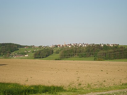
Islisberg is a municipality in the district of Bremgarten in the canton of Aargau in Switzerland.Wiki
- Leuba,
- Primarschule,
- Brugger Visuelle Kommunikation,
- Beauty Time Brugger,
- Jacqueline Casanova 'Malergeschäft',
- Hotel Nonna Erika Rupp,
- Gemeindeverwaltung Islisberg,
- Gemeindeverwaltung,
- Marinas Dorfladen & Catering Services,
- Rainer Stutz,
- Berghof,
- Wanner Immobilien & Verwaltungen,
- Katholische Kirche,
- Schmidmeister Steuerungsbau und Planung,
- Gartenbau Stutz,
- Susan Steiner,
- E. + E. Stutz Schreinerei,
- As Küchendesign GmbH,
- Unternehmensberatung Kralewski,
- Peter Hofmann Sport-Fanartikel.Ch
Places Near Islisberg (Geneve)
- HUG - Hôpitaux Universitaires de Genève, Genève,
- Stade de Genève, Carouge (Ge),
- Clinique Générale Beaulieu, Genève,
- Office Cantonal Des Véhicules, Carouge (Ge),
- Otto's,
- Cimetière De St.-Georges, Genève,
- Place Dorcière, Genève,
- Route de Peney, Vernier,
- Hôpital des Trois-Chêne, Thônex,
- IKEA, Vernier,
- IKEA Vernier, Vernier,
- Hôpital, Genève,
- La Praille, Carouge (Ge),
- Balexert, Vernier,
- Clinique La Lignière, Gland,
- Palexpo, Le Grand-Saconnex,
- Gare de Genève Cornavin, Genève,
- Ferney-Voltaire,
- Centre de Loisir Vitam'parc,
- Conforama, Meyrin
How to get to popular places in Geneve with public transit
Get around Geneve by public transit!
Traveling around Geneve has never been so easy. See step by step directions as you travel to any attraction, street or major public transit station. View bus and train schedules, arrival times, service alerts and detailed routes on a map, so you know exactly how to get to anywhere in Geneve.
When traveling to any destination around Geneve use Moovit's Live Directions with Get Off Notifications to know exactly where and how far to walk, how long to wait for your line, and how many stops are left. Moovit will alert you when it's time to get off — no need to constantly re-check whether yours is the next stop.
Wondering how to use public transit in Geneve or how to pay for public transit in Geneve? Moovit public transit app can help you navigate your way with public transit easily, and at minimum cost. It includes public transit fees, ticket prices, and costs. Looking for a map of Geneve public transit lines? Moovit public transit app shows all public transit maps in Geneve with all Bus, Train, Metro, Light Rail, Ferry, Cable Car and Funicular routes and stops on an interactive map.
Geneve has 7 transit type(s), including: Bus, Train, Metro, Light Rail, Ferry, Cable Car and Funicular, operated by several transit agencies, including Schweizerische Bundesbahnen SBB, Nyon-St-Cergue-Morez, Société Nationale des Chemins de fer Français, TPG, Interimsfahrplan / Horaire interimaire / Orario ad interim, SBB Infrastruktur AG Bahnersatz, Transports Publics de l'agglomération d'Annemasse, Bus Nyon-Prangins, Alpbus Fournier, CGN SA, Transports Publics Neuchâtelois SA (tc), But, PostAuto AG, Transports Publics de la Région Nyonnaise and SMGN