Directions to Isom Coverage (Queens) with public transportation
The following transit lines have routes that pass near Isom Coverage
 Bus: Q101, Q102, Q66, Q63.
- Train: FAR ROCKAWAY BRANCH, LONG BEACH BRANCH, RONKONKOMA BRANCH.
- Subway: M, N, R, W, E.
How to get to Isom Coverage by bus?
Click on the bus route to see step by step directions with maps, line arrival times and updated time schedules.
From The Oculus, Manhattan
82 minFrom The Shops At Atlas Park, Queens
63 minFrom George Washington Bridge, Manhattan
96 minFrom 1910 monterey avenue, Bronx
95 minFrom Radio Hotel, Manhattan
98 minFrom SoHo, Manhattan
68 minFrom United Palace Theatre, Manhattan
94 minFrom OZONE PARK, Queens
73 minFrom Irving Plaza, Manhattan
57 minFrom St John's University, Queens
77 min
How to get to Isom Coverage by train?
Click on the train route to see step by step directions with maps, line arrival times and updated time schedules.
How to get to Isom Coverage by subway?
Click on the subway route to see step by step directions with maps, line arrival times and updated time schedules.
From The Oculus, Manhattan
41 minFrom George Washington Bridge, Manhattan
59 minFrom 1910 monterey avenue, Bronx
53 minFrom Radio Hotel, Manhattan
58 minFrom SoHo, Manhattan
35 minFrom United Palace Theatre, Manhattan
57 minFrom OZONE PARK, Queens
65 minFrom Irving Plaza, Manhattan
31 minFrom St John's University, Queens
44 min
Bus stops near Isom Coverage in Queens
Bus lines to Isom Coverage in Queens
What are the closest stations to Isom Coverage?
The closest stations to Isom Coverage are:
- 31 St/37 Av is 276 yards away, 4 min walk.
- 36 Av is 303 yards away, 4 min walk.
- Northern Blvd/39 Av is 470 yards away, 6 min walk.
- 35 Av/31 St is 491 yards away, 6 min walk.
- Northern Blvd/37 St is 493 yards away, 6 min walk.
- Steinway St is 1079 yards away, 13 min walk.
Which bus lines stop near Isom Coverage?
These bus lines stop near Isom Coverage: Q101, Q102, Q66.
Which train lines stop near Isom Coverage?
These train lines stop near Isom Coverage: FAR ROCKAWAY BRANCH, LONG BEACH BRANCH, RONKONKOMA BRANCH.
Which subway lines stop near Isom Coverage?
These subway lines stop near Isom Coverage: M, N, R, W.
What’s the nearest subway station to Isom Coverage in Queens?
The nearest subway station to Isom Coverage in Queens is 36 Av. It’s a 4 min walk away.
What’s the nearest bus station to Isom Coverage in Queens?
The nearest bus station to Isom Coverage in Queens is 31 St/37 Av. It’s a 4 min walk away.
What time is the first subway to Isom Coverage in Queens?
The E is the first subway that goes to Isom Coverage in Queens. It stops nearby at 3:00 AM.
What time is the last subway to Isom Coverage in Queens?
The F is the last subway that goes to Isom Coverage in Queens. It stops nearby at 3:47 AM.
What time is the first bus to Isom Coverage in Queens?
The Q101 is the first bus that goes to Isom Coverage in Queens. It stops nearby at 3:11 AM.
What time is the last bus to Isom Coverage in Queens?
The Q66 is the last bus that goes to Isom Coverage in Queens. It stops nearby at 3:18 AM.
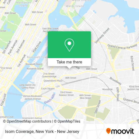
See Isom Coverage, Queens, on the map
Public Transit to Isom Coverage in Queens
Wondering how to get to Isom Coverage in Queens? Moovit helps you find the best way to get to Isom Coverage with step-by-step directions from the nearest public transit station.
Moovit provides free maps and live directions to help you navigate through your city. View schedules, routes, timetables, and find out how long does it take to get to Isom Coverage in real time.
Looking for the nearest stop or station to Isom Coverage? Check out this list of stops closest to your destination: 31 St/37 Av; 36 Av; Northern Blvd/39 Av; 35 Av/31 St; Northern Blvd/37 St; Steinway St.
Bus: Q101, Q102, Q66, Q63.Train: FAR ROCKAWAY BRANCH, LONG BEACH BRANCH, RONKONKOMA BRANCH.Subway: M, N, R, W, E, F.
Want to see if there’s another route that gets you there at an earlier time? Moovit helps you find alternative routes or times. Get directions from and directions to Isom Coverage easily from the Moovit App or Website.
We make riding to Isom Coverage easy, which is why over 1.5 million users, including users in Queens, trust Moovit as the best app for public transit. You don’t need to download an individual bus app or train app, Moovit is your all-in-one transit app that helps you find the best bus time or train time available.
For information on prices of subway, bus and train, costs and ride fares to Isom Coverage, please check the Moovit app.
Use the app to navigate to popular places including to the airport, hospital, stadium, grocery store, mall, coffee shop, school, college, and university.
Isom Coverage Address: 36-36 33rd St street in Queens
- Vship Co,
- Electronic Lifestyles Llc,
- Tijan Wilson,
- New York Junior Tennis & Learning,
- Get Simple Process,
- The High Risk Solution,
- Andrew B. Wolf, Fnp-C, Msn, Rn,
- Tunstall Americas,
- 103,
- Globe Life American Income Division,
- Big Apple Eats,
- National Income Life: Pappas Agency,
- Nexendo Wellness,
- Anastasios Manessis, Md,
- Enagic Vietnam Global,
- Flagstar Private Bank,
- Kanga's Indoor Playground,
- Kanga's Indoor Playcenter,
- Enagic Philadelphia Independent Distributors,
- Cityview Plaza
Places Near Isom Coverage (Queens)
- Wall Street, Manhattan,
- 26 Federal Plaza, Manhattan,
- Rockefeller Center, Manhattan,
- SoHo, Manhattan,
- 3 Stone St, Manhattan,
- Times Square, Manhattan,
- Katz's Deli, Manhattan,
- Queens Center Mall, Queens,
- San Gennaro Feast, Manhattan,
- qqqq, Manhattan,
- 911 Memorial, Manhattan,
- Mountainside Hospital, Glen Ridge,
- 66 John Street, Manhattan,
- Hudson Yards, Manhattan,
- 1 Police Plaza, Manhattan,
- 111 Centre New York City Supreme Court, Manhattan,
- Chinatown, Manhattan,
- Pier 83, Manhattan,
- Bellevue Hospital, Manhattan,
- 376 Hudson Street, Manhattan
How to get to popular places in New York - New Jersey with public transit
Get around Queens by public transit!
Traveling around Queens has never been so easy. See step by step directions as you travel to any attraction, street or major public transit station. View bus and train schedules, arrival times, service alerts and detailed routes on a map, so you know exactly how to get to anywhere in Queens.
When traveling to any destination around Queens use Moovit's Live Directions with Get Off Notifications to know exactly where and how far to walk, how long to wait for your line, and how many stops are left. Moovit will alert you when it's time to get off — no need to constantly re-check whether yours is the next stop.
Wondering how to use public transit in Queens or how to pay for public transit in Queens? Moovit public transit app can help you navigate your way with public transit easily, and at minimum cost. It includes public transit fees, ticket prices, and costs. Looking for a map of Queens public transit lines? Moovit public transit app shows all public transit maps in Queens with all Bus, Train, Subway, Light Rail, Ferry and Cable Car routes and stops on an interactive map.
New York - New Jersey has 6 transit type(s), including: Bus, Train, Subway, Light Rail, Ferry and Cable Car, operated by several transit agencies, including MTA Subway, Metro-North Railroad, LIRR, PATH, MTA New York City Transit - Express routes, MTA Bus, NJ Transit, NYC Ferry, NICE bus, Bee-Line Bus, NJ Transit Rail, Norwalk Transit District, Hartford Line, River Valley Transit and HART