Directions to Ispe (Montgomery County) with public transportation
The following transit lines have routes that pass near Ispe
 Bus: D96, M70, M22, FLIXBUS 2601, FLIXBUS 2605.
- Metro: RED.
How to get to Ispe by bus?
Click on the bus route to see step by step directions with maps, line arrival times and updated time schedules.
From The John F. Kennedy Center for the Performing Arts, Washington
84 minFrom Le Diplomate, Washington
66 minFrom Childrens Hospital, Washington
74 minFrom Residence Inn-Washington, Washington
73 minFrom Coolidge High School, Washington
68 minFrom Kalorama, Washington
60 minFrom Hyatt Place-Arlington Courthouse Plaza (Hyatt Place Arlington/Courthouse Plaza), Arlington County
71 minFrom 900 17th Street NW, Washington
63 minFrom U Street Metro Station, Washington
65 minFrom Capital Hilton, Washington
68 min
How to get to Ispe by metro?
Click on the metro route to see step by step directions with maps, line arrival times and updated time schedules.
From The John F. Kennedy Center for the Performing Arts, Washington
50 minFrom Le Diplomate, Washington
40 minFrom Childrens Hospital, Washington
62 minFrom Residence Inn-Washington, Washington
35 minFrom Coolidge High School, Washington
60 minFrom Kalorama, Washington
34 minFrom Hyatt Place-Arlington Courthouse Plaza (Hyatt Place Arlington/Courthouse Plaza), Arlington County
50 minFrom 900 17th Street NW, Washington
28 minFrom U Street Metro Station, Washington
39 minFrom Capital Hilton, Washington
31 min
Bus stops near Ispe in Montgomery County
Bus lines to Ispe in Montgomery County
- D96, South To Potomac Park,VIEW
- M22, North To Olney,VIEW
- M70, West To Montgomery Mall,VIEW
- FLIXBUS 2601, NYC - Washington DC,VIEW
- FLIXBUS 2605, NYC - Richmond,VIEW
- 798, 798 Bethesda,VIEW
- 36, Bethesda Loop,VIEW
- RED, Noma-Gallaudet U,VIEW
- 29, 29-Bethesda-GlenEcho-FriendshpHghts,VIEW
- 30, 30-Bethesda-Medical Center,VIEW
- 32, 32-Bethesda-Naval Ship R&D Center,VIEW
- 34, 34-Bethesda-Wheaton,VIEW
- 47, 47-Rockville-Mont. Mall-Bethesda,VIEW
What are the closest stations to Ispe?
The closest stations to Ispe are:
- Wisconsin Ave & Leland St is 269 yards away, 4 min walk.
- Montgomery Av+Waverly St is 407 yards away, 5 min walk.
- Bethesda is 445 yards away, 6 min walk.
- Montgomery Ln @ East Ln is 493 yards away, 7 min walk.
- Arlington Rd & Elm St is 509 yards away, 7 min walk.
- Bethesda Metro Station is 603 yards away, 8 min walk.
- Bethesda Station is 673 yards away, 9 min walk.
Which bus lines stop near Ispe?
These bus lines stop near Ispe: D96, M70.
Which metro line stops near Ispe?
RED (Shady Grove)
What’s the nearest bus station to Ispe in Montgomery County?
The nearest bus station to Ispe in Montgomery County is Wisconsin Ave & Leland St. It’s a 4 min walk away.
What time is the first metro to Ispe in Montgomery County?
The RED is the first metro that goes to Ispe in Montgomery County. It stops nearby at 5:16 AM.
What time is the last metro to Ispe in Montgomery County?
The RED is the last metro that goes to Ispe in Montgomery County. It stops nearby at 12:25 AM.
What time is the first bus to Ispe in Montgomery County?
The M70 is the first bus that goes to Ispe in Montgomery County. It stops nearby at 4:55 AM.
What time is the last bus to Ispe in Montgomery County?
The M70 is the last bus that goes to Ispe in Montgomery County. It stops nearby at 2:19 AM.
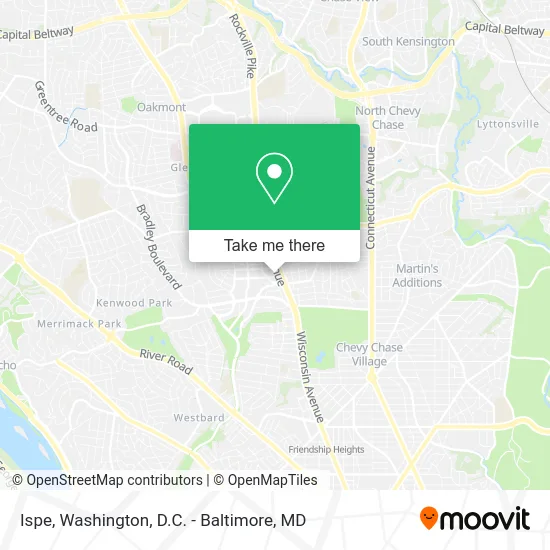
See Ispe, Montgomery County, on the map
Public Transit to Ispe in Montgomery County
Wondering how to get to Ispe in Montgomery County? Moovit helps you find the best way to get to Ispe with step-by-step directions from the nearest public transit station.
Moovit provides free maps and live directions to help you navigate through your city. View schedules, routes, timetables, and find out how long does it take to get to Ispe in real time.
Looking for the nearest stop or station to Ispe? Check out this list of stops closest to your destination: Wisconsin Ave & Leland St; Montgomery Av+Waverly St; Bethesda; Montgomery Ln @ East Ln; Arlington Rd & Elm St; Bethesda Metro Station; Bethesda Station .
Bus: D96, M70, M22, FLIXBUS 2601, FLIXBUS 2605, 798, 36, RED.Metro: RED.
Want to see if there’s another route that gets you there at an earlier time? Moovit helps you find alternative routes or times. Get directions from and directions to Ispe easily from the Moovit App or Website.
We make riding to Ispe easy, which is why over 1.5 million users, including users in Montgomery County, trust Moovit as the best app for public transit. You don’t need to download an individual bus app or train app, Moovit is your all-in-one transit app that helps you find the best bus time or train time available.
For information on prices of metro and bus, costs and ride fares to Ispe, please check the Moovit app.
Use the app to navigate to popular places including to the airport, hospital, stadium, grocery store, mall, coffee shop, school, college, and university.
Ispe Address: 7200 Wisconsin Ave Bethesda, MD 20814 street in Montgomery County
- Erica O'Neill, Realtor,
- Doxsys,
- Tacombi,
- Landmark Bethesda Row Cinema,
- Mon Ami Gabi,
- Woodmont Avenue Lot - Colonial Parking Station 734,
- Douglas Construction Group,
- Anine Bing,
- Mon Ami Gabi - Bethesda,
- Happy Hour Kickball,
- Tax Settlement Help,
- Robert Half Recruiters & Employment Agency (Bowytz Robert B),
- True Food Kitchen,
- Hilton Garden Inn-Bethesda,
- Terrain Cafe,
- Anthropologie,
- JOE & THE JUICE,
- Barnes & Noble,
- Bethesda Spine & Posture,
- Mexicue
Places Near Ispe (Montgomery County)
- Washington DC VA Medical Center, Washington,
- Museum Of The Bible, Washington,
- The Anthem, Washington,
- Pennsylvania Ave NW (3rd st and pennsylvania), Washington,
- Warner Theatre, Washington,
- PG Mall, Prince George's County,
- M&T Bank Stadium, Baltimore,
- Camden Yards, Baltimore,
- Rock Creek Tennis Center, Washington,
- Georgetown, Washington,
- Amazon Hq2, Arlington County,
- Marriott Marquis Washington, DC, Washington,
- National Zoo, Washington,
- Westfield Montgomery Mall, Montgomery County,
- Washington National Cathedral, Washington,
- Capital One Arena, Washington,
- National Museum of African American History and Culture, Washington,
- National Mall, Washington,
- Basilica of the National Shrine, Washington,
- Sibley Memorial Hospital, Washington
How to get to popular places in Washington, D.C. - Baltimore, MD with public transit
Get around Montgomery County by public transit!
Traveling around Montgomery County has never been so easy. See step by step directions as you travel to any attraction, street or major public transit station. View bus and train schedules, arrival times, service alerts and detailed routes on a map, so you know exactly how to get to anywhere in Montgomery County.
When traveling to any destination around Montgomery County use Moovit's Live Directions with Get Off Notifications to know exactly where and how far to walk, how long to wait for your line, and how many stops are left. Moovit will alert you when it's time to get off — no need to constantly re-check whether yours is the next stop.
Wondering how to use public transit in Montgomery County or how to pay for public transit in Montgomery County? Moovit public transit app can help you navigate your way with public transit easily, and at minimum cost. It includes public transit fees, ticket prices, and costs. Looking for a map of Montgomery County public transit lines? Moovit public transit app shows all public transit maps in Montgomery County with all Bus, Train, Metro, Light Rail and Ferry routes and stops on an interactive map.
Washington, D.C. - Baltimore, MD has 5 transit type(s), including: Bus, Train, Metro, Light Rail and Ferry, operated by several transit agencies, including WMATA, Montgomery County Ride On, Fairfax Connector, TheBus, PRTC, DASH - Alexandria, Arlington Transit (ART), RTA of Central Maryland, MDOT MTA, MDOT MTA Light RailLink, MDOT MTA Commuter Bus, MDOT MTA Local Bus, FXBGO!, Virginia Railway Express (VRE) and MARC