How to get to Issaad Riad by bus?
Click on the bus route to see step by step directions with maps, line arrival times and updated time schedules.
From Place Vendôme, Paris
78 minFrom Arco de Triunfo, Paris
64 minFrom Edf Smartside, Saint-Ouen
90 minFrom Fondation Louis Vuitton, Paris
42 minFrom Crematorium de Clamart, Clamart
96 minFrom Hôtel Pullman Paris Montparnasse, Paris
90 minFrom Hotel Lutetia, Paris
73 minFrom Ambassade de Côte d'Ivoire, Paris
51 minFrom Amazon.Fr Retail Cdg10, Clichy-La-Garenne
79 min
Bus stops near Issaad Riad in Rueil-Malmaison
Bus lines to Issaad Riad in Rueil-Malmaison
What are the closest stations to Issaad Riad?
The closest stations to Issaad Riad are:
- Dunant is 209 meters away, 3 min walk.
- La Paix is 391 meters away, 6 min walk.
- Place Besche is 548 meters away, 8 min walk.
- Les Godardes is 626 meters away, 9 min walk.
Which bus lines stop near Issaad Riad?
These bus lines stop near Issaad Riad: 144, 244, 263.
What’s the nearest bus station to Issaad Riad in Rueil-Malmaison?
The nearest bus station to Issaad Riad in Rueil-Malmaison is Dunant. It’s a 3 min walk away.
What time is the first bus to Issaad Riad in Rueil-Malmaison?
The N53 is the first bus that goes to Issaad Riad in Rueil-Malmaison. It stops nearby at 3:10 AM.
What time is the last bus to Issaad Riad in Rueil-Malmaison?
The N53 is the last bus that goes to Issaad Riad in Rueil-Malmaison. It stops nearby at 3:12 AM.
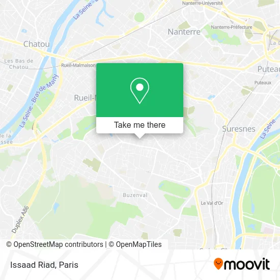
See Issaad Riad, Rueil-Malmaison, on the map
Public Transit to Issaad Riad in Rueil-Malmaison
Wondering how to get to Issaad Riad in Rueil-Malmaison? Moovit helps you find the best way to get to Issaad Riad with step-by-step directions from the nearest public transit station.
Moovit provides free maps and live directions to help you navigate through your city. View schedules, routes, timetables, and find out how long does it take to get to Issaad Riad in real time.
Looking for the nearest stop or station to Issaad Riad? Check out this list of stops closest to your destination: Dunant; La Paix; Place Besche; Les Godardes.
Bus: 144, 244, 263, N53, 141, 467, 565.
Want to see if there’s another route that gets you there at an earlier time? Moovit helps you find alternative routes or times. Get directions from and directions to Issaad Riad easily from the Moovit App or Website.
We make riding to Issaad Riad easy, which is why over 1.5 million users, including users in Rueil-Malmaison, trust Moovit as the best app for public transit. You don’t need to download an individual bus app or train app, Moovit is your all-in-one transit app that helps you find the best bus time or train time available.
For information on prices of bus, train, metro, RER and light rail, costs and ride fares to Issaad Riad, please check the Moovit app.
Use the app to navigate to popular places including to the airport, hospital, stadium, grocery store, mall, coffee shop, school, college, and university.
Issaad Riad Address: 28 Résidence les Taratres 92500 Rueil-Malmaison street in Rueil-Malmaison
- Rue Thiers,
- Résidence les Taratres,
- Azzedine Moussaoud,
- Dunant [144],
- 63 Avenue du 18 Juin 1940,
- O'Tacos,
- Pizza & Crêpe,
- O'Tacos,
- Lycée Gustave Eiffel,
- Dunant,
- O'Tacos Rueil Malmaison,
- Pharm le Tanou-Cormier,
- Wellandwell,
- C Gems,
- 135 Rue Filliette Nicolas Philibert,
- Lycée Gustave Eiffel,
- Melina,
- 78 Avenue du Président Georges Pompidou,
- Amathieu Maxime,
- Saint-Exupery
Places Near Issaad Riad (Rueil-Malmaison)
- Hôpital Pitié Salpêtrière, Paris,
- Hôpital Beaujon, Clichy,
- Hopital Lariboisière, Paris,
- Hopital Foch, Suresnes,
- Hôpital Henri Mondor, Creteil,
- Atelier Des Lumieres, Paris,
- Théâtre Mogador, Paris,
- Gare Routière Flixbus, Paris,
- Hôpital Saint-Joseph, Paris,
- Centre Hospitalier des 15/20, Paris,
- Fondation Louis Vuitton, Paris,
- Hôpital Cochin, Paris,
- Créteil Soleil, Creteil,
- Hôpital de la Pitié-Salpêtrière, Paris,
- Galeries Lafayette, Paris,
- Galeries Lafayette Haussmann, Paris,
- Marché Saint-Pierre, Paris,
- 29 Rue Manin, Paris,
- Hôpital Necker, Paris,
- Institut Curie, Paris
How to get to popular places in Paris with public transit
Get around Rueil-Malmaison by public transit!
Traveling around Rueil-Malmaison has never been so easy. See step by step directions as you travel to any attraction, street or major public transit station. View bus and train schedules, arrival times, service alerts and detailed routes on a map, so you know exactly how to get to anywhere in Rueil-Malmaison.
When traveling to any destination around Rueil-Malmaison use Moovit's Live Directions with Get Off Notifications to know exactly where and how far to walk, how long to wait for your line, and how many stops are left. Moovit will alert you when it's time to get off — no need to constantly re-check whether yours is the next stop.
Wondering how to use public transit in Rueil-Malmaison or how to pay for public transit in Rueil-Malmaison? Moovit public transit app can help you navigate your way with public transit easily, and at minimum cost. It includes public transit fees, ticket prices, and costs. Looking for a map of Rueil-Malmaison public transit lines? Moovit public transit app shows all public transit maps in Rueil-Malmaison with all Bus, Train, Metro, Light Rail, RER, Funicular and Gondola routes and stops on an interactive map.
Paris has 7 transit type(s), including: Bus, Train, Metro, Light Rail, RER, Funicular and Gondola, operated by several transit agencies, including RATP, RER, RER Bus de remplacement, Train, Train Bus de remplacement, Tramway Bus de remplacement, TER, ADP, Magical Shuttle, Argenteuil - Boucles de Seine, Autocars Dominique, Bièvre, Brie et 2 Morin, Le Bus - C.C. du Clermontois and Cœur d’Essonne