How to get to It Mundo by bus?
Click on the bus route to see step by step directions with maps, line arrival times and updated time schedules.
From Piscinas Naturales Las Berceas, Cercedilla
33 minFrom Autovía A-6 Km 20, Las Rozas De Madrid
98 minFrom Gran Plaza 2 Majadahonda, Área Metropolitana De Madrid Y Corredor Del Henares
81 minFrom Hospital HM Universitario Torrelodones, Torrelodones
57 minFrom Hospital De La Fuenfría., Cuenca Del Guadarrama
91 minFrom Polígono Európolis, Las Rozas De Madrid
92 minFrom Costco Wholesale, Las Rozas De Madrid
71 minFrom The Style Outlets Las Rozas, Las Rozas De Madrid
60 minFrom Heron City Madrid, Área Metropolitana De Madrid Y Corredor Del Henares
59 minFrom Manzanares el Real, Manzanares El Real
62 min
How to get to It Mundo by train?
Click on the train route to see step by step directions with maps, line arrival times and updated time schedules.
Bus stops near It Mundo in Alpedrete
Train stations near It Mundo in Alpedrete
Bus lines to It Mundo in Alpedrete
- 660, San Lorenzo de El Escorial - Guadarrama - Villalba,VIEW
- 682, Madrid (Moncloa) - Villalba - Guadarrama,VIEW
- 684, Madrid (Moncloa) - Cercedilla (por Guadarrama),VIEW
- 688, Madrid (Moncloa) - Los Molinos,VIEW
- VAC246, 2: Segovia (por Guadarrama),VIEW
- VAC246, 5 San Rafael - El Espinar (por Guadarrama),VIEW
- VAC246, 2 Madrid (Moncloa) (Por Guadarrama),VIEW
- 681, Madrid (Moncloa) - Alpedrete,VIEW
- 683, Madrid (Moncloa) - Collado Mediano,VIEW
- 685, Majadahonda (Hospital) - Las Rozas - Guadarrama,VIEW
- N602, Madrid (Moncloa) - Collado Villalba - Guadarrama,VIEW
- 2, Lanzadera 9,VIEW
- 6, Cantos Altos - Arroyo Arriba - Estación FF.CC.,VIEW
- 3, El Gorronal - Hospital - Estación FF.CC.,VIEW
- 664, P.º Moret - Moncloa,VIEW
What are the closest stations to It Mundo?
The closest stations to It Mundo are:
- Av. Reina Victoria - Cabeza Líjar is 90 meters away, 2 min walk.
- Av. Reina Victoria - Est. Los Negrales is 478 meters away, 7 min walk.
- Los Negrales is 640 meters away, 9 min walk.
- Tejar - Est. Los Negrales is 1072 meters away, 14 min walk.
- C.º Ventas Del Escorial - Maestro Acevedo is 1092 meters away, 14 min walk.
- Av. Juan Carlos I - Planetocio is 1215 meters away, 16 min walk.
- Las Zorreras - Navalquejigo is 1301 meters away, 17 min walk.
- Villalba De Guadarrama is 2692 meters away, 35 min walk.
Which bus lines stop near It Mundo?
These bus lines stop near It Mundo: 681, 684, 685.
Which train lines stop near It Mundo?
These train lines stop near It Mundo: C8B, REG.
What’s the nearest train station to It Mundo in Alpedrete?
The nearest train station to It Mundo in Alpedrete is Los Negrales. It’s a 9 min walk away.
What’s the nearest bus station to It Mundo in Alpedrete?
The nearest bus station to It Mundo in Alpedrete is Av. Reina Victoria - Cabeza Líjar. It’s a 2 min walk away.
What time is the first train to It Mundo in Alpedrete?
The C8A is the first train that goes to It Mundo in Alpedrete. It stops nearby at 5:48 AM.
What time is the last train to It Mundo in Alpedrete?
The C8A is the last train that goes to It Mundo in Alpedrete. It stops nearby at 12:27 AM.
What time is the first bus to It Mundo in Alpedrete?
The N602 is the first bus that goes to It Mundo in Alpedrete. It stops nearby at 3:05 AM.
What time is the last bus to It Mundo in Alpedrete?
The N602 is the last bus that goes to It Mundo in Alpedrete. It stops nearby at 3:05 AM.
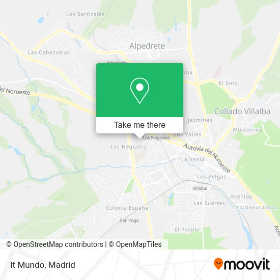
See It Mundo, Alpedrete, on the map
Public Transit to It Mundo in Alpedrete
Wondering how to get to It Mundo in Alpedrete? Moovit helps you find the best way to get to It Mundo with step-by-step directions from the nearest public transit station.
Moovit provides free maps and live directions to help you navigate through your city. View schedules, routes, timetables, and find out how long does it take to get to It Mundo in real time.
Looking for the nearest stop or station to It Mundo? Check out this list of stops closest to your destination: Av. Reina Victoria - Cabeza Líjar; Av. Reina Victoria - Est. Los Negrales; Los Negrales; Tejar - Est. Los Negrales; C.º Ventas Del Escorial - Maestro Acevedo; Av. Juan Carlos I - Planetocio; Las Zorreras - Navalquejigo; Villalba De Guadarrama.
Bus: 681, 684, 685, 660, 682, 688, VAC246, VAC246, VAC246, 683, N602.Train: C8B, REG, C8A, C10, MD.
Want to see if there’s another route that gets you there at an earlier time? Moovit helps you find alternative routes or times. Get directions from and directions to It Mundo easily from the Moovit App or Website.
We make riding to It Mundo easy, which is why over 1.5 million users, including users in Alpedrete, trust Moovit as the best app for public transit. You don’t need to download an individual bus app or train app, Moovit is your all-in-one transit app that helps you find the best bus time or train time available.
For information on prices of bus and train, costs and ride fares to It Mundo, please check the Moovit app.
Use the app to navigate to popular places including to the airport, hospital, stadium, grocery store, mall, coffee shop, school, college, and university.
It Mundo Address: Calle San Rafael, 28430 Negrales-Los Llanos Alpedrete street in Alpedrete
- Albergue Santa María De Los Negrales,
- Residencia Santa Maria,
- Los Negrales,
- Residencia Santa María De Los Negrales,
- Construcciones J.M. Recio,
- Casa de Convivencias La Concepción y San Pío X,
- Parque De Los Negrales,
- Alvarez Crespo Juan Pablo,
- Atocha,
- Bar Café Vinos,
- Tomevinos,
- Infoclinic,
- Bar-Restaurante Reina Victoria - Restaurante en Alpedrete,
- El Hiper de la Fruta,
- Bar Restaurante Reina Victoria,
- Talleres y Accesorios David Hernández,
- Amazon Counter-Estanco Los Negrales,
- Automascotas,
- Caserlim Facility Services,
- Runandrun
Places Near It Mundo (Alpedrete)
- Mendez Alvaro, Madrid,
- Centro Comercial Islazul, Área Metropolitana De Madrid Y Corredor Del Henares,
- Nassica, Área Metropolitana De Madrid Y Corredor Del Henares,
- Plenilunio, Área Metropolitana De Madrid Y Corredor Del Henares,
- Palacio De Vistalegre, Área Metropolitana De Madrid Y Corredor Del Henares,
- Centro Comercial La Gavia, Área Metropolitana De Madrid Y Corredor Del Henares,
- Estadio Wanda Metropolitano, Área Metropolitana De Madrid Y Corredor Del Henares,
- Hospital Universitario Ramón y Cajal, Madrid,
- Hospital Clínico Universitario San Carlos, Madrid,
- Centro Comercial La Vaguada, Área Metropolitana De Madrid Y Corredor Del Henares,
- Wizink Center, Madrid,
- Hospital Universitario La Paz, Madrid,
- Estacion de Chamartin, Madrid,
- Calle de López de Hoyos 169, Madrid,
- Plaza Mayor, Madrid,
- Tres Aguas, Alcorcón,
- Sala La Riviera, Madrid,
- Rastro De Madrid, Área Metropolitana De Madrid Y Corredor Del Henares,
- Mercadillo de Majadahonda, Majadahonda,
- Centro Comercial Oasiz Madrid, Área Metropolitana De Madrid Y Corredor Del Henares
How to get to popular places in Madrid with public transit
Get around Alpedrete by public transit!
Traveling around Alpedrete has never been so easy. See step by step directions as you travel to any attraction, street or major public transit station. View bus and train schedules, arrival times, service alerts and detailed routes on a map, so you know exactly how to get to anywhere in Alpedrete.
When traveling to any destination around Alpedrete use Moovit's Live Directions with Get Off Notifications to know exactly where and how far to walk, how long to wait for your line, and how many stops are left. Moovit will alert you when it's time to get off — no need to constantly re-check whether yours is the next stop.
Wondering how to use public transit in Alpedrete or how to pay for public transit in Alpedrete? Moovit public transit app can help you navigate your way with public transit easily, and at minimum cost. It includes public transit fees, ticket prices, and costs. Looking for a map of Alpedrete public transit lines? Moovit public transit app shows all public transit maps in Alpedrete with all Bus, Train, Metro and Light Rail routes and stops on an interactive map.
Madrid has 4 transit type(s), including: Bus, Train, Metro and Light Rail, operated by several transit agencies, including Metro de Madrid, Metro Ligero, Tranvía de Parla, Renfe Cercanías - Servicios de Autobús especiales, Renfe Cercanias, Renfe Cercanías, EMT, Interurbanos, Urbanos de Alcalá de Henares, Urbanos de Alcobendas, Urbanos de Alcorcón, Urbanos de Algete, Urbanos de Aranjuez, Urbanos de Arganda del Rey and Urbanos de Arroyomolinos