How to get to Izza Nail's by bus?
Click on the bus route to see step by step directions with maps, line arrival times and updated time schedules.
From Calle Aquiles Elorduy, Aguascalientes
58 minFrom La Santa Niña, Aguascalientes
61 minFrom Aguascalientes, Aguascalientes
41 minFrom Parroquia de la Purísima, Aguascalientes
39 minFrom Villasuncion, Aguascalientes
59 minFrom Col. Martínez Domínguez, Aguascalientes
56 minFrom Star Medica, Aguascalientes
40 minFrom Fracc. Bulevares 1ra. Sección, Aguascalientes
54 minFrom Fraccionamiento San Marcos, Aguascalientes
59 minFrom Avenida Ajedrecistas, Aguascalientes
73 min
Bus stops near Izza Nail's in Aguascalientes
Bus lines to Izza Nail's in Aguascalientes
What are the closest stations to Izza Nail's?
The closest stations to Izza Nail's are:
- Av.Valle De Los Romeros, 1501 is 224 meters away, 3 min walk.
- Ermita De San Sebastián, 904 is 791 meters away, 11 min walk.
Which bus lines stop near Izza Nail's?
These bus lines stop near Izza Nail's: RUTA 23, RUTA 30, RUTA 34.
What’s the nearest bus station to Izza Nail's in Aguascalientes?
The nearest bus station to Izza Nail's in Aguascalientes is Av.Valle De Los Romeros, 1501. It’s a 3 min walk away.
What time is the first bus to Izza Nail's in Aguascalientes?
The RUTA 30 is the first bus that goes to Izza Nail's in Aguascalientes. It stops nearby at 5:50 AM.
What time is the last bus to Izza Nail's in Aguascalientes?
The RUTA 30 is the last bus that goes to Izza Nail's in Aguascalientes. It stops nearby at 10:27 PM.
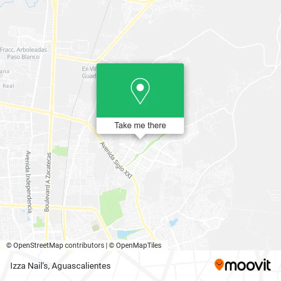
See Izza Nail's, Aguascalientes, on the map
Public Transit to Izza Nail's in Aguascalientes
Wondering how to get to Izza Nail's in Aguascalientes? Moovit helps you find the best way to get to Izza Nail's with step-by-step directions from the nearest public transit station.
Moovit provides free maps and live directions to help you navigate through your city. View schedules, routes, timetables, and find out how long does it take to get to Izza Nail's in real time.
Looking for the nearest stop or station to Izza Nail's? Check out this list of stops closest to your destination: Av.Valle De Los Romeros; Ermita De San Sebastián.
Bus: RUTA 23, RUTA 30, RUTA 34, RUTA 08, RUTA 37, RUTA 43, RUTA 43.
Want to see if there’s another route that gets you there at an earlier time? Moovit helps you find alternative routes or times. Get directions from and directions to Izza Nail's easily from the Moovit App or Website.
We make riding to Izza Nail's easy, which is why over 1.5 million users, including users in Aguascalientes, trust Moovit as the best app for public transit. You don’t need to download an individual bus app or train app, Moovit is your all-in-one transit app that helps you find the best bus time or train time available.
For information on prices of bus, costs and ride fares to Izza Nail's, please check the Moovit app.
Use the app to navigate to popular places including to the airport, hospital, stadium, grocery store, mall, coffee shop, school, college, and university.
Izza Nail's Address: Calle José Bustamante 311, Ntra Sra de la Asunción Sect Est, 20126 Aguascalientes, Aguascalientes street in Aguascalientes
- parque villas de nuestra sra de la asuncion,
- Umf 13 Imss,
- Manuel Cardona Villas de Nuestra Sra de la Asuncion Sect Estacion,
- Valle de los Romero Agu,
- Amazon Counter-Oxxo Valle de los Romero Agu,
- Pañal por Kilo,
- Av.Valle de Los Romeros,
- Boliando,
- Umf 12,
- Salvador Patiño Domínguez,
- Venta de Gelatinas,
- Unidad de Medicina Familiar Numero 12,
- Av.Federico Méndez,
- Carniceria Cristi,
- Papelería La Lomita,
- Grupo Recimetal,
- Abarrotes-Salvador Durán Castañedo,
- Venta de Helados y Paletas,
- WESTERN UNION,
- Universidad Metropolitana De Aguascalientes
Places Near Izza Nail's (Aguascalientes)
- Centro Comercial Altaria, Aguascalientes,
- Ciudad industrial, Aguascalientes,
- La Isla San Marcos, Aguascalientes,
- Terminal De Combis, Aguascalientes,
- Central De Autobuses, Aguascalientes,
- Nuevo Hospital Hidalgo, Aguascalientes,
- Agropecuario, Aguascalientes,
- ESPACIOS, Aguascalientes,
- Villas de Nuestra Señora de la Asunción, Aguascalientes,
- Aeropuerto de Aguascalientes S.A. de C.V., Aguascalientes,
- Hospital Imss No. 3, Aguascalientes,
- Jesús María, Aguascalientes,
- Isla San Marcos, Aguascalientes,
- Parque Las Tres Centurias, Aguascalientes,
- clinica 3 uaa, Aguascalientes,
- Imss Clinica 1, Aguascalientes,
- Centro, Aguascalientes,
- Universidad Autónoma de Aguascalientes, Aguascalientes,
- Blvd. Luis Donaldo Colosio, Aguascalientes,
- Villasuncion, Aguascalientes
How to get to popular places in Aguascalientes with public transit
Get around Aguascalientes by public transit!
Traveling around Aguascalientes has never been so easy. See step by step directions as you travel to any attraction, street or major public transit station. View bus and train schedules, arrival times, service alerts and detailed routes on a map, so you know exactly how to get to anywhere in Aguascalientes.
When traveling to any destination around Aguascalientes use Moovit's Live Directions with Get Off Notifications to know exactly where and how far to walk, how long to wait for your line, and how many stops are left. Moovit will alert you when it's time to get off — no need to constantly re-check whether yours is the next stop.
Wondering how to use public transit in Aguascalientes or how to pay for public transit in Aguascalientes? Moovit public transit app can help you navigate your way with public transit easily, and at minimum cost. It includes public transit fees, ticket prices, and costs. Looking for a map of Aguascalientes public transit lines? Moovit public transit app shows all public transit maps in Aguascalientes with all bus routes and stops on an interactive map.
Aguascalientes has 1 transit type(s), including: bus, operated by several transit agencies, including Coordinación General de Movilidad