Directions to JB&Jr Distribution (Baltimore) with public transportation
The following transit lines have routes that pass near JB&Jr Distribution
 Bus: GREEN ROUTE, ORANGE ROUTE, 150, CITYLINK NAVY, CITYLINK LIME.
- Train: MARC.
- Metro: METRO.
- Ferry: HC1.
How to get to JB&Jr Distribution by bus?
Click on the bus route to see step by step directions with maps, line arrival times and updated time schedules.
From Pimlico Race Course, Baltimore
70 minFrom Walmart Supercenter, Baltimore County
45 minFrom Medstar Union Memorial Hospital, Baltimore
39 minFrom Guinness Open Gate Brewery & Barrel House, Baltimore County
70 minFrom University Of Maryland Baltimore (Umbc), Baltimore County
46 minFrom Johns Hopkins University, Baltimore
41 minFrom Walmart, Baltimore County
44 minFrom Coppin State University, Baltimore
40 minFrom Mva, Baltimore
60 minFrom NSA Friendship Annex (FANX), Anne Arundel County
92 min
How to get to JB&Jr Distribution by train?
Click on the train route to see step by step directions with maps, line arrival times and updated time schedules.
How to get to JB&Jr Distribution by metro?
Click on the metro route to see step by step directions with maps, line arrival times and updated time schedules.
Bus stops near JB&Jr Distribution in Baltimore
Ferry stations near JB&Jr Distribution in Baltimore
Metro station near JB&Jr Distribution in Baltimore
- Shot Tower Metro, 25 min walk,VIEW
Bus lines to JB&Jr Distribution in Baltimore
What are the closest stations to JB&Jr Distribution?
The closest stations to JB&Jr Distribution are:
- Fleet St & Exeter St Eb is 175 yards away, 3 min walk.
- Fleet & Exeter is 175 yards away, 3 min walk.
- Eastern Ave & Albemarle St is 452 yards away, 6 min walk.
- Caroline St & Eastern Ave FS Sb is 504 yards away, 7 min walk.
- Pratt & Albemarle Eb is 687 yards away, 9 min walk.
- Maritime Park is 955 yards away, 12 min walk.
- Pier Five is 1010 yards away, 12 min walk.
- Shot Tower Metro is 2043 yards away, 25 min walk.
- Key Hwy & Covington is 2283 yards away, 28 min walk.
- Key Hwy & Covington Ns Eb is 2283 yards away, 28 min walk.
- Locust Point is 5011 yards away, 59 min walk.
Which bus lines stop near JB&Jr Distribution?
These bus lines stop near JB&Jr Distribution: GREEN ROUTE, ORANGE ROUTE.
Which train line stops near JB&Jr Distribution?
MARC (Inbound - Penn)
Which metro line stops near JB&Jr Distribution?
METRO (Towards John Hopkins)
What’s the nearest metro station to JB&Jr Distribution in Baltimore?
The nearest metro station to JB&Jr Distribution in Baltimore is Shot Tower Metro. It’s a 25 min walk away.
What’s the nearest bus station to JB&Jr Distribution in Baltimore?
The nearest bus stations to JB&Jr Distribution in Baltimore are Fleet St & Exeter St Eb and Fleet & Exeter. The closest one is a 3 min walk away.
What’s the nearest ferry station to JB&Jr Distribution in Baltimore?
The nearest ferry stations to JB&Jr Distribution in Baltimore are Maritime Park and Pier Five. The closest one is a 12 min walk away.
What time is the first metro to JB&Jr Distribution in Baltimore?
The METRO is the first metro that goes to JB&Jr Distribution in Baltimore. It stops nearby at 5:07 AM.
What time is the last metro to JB&Jr Distribution in Baltimore?
The METRO is the last metro that goes to JB&Jr Distribution in Baltimore. It stops nearby at 12:27 AM.
What time is the first bus to JB&Jr Distribution in Baltimore?
The 65 is the first bus that goes to JB&Jr Distribution in Baltimore. It stops nearby at 3:55 AM.
What time is the last bus to JB&Jr Distribution in Baltimore?
The CITYLINK NAVY is the last bus that goes to JB&Jr Distribution in Baltimore. It stops nearby at 3:09 AM.
What time is the first ferry to JB&Jr Distribution in Baltimore?
The HC3 is the first ferry that goes to JB&Jr Distribution in Baltimore. It stops nearby at 6:00 AM.
What time is the last ferry to JB&Jr Distribution in Baltimore?
The HC3 is the last ferry that goes to JB&Jr Distribution in Baltimore. It stops nearby at 8:07 PM.
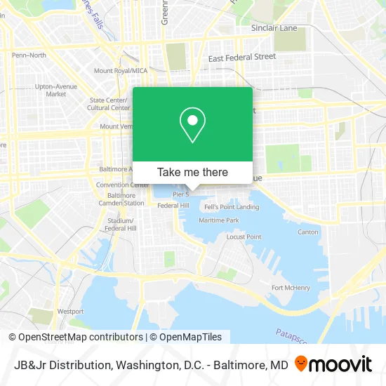
See JB&Jr Distribution, Baltimore, on the map
Public Transit to JB&Jr Distribution in Baltimore
Wondering how to get to JB&Jr Distribution in Baltimore? Moovit helps you find the best way to get to JB&Jr Distribution with step-by-step directions from the nearest public transit station.
Moovit provides free maps and live directions to help you navigate through your city. View schedules, routes, timetables, and find out how long does it take to get to JB&Jr Distribution in real time.
Looking for the nearest stop or station to JB&Jr Distribution? Check out this list of stops closest to your destination: Fleet St & Exeter St Eb; Fleet & Exeter; Eastern Ave & Albemarle St; Caroline St & Eastern Ave FS Sb; Pratt & Albemarle Eb; Maritime Park; Pier Five; Shot Tower Metro; Key Hwy & Covington; Key Hwy & Covington Ns Eb; Locust Point.
Bus: GREEN ROUTE, ORANGE ROUTE, 150, CITYLINK NAVY, CITYLINK LIME.Train: MARC.Metro: METRO.Ferry: HC1.
Want to see if there’s another route that gets you there at an earlier time? Moovit helps you find alternative routes or times. Get directions from and directions to JB&Jr Distribution easily from the Moovit App or Website.
We make riding to JB&Jr Distribution easy, which is why over 1.5 million users, including users in Baltimore, trust Moovit as the best app for public transit. You don’t need to download an individual bus app or train app, Moovit is your all-in-one transit app that helps you find the best bus time or train time available.
For information on prices of bus, metro, light rail and train, costs and ride fares to JB&Jr Distribution, please check the Moovit app.
Use the app to navigate to popular places including to the airport, hospital, stadium, grocery store, mall, coffee shop, school, college, and university.
JB&Jr Distribution Address: 100 International Dr Baltimore, MD 21202 street in Baltimore
- Aidan Jones - Re / Max Advantage Realty,
- GBC Management Group,
- Baltimore Research,
- Rapha Beth - Beth Rapha Behavioral Health System,
- The Eden,
- War Horse,
- Adflick,
- Trio Caliente,
- Dean Triantis,
- The Quantum Group,
- FedEx,
- Four Seasons-Baltimore ,
- Software Data Engineering,
- Blue Gems Aba,
- Balani Custom Clothiers - Suits, Tuxedos, & Shirts,
- Viruni Law,
- Glow Optical Studios,
- Wavr Mag,
- Four Seasons Baltimore,
- Freedom Boat Club
Places Near JB&Jr Distribution (Baltimore)
- Capital One Arena, Washington,
- PG Mall, Prince George's County,
- Georgetown, Washington,
- National Zoo, Washington,
- Sibley Memorial Hospital, Washington,
- Rock Creek Tennis Center, Washington,
- Washington DC VA Medical Center, Washington,
- Museum Of The Bible, Washington,
- Pennsylvania Ave NW (3rd st and pennsylvania), Washington,
- Basilica of the National Shrine, Washington,
- Camden Yards, Baltimore,
- National Mall, Washington,
- Westfield Montgomery Mall, Montgomery County,
- National Museum of African American History and Culture, Washington,
- Warner Theatre, Washington,
- The Anthem, Washington,
- Amazon Hq2, Arlington County,
- Marriott Marquis Washington, DC, Washington,
- M&T Bank Stadium, Baltimore,
- Washington National Cathedral, Washington
How to get to popular places in Washington, D.C. - Baltimore, MD with public transit
Get around Baltimore by public transit!
Traveling around Baltimore has never been so easy. See step by step directions as you travel to any attraction, street or major public transit station. View bus and train schedules, arrival times, service alerts and detailed routes on a map, so you know exactly how to get to anywhere in Baltimore.
When traveling to any destination around Baltimore use Moovit's Live Directions with Get Off Notifications to know exactly where and how far to walk, how long to wait for your line, and how many stops are left. Moovit will alert you when it's time to get off — no need to constantly re-check whether yours is the next stop.
Wondering how to use public transit in Baltimore or how to pay for public transit in Baltimore? Moovit public transit app can help you navigate your way with public transit easily, and at minimum cost. It includes public transit fees, ticket prices, and costs. Looking for a map of Baltimore public transit lines? Moovit public transit app shows all public transit maps in Baltimore with all Bus, Train, Metro, Light Rail and Ferry routes and stops on an interactive map.
Washington, D.C. - Baltimore, MD has 5 transit type(s), including: Bus, Train, Metro, Light Rail and Ferry, operated by several transit agencies, including WMATA, Montgomery County Ride On, Fairfax Connector, TheBus, PRTC, DASH - Alexandria, Arlington Transit (ART), RTA of Central Maryland, MDOT MTA, MDOT MTA Light RailLink, MDOT MTA Commuter Bus, MDOT MTA Local Bus, FXBGO!, Virginia Railway Express (VRE) and MARC