How to get to JM Interpart by bus?
Click on the bus route to see step by step directions with maps, line arrival times and updated time schedules.
From Miami Airport Rental Car Center, Miami
94 minFrom Flagler & 57 Ave, Miami
50 minFrom Zezgo Miami Rent A Car, Miami
97 minFrom SW 8th St / SW 67th Ave, Miami
69 minFrom Embassy Suites by Hilton Miami International Airport, Miami
83 minFrom SW 137 Ave. & SW 8 St., Kendale Lakes-Tamiami
46 minFrom N Le Jeune Rd / SW 42nd Ave, Miami
66 minFrom Hyatt Place Miami Airport-East, Miami
85 minFrom Rapids Water Park, Miami
81 minFrom Red Coach, Miami
133 min
Bus stops near JM Interpart in North Westside
Bus lines to JM Interpart in North Westside
What are the closest stations to JM Interpart?
The closest stations to JM Interpart are:
- Nw 19 St@nw 102 Av is 642 yards away, 8 min walk.
- Nw 107 Av & Nw 19 St is 983 yards away, 12 min walk.
- Nw 17 St @ Nw 107 Av is 1370 yards away, 17 min walk.
Which bus lines stop near JM Interpart?
These bus lines stop near JM Interpart: 137, 7, DLOOP2, DLOOP4.
What’s the nearest bus station to JM Interpart in North Westside?
The nearest bus station to JM Interpart in North Westside is Nw 19 St@nw 102 Av. It’s a 8 min walk away.
What time is the first bus to JM Interpart in North Westside?
The 7 is the first bus that goes to JM Interpart in North Westside. It stops nearby at 4:52 AM.
What time is the last bus to JM Interpart in North Westside?
The 107 is the last bus that goes to JM Interpart in North Westside. It stops nearby at 12:49 AM.
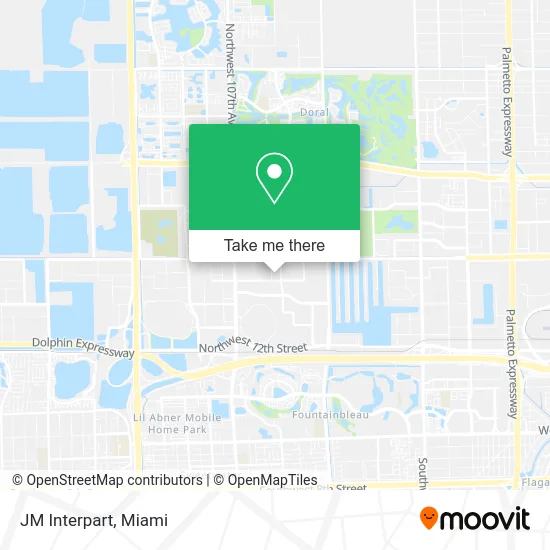
See JM Interpart, North Westside, on the map
Public Transit to JM Interpart in North Westside
Wondering how to get to JM Interpart in North Westside? Moovit helps you find the best way to get to JM Interpart with step-by-step directions from the nearest public transit station.
Moovit provides free maps and live directions to help you navigate through your city. View schedules, routes, timetables, and find out how long does it take to get to JM Interpart in real time.
Looking for the nearest stop or station to JM Interpart? Check out this list of stops closest to your destination: Nw 19 St@nw 102 Av; Nw 107 Av & Nw 19 St; Nw 17 St @ Nw 107 Av.
Bus: 137, 7, DLOOP2, DLOOP4, DLOOP1, 107.
Want to see if there’s another route that gets you there at an earlier time? Moovit helps you find alternative routes or times. Get directions from and directions to JM Interpart easily from the Moovit App or Website.
We make riding to JM Interpart easy, which is why over 1.5 million users, including users in North Westside, trust Moovit as the best app for public transit. You don’t need to download an individual bus app or train app, Moovit is your all-in-one transit app that helps you find the best bus time or train time available.
For information on prices of bus, train and light rail, costs and ride fares to JM Interpart, please check the Moovit app.
Use the app to navigate to popular places including to the airport, hospital, stadium, grocery store, mall, coffee shop, school, college, and university.
JM Interpart Address: 2201 NW 102nd Pl Miami, FL 33172 street in North Westside
- Ezenzia,
- Loch on Twitter,
- Emergency Locksmith In Doral,
- Warehouse Miami,
- Cima Aviation,
- RMCC,
- Prima Classe Kitchen,
- Swiss Pac USA,
- LEXUS Plast Company USA,
- Yusen Logistics,
- Scentia,
- Rxo,
- MG Merchant Services,
- Foundart Academy, Inc.,
- Cop World USA,
- Margarita Gran Salon,
- Blanco Studios - Doral,
- Best Accounting,
- Yuliett Rodriguez,
- Level 7 Global Holdings Corp.
Places Near JM Interpart (North Westside)
- Aventura Mall, Miami,
- Keiser University Flagship Campus, West Palm Beach,
- Miami Design District, Miami,
- Marlins Park, Miami,
- Dolphin Mall, Miami,
- Wynwood, Miami,
- Miami VA Hospital, Miami,
- Sawgrass Mall, Miami,
- Little Havana, Miami,
- Miami-Dade County Courthouse, Miami,
- Hard Rock Stadium, Miami Gardens,
- Port of Miami Cruise Terminal, Miami,
- Miami Freedom Park, Miami,
- Zoo Miami, Miami,
- Aventura Mall, Miami Beach,
- Dolphin Mall Bus, Miami,
- Sawgrass mall ( FL ), Miami Beach,
- Bayside Marketplace, Miami,
- Richard E. Gerstein Justice Building, Miami,
- Brickell City Centre, Miami
How to get to popular places in Miami with public transit
Get around North Westside by public transit!
Traveling around North Westside has never been so easy. See step by step directions as you travel to any attraction, street or major public transit station. View bus and train schedules, arrival times, service alerts and detailed routes on a map, so you know exactly how to get to anywhere in North Westside.
When traveling to any destination around North Westside use Moovit's Live Directions with Get Off Notifications to know exactly where and how far to walk, how long to wait for your line, and how many stops are left. Moovit will alert you when it's time to get off — no need to constantly re-check whether yours is the next stop.
Wondering how to use public transit in North Westside or how to pay for public transit in North Westside? Moovit public transit app can help you navigate your way with public transit easily, and at minimum cost. It includes public transit fees, ticket prices, and costs. Looking for a map of North Westside public transit lines? Moovit public transit app shows all public transit maps in North Westside with all Bus, Train, Light Rail and Ferry routes and stops on an interactive map.
Miami has 4 transit type(s), including: Bus, Train, Light Rail and Ferry, operated by several transit agencies, including Broward County Transit, Miami-Dade Transit, Metrorail, Palm Tran, Tri-Rail, Brightline, MARTY, City of Homestead Trolley, Key West Transit, Treasure Coast Connector, GoLine IRT, Amtrak, Greyhound-us, FlixBus-us and Aventura Express Shuttle Bus