Directions to J-Cap Programs (Queens) with public transportation
The following transit lines have routes that pass near J-Cap Programs
 Bus: Q113, Q51, Q6, QM21, QM65.
- Train: BABYLON BRANCH, CITY TERMINAL ZONE, FAR ROCKAWAY BRANCH, LONG BEACH BRANCH, WEST HEMPSTEAD BRANCH.
- Subway: E, J, Z.
How to get to J-Cap Programs by bus?
Click on the bus route to see step by step directions with maps, line arrival times and updated time schedules.
From US Open Tennis, Queens
81 minFrom Far Rockaway, NY, Queens
49 minFrom Belmont Park, Elmont
80 minFrom 30-56 Whitestone Expwy, Queens
69 minFrom Flushing Meadows-Corona Park, Queens
69 minFrom Resorts World Shuttle Bus, Queens
66 minFrom Green Acres Mall, South Valley Stream
51 minFrom Queens Center Mall, Queens
65 min
How to get to J-Cap Programs by train?
Click on the train route to see step by step directions with maps, line arrival times and updated time schedules.
How to get to J-Cap Programs by subway?
Click on the subway route to see step by step directions with maps, line arrival times and updated time schedules.
Bus stops near J-Cap Programs in Queens
Train stations near J-Cap Programs in Queens
Subway station near J-Cap Programs in Queens
- Jamaica Center-Parsons/Archer, 33 min walk,VIEW
Bus lines to J-Cap Programs in Queens
What are the closest stations to J-Cap Programs?
The closest stations to J-Cap Programs are:
- Sutphin Blvd/116 Av is 52 yards away, 1 min walk.
- Linden Blvd/ Sutphin Blvd is 588 yards away, 8 min walk.
- Linden Blvd/Sutphin Blvd is 603 yards away, 8 min walk.
- 142 St/116 Av is 826 yards away, 10 min walk.
- St.Albans is 981 yards away, 12 min walk.
- Locust Manor is 1869 yards away, 23 min walk.
- Jamaica is 2594 yards away, 31 min walk.
- Jamaica Center-Parsons/Archer is 2737 yards away, 33 min walk.
Which bus lines stop near J-Cap Programs?
These bus lines stop near J-Cap Programs: Q113, Q51, Q6.
Which train lines stop near J-Cap Programs?
These train lines stop near J-Cap Programs: BABYLON BRANCH, CITY TERMINAL ZONE, FAR ROCKAWAY BRANCH, LONG BEACH BRANCH.
Which subway lines stop near J-Cap Programs?
These subway lines stop near J-Cap Programs: E, J.
What’s the nearest train station to J-Cap Programs in Queens?
The nearest train station to J-Cap Programs in Queens is St.Albans. It’s a 12 min walk away.
What’s the nearest bus station to J-Cap Programs in Queens?
The nearest bus station to J-Cap Programs in Queens is Sutphin Blvd/116 Av. It’s a 1 min walk away.
What time is the first light rail to J-Cap Programs in Queens?
The AIRTRAIN is the first light rail that goes to J-Cap Programs in Queens. It stops nearby at 3:00 AM.
What time is the last light rail to J-Cap Programs in Queens?
The AIRTRAIN is the last light rail that goes to J-Cap Programs in Queens. It stops nearby at 3:06 AM.
What time is the first subway to J-Cap Programs in Queens?
The E is the first subway that goes to J-Cap Programs in Queens. It stops nearby at 3:06 AM.
What time is the last subway to J-Cap Programs in Queens?
The J is the last subway that goes to J-Cap Programs in Queens. It stops nearby at 3:49 AM.
What time is the first train to J-Cap Programs in Queens?
The BABYLON BRANCH is the first train that goes to J-Cap Programs in Queens. It stops nearby at 3:07 AM.
What time is the last train to J-Cap Programs in Queens?
The BABYLON BRANCH is the last train that goes to J-Cap Programs in Queens. It stops nearby at 3:07 AM.
What time is the first bus to J-Cap Programs in Queens?
The Q6 is the first bus that goes to J-Cap Programs in Queens. It stops nearby at 3:02 AM.
What time is the last bus to J-Cap Programs in Queens?
The Q6 is the last bus that goes to J-Cap Programs in Queens. It stops nearby at 3:07 AM.
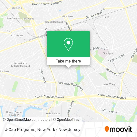
See J-Cap Programs, Queens, on the map
Public Transit to J-Cap Programs in Queens
Wondering how to get to J-Cap Programs in Queens? Moovit helps you find the best way to get to J-Cap Programs with step-by-step directions from the nearest public transit station.
Moovit provides free maps and live directions to help you navigate through your city. View schedules, routes, timetables, and find out how long does it take to get to J-Cap Programs in real time.
Looking for the nearest stop or station to J-Cap Programs? Check out this list of stops closest to your destination: Sutphin Blvd/116 Av; Linden Blvd/ Sutphin Blvd; Linden Blvd/Sutphin Blvd; 142 St/116 Av; St.Albans; Locust Manor; Jamaica; Jamaica Center-Parsons/Archer.
Bus: Q113, Q51, Q6, QM21, QM65.Train: BABYLON BRANCH, CITY TERMINAL ZONE, FAR ROCKAWAY BRANCH, LONG BEACH BRANCH, WEST HEMPSTEAD BRANCH, AIRTRAIN, HEMPSTEAD BRANCH, MONTAUK BRANCH, OYSTER BAY BRANCH.Subway: E, J, Z.
Want to see if there’s another route that gets you there at an earlier time? Moovit helps you find alternative routes or times. Get directions from and directions to J-Cap Programs easily from the Moovit App or Website.
We make riding to J-Cap Programs easy, which is why over 1.5 million users, including users in Queens, trust Moovit as the best app for public transit. You don’t need to download an individual bus app or train app, Moovit is your all-in-one transit app that helps you find the best bus time or train time available.
For information on prices of bus, subway and train, costs and ride fares to J-Cap Programs, please check the Moovit app.
Use the app to navigate to popular places including to the airport, hospital, stadium, grocery store, mall, coffee shop, school, college, and university.
J-Cap Programs Address: 116-30 Sutphin Blvd street in Queens
- J-Cap Medical,
- Masjid Abubakar,
- Rugged Cross Church of Prayer for All People,
- Dream City,
- Hairworks Salon 116th Sutphin Boulevard,
- Rugged Cross Church Of Prayer,
- 116 Sutphin Deli,
- Peace Power and Faith Ministries International,
- Rugged Cross Church Of God,
- 116th Ave (Sutphin Blvd and 116th),
- Dunamis New Testament Church Of God,
- Seventh Day Church Of God,
- Amazon Locker - Jaad,
- Afrolink Express Multiservices,
- Vinted Go Parcel Shop,
- Hairworks Beauty Salon,
- The Resurrection Celebration Center,
- Uniform Store,
- Shell,
- Number 1
Places Near J-Cap Programs (Queens)
- San Gennaro Feast, Manhattan,
- Bellevue Hospital, Manhattan,
- Rockefeller Center, Manhattan,
- 376 Hudson Street, Manhattan,
- Mountainside Hospital, Glen Ridge,
- 1 Police Plaza, Manhattan,
- 911 Memorial, Manhattan,
- Hudson Yards, Manhattan,
- Katz's Deli, Manhattan,
- Wall Street, Manhattan,
- 3 Stone St, Manhattan,
- 66 John Street, Manhattan,
- 111 Centre New York City Supreme Court, Manhattan,
- SoHo, Manhattan,
- Pier 83, Manhattan,
- Times Square, Manhattan,
- Queens Center Mall, Queens,
- Chinatown, Manhattan,
- 26 Federal Plaza, Manhattan,
- qqqq, Manhattan
How to get to popular places in New York - New Jersey with public transit
Get around Queens by public transit!
Traveling around Queens has never been so easy. See step by step directions as you travel to any attraction, street or major public transit station. View bus and train schedules, arrival times, service alerts and detailed routes on a map, so you know exactly how to get to anywhere in Queens.
When traveling to any destination around Queens use Moovit's Live Directions with Get Off Notifications to know exactly where and how far to walk, how long to wait for your line, and how many stops are left. Moovit will alert you when it's time to get off — no need to constantly re-check whether yours is the next stop.
Wondering how to use public transit in Queens or how to pay for public transit in Queens? Moovit public transit app can help you navigate your way with public transit easily, and at minimum cost. It includes public transit fees, ticket prices, and costs. Looking for a map of Queens public transit lines? Moovit public transit app shows all public transit maps in Queens with all Bus, Train, Subway, Light Rail, Ferry and Cable Car routes and stops on an interactive map.
New York - New Jersey has 6 transit type(s), including: Bus, Train, Subway, Light Rail, Ferry and Cable Car, operated by several transit agencies, including MTA Subway, Metro-North Railroad, LIRR, PATH, MTA New York City Transit - Express routes, MTA Bus, NJ Transit, NYC Ferry, NICE bus, Bee-Line Bus, NJ Transit Rail, Norwalk Transit District, Hartford Line, River Valley Transit and HART