Directions to J Salgado & Cia (Todos Os Santos) with public transportation
The following transit lines have routes that pass near J Salgado & Cia
 Bus: 277, 560L, 623, 627, 650.
- Metro: L2.
- Train: RAMAL DEODORO, RAMAL JAPERI, RAMAL SANTA CRUZ, RAMAL BELFORD ROXO.
How to get to J Salgado & Cia by bus?
Click on the bus route to see step by step directions with maps, line arrival times and updated time schedules.
From Hospital Maternidade Fernando Magalhães, Vasco Da Gama
36 minFrom Presidente Vargas, Centro
43 minFrom Rio das pedras/ Jacarepaguá, Jacarepaguá
36 minFrom Avenida Ministro Edgard Romero 4, Madureira
28 minFrom Feira de Acari, Acari
48 minFrom Hospital Quinta D'Or, Imperial De São Cristóvão
42 minFrom Acari, Acari
49 minFrom Hospital Ronaldo Gazolla, Coelho Neto
53 minFrom Praça Saiqui, Vila Valqueire
41 minFrom Rua Gomes Freire, 822, Centro
57 min
How to get to J Salgado & Cia by train?
Click on the train route to see step by step directions with maps, line arrival times and updated time schedules.
From Hospital Maternidade Fernando Magalhães, Vasco Da Gama
52 minFrom Presidente Vargas, Centro
43 minFrom Avenida Ministro Edgard Romero 4, Madureira
32 minFrom Hospital Quinta D'Or, Imperial De São Cristóvão
31 minFrom Hospital Ronaldo Gazolla, Coelho Neto
76 minFrom Rua Gomes Freire, 822, Centro
45 min
How to get to J Salgado & Cia by metro?
Click on the metro route to see step by step directions with maps, line arrival times and updated time schedules.
From Hospital Maternidade Fernando Magalhães, Vasco Da Gama
78 minFrom Presidente Vargas, Centro
57 minFrom Feira de Acari, Acari
60 minFrom Hospital Quinta D'Or, Imperial De São Cristóvão
57 minFrom Acari, Acari
62 minFrom Hospital Ronaldo Gazolla, Coelho Neto
71 minFrom Rua Gomes Freire, 822, Centro
66 min
Bus stops near J Salgado & Cia in Todos Os Santos
Train stations near J Salgado & Cia in Todos Os Santos
Bus lines to J Salgado & Cia in Todos Os Santos
- 456, LECD132 - Norte Shopping - Copacabana (Brs 3 - via Vila Isabel / Estácio / Santa Bárbara),VIEW
- 544, Nova Iguaçu - Méier (Via Norte Shopping),VIEW
- 560L, Caxias - Méier,VIEW
- 627, Inhaúma - Saens Peña (Brs 6 - Via Méier),VIEW
- 650, Marechal Hermes - Engenho Novo (Via Méier),VIEW
- 688, Pavuna - Méier (Via Álvaro de Miranda),VIEW
- 692, Méier - Alvorada (Via Freguesia / Linha Amarela / Norte Shopping),VIEW
- SP 692, Freguesia - Méier (Via Norte Shopping),VIEW
- SV 692, Meier - Alvorada (Expresso),VIEW
- 254, Madureira - Candelária (Brs 4 - Via Méier / Uerj),VIEW
- 277, Rocha Miranda - Candelária (Brs 4 - Via Madureira / São Cristóvão),VIEW
- 543, Nova Iguaçu - Méier (Via Engenho de Dentro),VIEW
- 623, Penha - Saens Peña (Brs 6 - Via Túnel Noel Rosa),VIEW
- 638, Marechal Hermes - Saens Peña (Brs 6 - Via Madureira / Méier / Vila Isabel),VIEW
- 669, Pavuna - Méier (Via Alcobaça),VIEW
- SV 669, Pavuna - Méier (Via Camboatá),VIEW
- 687, Pavuna - Méier (Via Est. Velha da Pavuna),VIEW
- 729L, São Vicente - Méier (Via Pavuna),VIEW
- 946, Engenho Da Rainha,VIEW
- 639, Jardim América,VIEW
What are the closest stations to J Salgado & Cia?
The closest stations to J Salgado & Cia are:
- Rua José Bonifácio, 73 | Condomínio East Side Meier is 279 meters away, 4 min walk.
- Rua Cirne Maia, 120-142 is 337 meters away, 5 min walk.
- Rua José Bonifácio, 715 is 341 meters away, 5 min walk.
- Rua Arquias Cordeiro, 3106 is 476 meters away, 7 min walk.
- Avenida Amaro Cavalcanti, 951-969 is 752 meters away, 10 min walk.
- Silva Freire is 1399 meters away, 18 min walk.
- Méier is 1532 meters away, 20 min walk.
- Pilares is 3214 meters away, 42 min walk.
Which bus lines stop near J Salgado & Cia?
These bus lines stop near J Salgado & Cia: 277, 560L, 623, 627, 650, 688, 692.
Which metro line stops near J Salgado & Cia?
L2 (Pavuna)
Which train lines stop near J Salgado & Cia?
These train lines stop near J Salgado & Cia: RAMAL DEODORO, RAMAL JAPERI, RAMAL SANTA CRUZ.
What’s the nearest train station to J Salgado & Cia in Todos Os Santos?
The nearest train station to J Salgado & Cia in Todos Os Santos is Silva Freire. It’s a 18 min walk away.
What’s the nearest bus station to J Salgado & Cia in Todos Os Santos?
The nearest bus station to J Salgado & Cia in Todos Os Santos is Rua José Bonifácio, 73 | Condomínio East Side Meier. It’s a 4 min walk away.
What time is the first train to J Salgado & Cia in Todos Os Santos?
The RAMAL DEODORO is the first train that goes to J Salgado & Cia in Todos Os Santos. It stops nearby at 4:21 AM.
What time is the last train to J Salgado & Cia in Todos Os Santos?
The RAMAL SANTA CRUZ is the last train that goes to J Salgado & Cia in Todos Os Santos. It stops nearby at 11:45 PM.
What time is the first bus to J Salgado & Cia in Todos Os Santos?
The SN 636 is the first bus that goes to J Salgado & Cia in Todos Os Santos. It stops nearby at 3:05 AM.
What time is the last bus to J Salgado & Cia in Todos Os Santos?
The SN 639 is the last bus that goes to J Salgado & Cia in Todos Os Santos. It stops nearby at 3:24 AM.
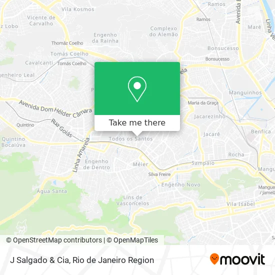
See J Salgado & Cia, Todos Os Santos, on the map
Public Transit to J Salgado & Cia in Todos Os Santos
Wondering how to get to J Salgado & Cia in Todos Os Santos? Moovit helps you find the best way to get to J Salgado & Cia with step-by-step directions from the nearest public transit station.
Moovit provides free maps and live directions to help you navigate through your city. View schedules, routes, timetables, and find out how long does it take to get to J Salgado & Cia in real time.
Looking for the nearest stop or station to J Salgado & Cia? Check out this list of stops closest to your destination: Rua José Bonifácio; Rua Cirne Maia; Rua José Bonifácio; Rua Arquias Cordeiro; Avenida Amaro Cavalcanti; Silva Freire; Méier; Pilares.
Bus: 277, 560L, 623, 627, 650, 688, 692, 456, 544, 254, 543, 638, 946.Metro: L2.Train: RAMAL DEODORO, RAMAL JAPERI, RAMAL SANTA CRUZ, RAMAL BELFORD ROXO.
Want to see if there’s another route that gets you there at an earlier time? Moovit helps you find alternative routes or times. Get directions from and directions to J Salgado & Cia easily from the Moovit App or Website.
We make riding to J Salgado & Cia easy, which is why over 1.5 million users, including users in Todos Os Santos, trust Moovit as the best app for public transit. You don’t need to download an individual bus app or train app, Moovit is your all-in-one transit app that helps you find the best bus time or train time available.
For information on prices of bus, metro and train, costs and ride fares to J Salgado & Cia, please check the Moovit app.
Use the app to navigate to popular places including to the airport, hospital, stadium, grocery store, mall, coffee shop, school, college, and university.
J Salgado & Cia Address: Rua José Bonifácio, 356 Todos os Santos Rio de Janeiro-RJ 20770-240 street in Todos Os Santos
- Feijoada Amigos do Tangerina,
- Pra Voce Shop,
- Rua Jose Bonifacio,
- Danielly Hair,
- Rua José Bonifácio / Travessa Todos os Santos,
- Claudia Penha Crovesy Lourenco,
- Mercearia Mar E Mel,
- Salao de Beleza Angela Aguiar,
- Rua José Bonifácio / Rua Padre Ildefonso Penalba,
- Dr. Renato Redorat [Endocrinologista],
- 402,
- Depósito de Doces Santa Luzia,
- Ely Oliveira Cabelereira,
- Rua Padre Ildefonso Penalba, 498,
- Copiadora Obadias,
- Igreja Evangélica Assembléia De Deus,
- Salao de Cabeleireiro,
- Esporte Clube Valim,
- União Espírita Fernandes Figueira e Bezerra de Menezes,
- Rua José Bonifácio 266
Places Near J Salgado & Cia (Todos Os Santos)
- Rio De Janeiro,
- Shopping RioSul, Botafogo,
- Hospital Pedro Ernesto, Vila Isabel,
- Feirão De Malhas, Duque De Caxias,
- Rodoviária Novo Rio (Rodoviária do Rio de Janeiro), Santo Cristo,
- Shopping Nova América, Del Castilho,
- Hospital Municipal Ronaldo Gazolla, Acari,
- Niterói, Niterói,
- Shopping Downtown, Barra Da Tijuca,
- Avenida Venezuela 134, Saúde,
- Rua Ulysses Guimarães 16, Cidade Nova,
- Praia do Arpoador, Ipanema,
- Museu Do Amanhã, Centro,
- Shopping Rio Sul, Botafogo,
- Hospital Federal Cardoso Fontes, Jacarepaguá,
- Rua Licínio Cardoso, São Francisco Xavier,
- Norte Shopping, Cachambi,
- Avenida Rio Branco, Centro,
- Hospital Federal Do Andaraí, Andaraí,
- Feira Livre da Gloria, Glória
How to get to popular places in Rio de Janeiro Region with public transit
Get around Todos Os Santos by public transit!
Traveling around Todos Os Santos has never been so easy. See step by step directions as you travel to any attraction, street or major public transit station. View bus and train schedules, arrival times, service alerts and detailed routes on a map, so you know exactly how to get to anywhere in Todos Os Santos.
When traveling to any destination around Todos Os Santos use Moovit's Live Directions with Get Off Notifications to know exactly where and how far to walk, how long to wait for your line, and how many stops are left. Moovit will alert you when it's time to get off — no need to constantly re-check whether yours is the next stop.
Wondering how to use public transit in Todos Os Santos or how to pay for public transit in Todos Os Santos? Moovit public transit app can help you navigate your way with public transit easily, and at minimum cost. It includes public transit fees, ticket prices, and costs. Looking for a map of Todos Os Santos public transit lines? Moovit public transit app shows all public transit maps in Todos Os Santos with all Bus, Train, Metro, Light Rail, Ferry, Cable Car, Gondola and Funicular routes and stops on an interactive map.
Rio de Janeiro Region has 8 transit type(s), including: Bus, Train, Metro, Light Rail, Ferry, Cable Car, Gondola and Funicular, operated by several transit agencies, including TrensRJ, Metrô Rio, VLT Carioca, Barcas Rio, BRT MOBI-Rio, Auto Viação Alpha, Auto Viação Tijuca, Gire Transportes, Transurb, Viação Nossa Senhora das Graças, Consórcio INTERSUL, Braso Lisboa (Municipal), Caprichosa Auto Ônibus, Auto Viação Três Amigos and Rodoviária Âncora Matias