How to get to Jac Land & Tree by bus?
Click on the bus route to see step by step directions with maps, line arrival times and updated time schedules.
Bus stop near Jac Land & Tree in Hyde Park, Ny
- Route 9 & Cr 41 (West Market Street), 2 min walk,VIEW
Bus lines to Jac Land & Tree in Hyde Park, Ny
- C, Eastbound,VIEW
What are the closest stations to Jac Land & Tree?
The closest stations to Jac Land & Tree are:
- Route 9 & Cr 41 (West Market Street) is 145 yards away, 2 min walk.
Which bus lines stop near Jac Land & Tree?
These bus lines stop near Jac Land & Tree: C, J.
What’s the nearest bus station to Jac Land & Tree in Hyde Park, Ny?
The nearest bus station to Jac Land & Tree in Hyde Park, Ny is Route 9 & Cr 41 (West Market Street). It’s a 2 min walk away.
What time is the first bus to Jac Land & Tree in Hyde Park, Ny?
The C is the first bus that goes to Jac Land & Tree in Hyde Park, Ny. It stops nearby at 5:54 AM.
What time is the last bus to Jac Land & Tree in Hyde Park, Ny?
The C is the last bus that goes to Jac Land & Tree in Hyde Park, Ny. It stops nearby at 10:43 PM.
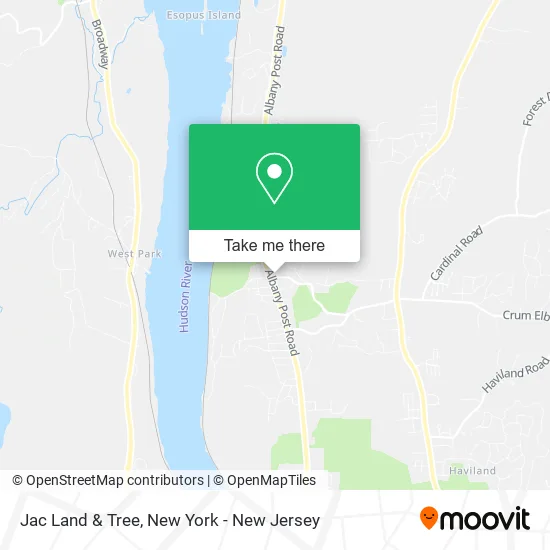
See Jac Land & Tree, Hyde Park, Ny, on the map
Public Transit to Jac Land & Tree in Hyde Park, Ny
Wondering how to get to Jac Land & Tree in Hyde Park, Ny? Moovit helps you find the best way to get to Jac Land & Tree with step-by-step directions from the nearest public transit station.
Moovit provides free maps and live directions to help you navigate through your city. View schedules, routes, timetables, and find out how long does it take to get to Jac Land & Tree in real time.
Looking for the nearest stop or station to Jac Land & Tree? Check out this list of stops closest to your destination: Route 9 & Cr 41 (West Market Street).
Bus: C, J.
Want to see if there’s another route that gets you there at an earlier time? Moovit helps you find alternative routes or times. Get directions from and directions to Jac Land & Tree easily from the Moovit App or Website.
We make riding to Jac Land & Tree easy, which is why over 1.5 million users, including users in Hyde Park, Ny, trust Moovit as the best app for public transit. You don’t need to download an individual bus app or train app, Moovit is your all-in-one transit app that helps you find the best bus time or train time available.
For information on prices of bus and train, costs and ride fares to Jac Land & Tree, please check the Moovit app.
Use the app to navigate to popular places including to the airport, hospital, stadium, grocery store, mall, coffee shop, school, college, and university.
Jac Land & Tree Address: E Market St Hyde Park, NY 12538 street in Hyde Park, Ny
- Post Office,
- Pacific Wrecks,
- Hudson Valley Council,
- Hudson Valley Arborists,
- Farmers Market in Hyde Park,
- Community Innovations,
- Plattekill Historical Society,
- Wappingers Historical Society,
- Jewish Federation of Hunterdon, Somerset,
- Margaret Doner,
- Hudson Valley,
- Powerhouse Gym East Fishkill,
- The Art of Skin- Tania Cohen DMSC, Pa-C,
- Hyde Park Food Pantry of Dutchess County,
- Abilities First Inc,
- Gabler Robert J,
- Vanderbilt Gardens,
- Salon 52 by Chelsea Harris,
- Eleanor Roosevelt National Historic Site,
- Q29
Places Near Jac Land & Tree (Hyde Park, Ny)
- 1 Police Plaza, Manhattan,
- 111 Centre New York City Supreme Court, Manhattan,
- 3 Stone St, Manhattan,
- Wall Street, Manhattan,
- Bellevue Hospital, Manhattan,
- Katz's Deli, Manhattan,
- Rockefeller Center, Manhattan,
- Times Square, Manhattan,
- 911 Memorial, Manhattan,
- SoHo, Manhattan,
- 376 Hudson Street, Manhattan,
- 26 Federal Plaza, Manhattan,
- 66 John Street, Manhattan,
- Pier 83, Manhattan,
- qqqq, Manhattan,
- Mountainside Hospital, Glen Ridge,
- Hudson Yards, Manhattan,
- Chinatown, Manhattan,
- San Gennaro Feast, Manhattan,
- Queens Center Mall, Queens
How to get to popular places in New York - New Jersey with public transit
Get around Hyde Park, Ny by public transit!
Traveling around Hyde Park, Ny has never been so easy. See step by step directions as you travel to any attraction, street or major public transit station. View bus and train schedules, arrival times, service alerts and detailed routes on a map, so you know exactly how to get to anywhere in Hyde Park, Ny.
When traveling to any destination around Hyde Park, Ny use Moovit's Live Directions with Get Off Notifications to know exactly where and how far to walk, how long to wait for your line, and how many stops are left. Moovit will alert you when it's time to get off — no need to constantly re-check whether yours is the next stop.
Wondering how to use public transit in Hyde Park, Ny or how to pay for public transit in Hyde Park, Ny? Moovit public transit app can help you navigate your way with public transit easily, and at minimum cost. It includes public transit fees, ticket prices, and costs. Looking for a map of Hyde Park, Ny public transit lines? Moovit public transit app shows all public transit maps in Hyde Park, Ny with all Bus, Train, Subway, Light Rail, Ferry and Cable Car routes and stops on an interactive map.
New York - New Jersey has 6 transit type(s), including: Bus, Train, Subway, Light Rail, Ferry and Cable Car, operated by several transit agencies, including MTA Subway, Metro-North Railroad, LIRR, PATH, MTA New York City Transit - Express routes, MTA Bus, NJ Transit, NYC Ferry, NICE bus, Bee-Line Bus, NJ Transit Rail, Norwalk Transit District, Hartford Line, River Valley Transit and HART