Directions to Jair Lanches Valqueire (Oswaldo Cruz) with public transportation
The following transit lines have routes that pass near Jair Lanches Valqueire
 Bus: 383, 624, 794, SV 383, 363.
- Train: RAMAL DEODORO, RAMAL SANTA CRUZ, RAMAL JAPERI, RAMAL BELFORD ROXO.
How to get to Jair Lanches Valqueire by bus?
Click on the bus route to see step by step directions with maps, line arrival times and updated time schedules.
From Avenida Doutor Manoel Teles, Duque De Caxias
61 minFrom Rua Sérgio Buarque de Holanda, Jacarepaguá
44 minFrom Rua Araguaia, Freguesia (Jacarepaguá)
44 minFrom Avenida José Wilker, Jacarepaguá
45 minFrom Estrada General Americano Freire, Realengo
38 minFrom BRT - Estação Boiuna, Taquara
25 minFrom Estrada do Pau-Ferro, Freguesia (Jacarepaguá)
43 minFrom Logistica Jm 2002 Transportadora, São João De Meriti
61 minFrom BRT - Estação Asa Branca, Jacarepaguá
38 minFrom Gardênia Azul, Gardênia Azul
42 min
How to get to Jair Lanches Valqueire by train?
Click on the train route to see step by step directions with maps, line arrival times and updated time schedules.
Bus stops near Jair Lanches Valqueire in Oswaldo Cruz
Train stations near Jair Lanches Valqueire in Oswaldo Cruz
Bus lines to Jair Lanches Valqueire in Oswaldo Cruz
- 363, Vila Valqueire - Candelária (Brs 5 - Via Dias da Cruz),VIEW
- SN 363, Vila Valqueire - Candelária (Brs 5 - Via Dias da Cruz),VIEW
- SR 363, Vila Valqueire - Candelária (Brs 5 - Expresso - Via Radial Oeste),VIEW
- 383, Realengo - Praça da República (Brs 5),VIEW
- SN 383, Realengo - Praça da República (BRS 5 - Noturno),VIEW
- SV 391, Padre Miguel - Praça da República (Brs 5 - Via Sulacap / Méier),VIEW
- 624, Mariópolis - Praça da Bandeira (Via Norte Shopping),VIEW
- SN 624, Mariópolis - Praça da República (Via Norte Shopping),VIEW
- SV 624, Mariópolis - Praça da Bandeira (Via Guadalupe),VIEW
- 745, Bangu - Cascadura (Via Campo dos Afonsos),VIEW
- 746, Jabour - Cascadura (Via Brt Sulacap),VIEW
- 794, Bangu - Cascadura (Via Jardim Novo),VIEW
- SN 794, Jabour - Cascadura (Via Jardim Novo),VIEW
- 2345, Valqueire - Castelo (Brs 5 - Via Norte Shopping),VIEW
- 917, Bonsucesso,VIEW
- 678, Méier,VIEW
What are the closest stations to Jair Lanches Valqueire?
The closest stations to Jair Lanches Valqueire are:
- Estrada Intendente Magalhães, 566 is 78 meters away, 2 min walk.
- Estrada Intendente Magalhães, 678 is 159 meters away, 3 min walk.
- Rua Quiririm, 90 is 293 meters away, 4 min walk.
- Prefeito Bento Ribeiro is 1528 meters away, 20 min walk.
- Mercadão De Madureira is 2287 meters away, 30 min walk.
Which bus lines stop near Jair Lanches Valqueire?
These bus lines stop near Jair Lanches Valqueire: 383, 624, 794, SV 383.
Which train lines stop near Jair Lanches Valqueire?
These train lines stop near Jair Lanches Valqueire: RAMAL DEODORO, RAMAL SANTA CRUZ.
What’s the nearest train station to Jair Lanches Valqueire in Oswaldo Cruz?
The nearest train station to Jair Lanches Valqueire in Oswaldo Cruz is Prefeito Bento Ribeiro. It’s a 20 min walk away.
What’s the nearest bus station to Jair Lanches Valqueire in Oswaldo Cruz?
The nearest bus station to Jair Lanches Valqueire in Oswaldo Cruz is Estrada Intendente Magalhães, 566. It’s a 2 min walk away.
What time is the first train to Jair Lanches Valqueire in Oswaldo Cruz?
The RAMAL DEODORO is the first train that goes to Jair Lanches Valqueire in Oswaldo Cruz. It stops nearby at 4:33 AM.
What time is the last train to Jair Lanches Valqueire in Oswaldo Cruz?
The RAMAL SANTA CRUZ is the last train that goes to Jair Lanches Valqueire in Oswaldo Cruz. It stops nearby at 11:31 PM.
What time is the first bus to Jair Lanches Valqueire in Oswaldo Cruz?
The 746 is the first bus that goes to Jair Lanches Valqueire in Oswaldo Cruz. It stops nearby at 3:07 AM.
What time is the last bus to Jair Lanches Valqueire in Oswaldo Cruz?
The SN 794 is the last bus that goes to Jair Lanches Valqueire in Oswaldo Cruz. It stops nearby at 3:18 AM.
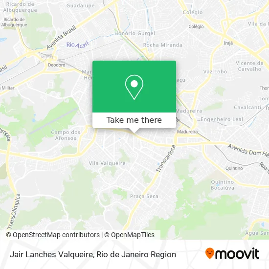
See Jair Lanches Valqueire, Oswaldo Cruz, on the map
Public Transit to Jair Lanches Valqueire in Oswaldo Cruz
Wondering how to get to Jair Lanches Valqueire in Oswaldo Cruz? Moovit helps you find the best way to get to Jair Lanches Valqueire with step-by-step directions from the nearest public transit station.
Moovit provides free maps and live directions to help you navigate through your city. View schedules, routes, timetables, and find out how long does it take to get to Jair Lanches Valqueire in real time.
Looking for the nearest stop or station to Jair Lanches Valqueire? Check out this list of stops closest to your destination: Estrada Intendente Magalhães; Estrada Intendente Magalhães; Rua Quiririm; Prefeito Bento Ribeiro; Mercadão De Madureira.
Bus: 383, 624, 794, SV 383, 363, SN 363, SR 363, SN 383, 917, 678.Train: RAMAL DEODORO, RAMAL SANTA CRUZ, RAMAL JAPERI, RAMAL BELFORD ROXO.
Want to see if there’s another route that gets you there at an earlier time? Moovit helps you find alternative routes or times. Get directions from and directions to Jair Lanches Valqueire easily from the Moovit App or Website.
We make riding to Jair Lanches Valqueire easy, which is why over 1.5 million users, including users in Oswaldo Cruz, trust Moovit as the best app for public transit. You don’t need to download an individual bus app or train app, Moovit is your all-in-one transit app that helps you find the best bus time or train time available.
For information on prices of bus and train, costs and ride fares to Jair Lanches Valqueire, please check the Moovit app.
Use the app to navigate to popular places including to the airport, hospital, stadium, grocery store, mall, coffee shop, school, college, and university.
Jair Lanches Valqueire Address: Estr. Int. Magalhães, 1528-1612 street in Oswaldo Cruz
- Espetto Carioca,
- Esperto Carioca Valqueire,
- Estrada Henrique de Melo / Estrada Intendente Magalhães,
- Rua Anália Franco / Estrada Intendente Magalhães,
- Transportes Barra,
- Thiago Pedras Decorativas,
- henrique de melo,
- Estrada Intendente Magalhães Próximo ao 586-588,
- Movida,
- Supermercados Guanabara,
- Estrada Intendente Magalhães,
- Movida Rent a Car,
- Rua Anália Franco 150,
- Campo do Muralha,
- Transportes Barra,
- Body Coach Club - Valqueire,
- Pro-Fisio Centro de Fisioterapia,
- Colégio Pentágono,
- Pentágono (Colégio Pentágono),
- Hotel Shelton
Places Near Jair Lanches Valqueire (Oswaldo Cruz)
- Norte Shopping, Cachambi,
- Hospital Federal Cardoso Fontes, Jacarepaguá,
- Hospital Municipal Ronaldo Gazolla, Acari,
- Shopping Downtown, Barra Da Tijuca,
- Feira Livre da Gloria, Glória,
- Rua Ulysses Guimarães 16, Cidade Nova,
- Hospital Pedro Ernesto, Vila Isabel,
- Museu Do Amanhã, Centro,
- Shopping RioSul, Botafogo,
- Rio De Janeiro,
- Rodoviária Novo Rio (Rodoviária do Rio de Janeiro), Santo Cristo,
- Niterói, Niterói,
- Shopping Rio Sul, Botafogo,
- Praia do Arpoador, Ipanema,
- Feirão De Malhas, Duque De Caxias,
- Shopping Nova América, Del Castilho,
- Rua Licínio Cardoso, São Francisco Xavier,
- Avenida Rio Branco, Centro,
- Hospital Federal Do Andaraí, Andaraí,
- Avenida Venezuela 134, Saúde
How to get to popular places in Rio de Janeiro Region with public transit
Get around Oswaldo Cruz by public transit!
Traveling around Oswaldo Cruz has never been so easy. See step by step directions as you travel to any attraction, street or major public transit station. View bus and train schedules, arrival times, service alerts and detailed routes on a map, so you know exactly how to get to anywhere in Oswaldo Cruz.
When traveling to any destination around Oswaldo Cruz use Moovit's Live Directions with Get Off Notifications to know exactly where and how far to walk, how long to wait for your line, and how many stops are left. Moovit will alert you when it's time to get off — no need to constantly re-check whether yours is the next stop.
Wondering how to use public transit in Oswaldo Cruz or how to pay for public transit in Oswaldo Cruz? Moovit public transit app can help you navigate your way with public transit easily, and at minimum cost. It includes public transit fees, ticket prices, and costs. Looking for a map of Oswaldo Cruz public transit lines? Moovit public transit app shows all public transit maps in Oswaldo Cruz with all Bus, Train, Metro, Light Rail, Ferry, Cable Car, Gondola and Funicular routes and stops on an interactive map.
Rio de Janeiro Region has 8 transit type(s), including: Bus, Train, Metro, Light Rail, Ferry, Cable Car, Gondola and Funicular, operated by several transit agencies, including TrensRJ, Metrô Rio, VLT Carioca, Barcas Rio, BRT MOBI-Rio, Auto Viação Alpha, Auto Viação Tijuca, Gire Transportes, Transurb, Viação Nossa Senhora das Graças, Consórcio INTERSUL, Braso Lisboa (Municipal), Caprichosa Auto Ônibus, Auto Viação Três Amigos and Rodoviária Âncora Matias