Directions to Jamba (Anne Arundel County) with public transportation
The following transit lines have routes that pass near Jamba
 Bus: 75, SHUTTLE, SHUTTLE, SHUTTLE, SHUTTLE.
- Train: NORTHEAST REGIONAL, ACELA, CAROLINIAN, CRESCENT, PALMETTO.
- Light Rail: LIGHT RAILLINK.
How to get to Jamba by bus?
Click on the bus route to see step by step directions with maps, line arrival times and updated time schedules.
From Elkridge, MD, Howard County
70 minFrom Arundel Mills, Anne Arundel County
45 minFrom Hanover, Baltimore
74 minFrom M&T Bank Stadium, Baltimore
70 minFrom Horseshoe Casino Baltimore, Baltimore
60 minFrom Port of Baltimore - Cruise Maryland Terminal, Baltimore
79 minFrom Topgolf, Baltimore
63 minFrom Baltimore Penn Station, Baltimore
69 minFrom MD Live Casino Arundel Mills, Anne Arundel County
43 minFrom Nick's Fish House, Baltimore
65 min
How to get to Jamba by train?
Click on the train route to see step by step directions with maps, line arrival times and updated time schedules.
Bus stops near Jamba in Anne Arundel County
Light Rail stations near Jamba in Anne Arundel County
- Bwi Business District, 8 min walk,VIEW
Train stations near Jamba in Anne Arundel County
Bus lines to Jamba in Anne Arundel County
- 75, Arundel Mills Shopping Center,VIEW
- SHUTTLE, BWI Daily Parking Garage - Upper Level Terminal - Concourse E,VIEW
- SHUTTLE, BWI Long Term Parking A - Upper Level Terminal - Concourse E,VIEW
- SHUTTLE, Off-Site Parking Pick-Up (Zone 2) - BWI Amtrak/MARC Station,VIEW
- SHUTTLE, BWI Long Term Parking B - Upper Level Terminal - Concourse E,VIEW
- SHUTTLE, BWI Express Parking Lot - Upper Level Terminal - Concourse E,VIEW
- 201, 201/2 Bwi Airport,VIEW
What are the closest stations to Jamba?
The closest stations to Jamba are:
- Bwi Business District Light Rail Station Bay 1 is 647 yards away, 8 min walk.
- Bwi Business District is 650 yards away, 8 min walk.
- Off-Site Parking Pick-Up (Zone 4) is 949 yards away, 12 min walk.
- Bwi International Terminal Eb Upper Level is 949 yards away, 12 min walk.
- Bwi Thurgood Marshall Airport, Md is 2947 yards away, 35 min walk.
- Bwi Rail Station Marc Nb is 2947 yards away, 35 min walk.
Which bus line stops near Jamba?
75 (Patapsco Station)
Which train line stops near Jamba?
NORTHEAST REGIONAL (Springfield)
Which light rail line stops near Jamba?
LIGHT RAILLINK (Soutbound)
What’s the nearest light rail station to Jamba in Anne Arundel County?
The nearest light rail station to Jamba in Anne Arundel County is Bwi Business District. It’s a 8 min walk away.
What’s the nearest bus station to Jamba in Anne Arundel County?
The nearest bus station to Jamba in Anne Arundel County is Bwi Business District Light Rail Station Bay 1. It’s a 8 min walk away.
What time is the first light rail to Jamba in Anne Arundel County?
The LIGHT RAILLINK is the first light rail that goes to Jamba in Anne Arundel County. It stops nearby at 4:37 AM.
What time is the last light rail to Jamba in Anne Arundel County?
The LIGHT RAILLINK is the last light rail that goes to Jamba in Anne Arundel County. It stops nearby at 12:48 AM.
What time is the first train to Jamba in Anne Arundel County?
The ACELA is the first train that goes to Jamba in Anne Arundel County. It stops nearby at 5:21 AM.
What time is the last train to Jamba in Anne Arundel County?
The NORTHEAST REGIONAL is the last train that goes to Jamba in Anne Arundel County. It stops nearby at 10:56 PM.
What time is the first bus to Jamba in Anne Arundel County?
The SHUTTLE is the first bus that goes to Jamba in Anne Arundel County. It stops nearby at 3:05 AM.
What time is the last bus to Jamba in Anne Arundel County?
The SHUTTLE is the last bus that goes to Jamba in Anne Arundel County. It stops nearby at 2:52 AM.
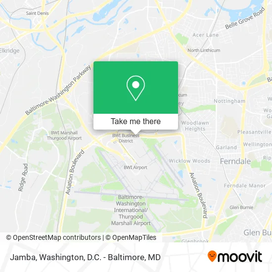
See Jamba, Anne Arundel County, on the map
Public Transit to Jamba in Anne Arundel County
Wondering how to get to Jamba in Anne Arundel County? Moovit helps you find the best way to get to Jamba with step-by-step directions from the nearest public transit station.
Moovit provides free maps and live directions to help you navigate through your city. View schedules, routes, timetables, and find out how long does it take to get to Jamba in real time.
Looking for the nearest stop or station to Jamba? Check out this list of stops closest to your destination: Bwi Business District Light Rail Station Bay 1; Bwi Business District; Off-Site Parking Pick-Up (Zone 4); Bwi International Terminal Eb Upper Level; Bwi Thurgood Marshall Airport; Bwi Rail Station Marc Nb.
Bus: 75, SHUTTLE, SHUTTLE, SHUTTLE, SHUTTLE, SHUTTLE, 201.Train: NORTHEAST REGIONAL, ACELA, CAROLINIAN, CRESCENT, PALMETTO, MARC.Light Rail: LIGHT RAILLINK.
Want to see if there’s another route that gets you there at an earlier time? Moovit helps you find alternative routes or times. Get directions from and directions to Jamba easily from the Moovit App or Website.
We make riding to Jamba easy, which is why over 1.5 million users, including users in Anne Arundel County, trust Moovit as the best app for public transit. You don’t need to download an individual bus app or train app, Moovit is your all-in-one transit app that helps you find the best bus time or train time available.
For information on prices of bus, light rail and train, costs and ride fares to Jamba, please check the Moovit app.
Use the app to navigate to popular places including to the airport, hospital, stadium, grocery store, mall, coffee shop, school, college, and university.
Jamba Address: Airport Loop BWI Airport, MD 21240 street in Anne Arundel County
- Southwest Airlines People Department,
- Quantem Aviation,
- Goosehead Insurance - Aaron Owens,
- Shell Recharge,
- BWI Cargo-North Cargo Complex,
- DHL Express Servicepoint,
- DHL,
- Ups,
- BWI-Employee Parking,
- USPS Collection Box - Express,
- BWI Employee Shuttle,
- New BWI Employee Parking Lot,
- Delta Air Lines,
- BWI Airport & Light Rail Station,
- Vera Bradley,
- Light Rail-BWI Business District,
- Pandora,
- BWI Daily Gara,
- NY Halal Food,
- Chick-fil-A
Places Near Jamba (Anne Arundel County)
- Westfield Montgomery Mall, Montgomery County,
- Amazon Hq2, Arlington County,
- Basilica of the National Shrine, Washington,
- National Theatre, Washington,
- Washington National Cathedral, Washington,
- M&T Bank Stadium, Baltimore,
- Marriott Marquis Washington, DC, Washington,
- National Zoo, Washington,
- Georgetown, Washington,
- The Anthem, Washington,
- Rock Creek Tennis Center, Washington,
- PG Mall, Prince George's County,
- Pennsylvania Ave NW (3rd st and pennsylvania), Washington,
- Warner Theatre, Washington,
- National Museum of African American History and Culture, Washington,
- Museum Of The Bible, Washington,
- Camden Yards, Baltimore,
- Washington DC VA Medical Center, Washington,
- Capital One Arena, Washington,
- Sibley Memorial Hospital, Washington
How to get to popular places in Washington, D.C. - Baltimore, MD with public transit
Get around Anne Arundel County by public transit!
Traveling around Anne Arundel County has never been so easy. See step by step directions as you travel to any attraction, street or major public transit station. View bus and train schedules, arrival times, service alerts and detailed routes on a map, so you know exactly how to get to anywhere in Anne Arundel County.
When traveling to any destination around Anne Arundel County use Moovit's Live Directions with Get Off Notifications to know exactly where and how far to walk, how long to wait for your line, and how many stops are left. Moovit will alert you when it's time to get off — no need to constantly re-check whether yours is the next stop.
Wondering how to use public transit in Anne Arundel County or how to pay for public transit in Anne Arundel County? Moovit public transit app can help you navigate your way with public transit easily, and at minimum cost. It includes public transit fees, ticket prices, and costs. Looking for a map of Anne Arundel County public transit lines? Moovit public transit app shows all public transit maps in Anne Arundel County with all Bus, Train, Metro, Light Rail and Ferry routes and stops on an interactive map.
Washington, D.C. - Baltimore, MD has 5 transit type(s), including: Bus, Train, Metro, Light Rail and Ferry, operated by several transit agencies, including WMATA, Montgomery County Ride On, Fairfax Connector, TheBus, PRTC, DASH - Alexandria, Arlington Transit (ART), RTA of Central Maryland, MDOT MTA, MDOT MTA Light RailLink, MDOT MTA Commuter Bus, MDOT MTA Local Bus, FXBGO!, Virginia Railway Express (VRE) and MARC
Public transit lines with stations closest to Jamba in Anne Arundel County
Train lines with stations closest to Jamba in Anne Arundel County
Bus lines with stations closest to Jamba in Anne Arundel County
Off-Site Parking Pick-Up (Zone 4)
- SHUTTLEBWI Daily Parking Garage - Upper Level Terminal - Concourse E
- SHUTTLEBWI Long Term Parking A - Upper Level Terminal - Concourse E
- SHUTTLEOff-Site Parking Pick-Up (Zone 2) - BWI Amtrak/MARC Station
- SHUTTLEBWI Long Term Parking B - Upper Level Terminal - Concourse E
- SHUTTLEBWI Express Parking Lot - Upper Level Terminal - Concourse E