How to get to Jan Holmsgaard A/S by bus?
Click on the bus route to see step by step directions with maps, line arrival times and updated time schedules.
Bus stops near Jan Holmsgaard A/S in Frederikshavn
Bus lines to Jan Holmsgaard A/S in Frederikshavn
What are the closest stations to Jan Holmsgaard A/S?
The closest stations to Jan Holmsgaard A/S are:
- Hedebo (Frederikshavnsvej / Sæby) is 520 meters away, 7 min walk.
- Sæby Nord (Viking / Frederikshavnsvej / Sæby) is 1254 meters away, 17 min walk.
Which bus lines stop near Jan Holmsgaard A/S?
These bus lines stop near Jan Holmsgaard A/S: 273, 73, 973X.
What’s the nearest bus station to Jan Holmsgaard A/S in Frederikshavn?
The nearest bus station to Jan Holmsgaard A/S in Frederikshavn is Hedebo (Frederikshavnsvej / Sæby). It’s a 7 min walk away.
What time is the first bus to Jan Holmsgaard A/S in Frederikshavn?
The 73N is the first bus that goes to Jan Holmsgaard A/S in Frederikshavn. It stops nearby at 4:42 AM.
What time is the last bus to Jan Holmsgaard A/S in Frederikshavn?
The 73 is the last bus that goes to Jan Holmsgaard A/S in Frederikshavn. It stops nearby at 11:11 PM.
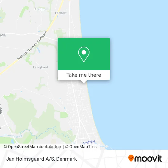
See Jan Holmsgaard A/S, Frederikshavn, on the map
Public Transit to Jan Holmsgaard A/S in Frederikshavn
Wondering how to get to Jan Holmsgaard A/S in Frederikshavn? Moovit helps you find the best way to get to Jan Holmsgaard A/S with step-by-step directions from the nearest public transit station.
Moovit provides free maps and live directions to help you navigate through your city. View schedules, routes, timetables, and find out how long does it take to get to Jan Holmsgaard A/S in real time.
Looking for the nearest stop or station to Jan Holmsgaard A/S? Check out this list of stops closest to your destination: Hedebo (Frederikshavnsvej / Sæby); Sæby Nord (Viking / Frederikshavnsvej / Sæby).
Bus: 273, 73, 973X, 73N, 404.
Want to see if there’s another route that gets you there at an earlier time? Moovit helps you find alternative routes or times. Get directions from and directions to Jan Holmsgaard A/S easily from the Moovit App or Website.
We make riding to Jan Holmsgaard A/S easy, which is why over 1.5 million users, including users in Frederikshavn, trust Moovit as the best app for public transit. You don’t need to download an individual bus app or train app, Moovit is your all-in-one transit app that helps you find the best bus time or train time available.
For information on prices of bus and train, costs and ride fares to Jan Holmsgaard A/S, please check the Moovit app.
Use the app to navigate to popular places including to the airport, hospital, stadium, grocery store, mall, coffee shop, school, college, and university.
Jan Holmsgaard A/S Address: Strandkanten 101 9300 Sæby street in Frederikshavn
- Svalereden Camp,
- Hedebo Strand Camping, Plads 134,
- Abildgård Kirkes Menighedsråd,
- Nordic Fliser Aps,
- Holiday Home Strandgården,
- Hedebo Strand Camping,
- Hedebo Strand Camping,
- Hedebo Strand Super i,
- Hedebo Strand Camping Holding Aps,
- Wild'n Wet Adventure V / Bruno Bülov,
- Andelsboligforeningen Skrænten,
- Oluf Krags Vej (Boelsmindevej / Sæby),
- Inges Blomster,
- Hotel Viking Aqua Spa & Wellness Resort,
- Holiday Home Haulundsvej Sæby IX,
- Sakura Sushi Aps,
- Svalerede Campi,
- M J Teknik V/Michael Jakobsen,
- Svalereden Camping Og Hytteby,
- Anne Dortes Private Pasningsordning
Places Near Jan Holmsgaard A/S (Frederikshavn)
- Fisketorvet, København,
- Field's, København,
- Bispebjerg Hospital, København,
- Aalborg Universitetshospital, Aalborg,
- Ikea, Århus,
- Reffen, København,
- Royal Arena, København,
- Eventyrpigerne, Sorø,
- Refshaleøen, København,
- Nyhavn, København,
- Carlsberg Byen, København,
- Valbyparken, København,
- Seduction Girls, Rødovre,
- Dr Koncerthuset, København,
- Grundtvigs Kirke, København,
- Christiania, København,
- Rigshospitalet, København,
- Bella Center, København,
- Marmorkirken, København,
- Operaen, København
How to get to popular places in Denmark with public transit
Get around Frederikshavn by public transit!
Traveling around Frederikshavn has never been so easy. See step by step directions as you travel to any attraction, street or major public transit station. View bus and train schedules, arrival times, service alerts and detailed routes on a map, so you know exactly how to get to anywhere in Frederikshavn.
When traveling to any destination around Frederikshavn use Moovit's Live Directions with Get Off Notifications to know exactly where and how far to walk, how long to wait for your line, and how many stops are left. Moovit will alert you when it's time to get off — no need to constantly re-check whether yours is the next stop.
Wondering how to use public transit in Frederikshavn or how to pay for public transit in Frederikshavn? Moovit public transit app can help you navigate your way with public transit easily, and at minimum cost. It includes public transit fees, ticket prices, and costs. Looking for a map of Frederikshavn public transit lines? Moovit public transit app shows all public transit maps in Frederikshavn with all Bus, Train, Metro, Light Rail and Ferry routes and stops on an interactive map.
Denmark has 5 transit type(s), including: Bus, Train, Metro, Light Rail and Ferry, operated by several transit agencies, including Metroselskabet, DSB S-tog, Lokaltog A/S, Midttrafik, Odense Letbane, DSB, NT, GoCollective, Skånetrafiken, Movia, FYNBUS, Sydtrafik, Bornholms Trafik, Citybus and Ærø Kommune