How to get to Java Works Café @ Tisch by bus?
Click on the bus route to see step by step directions with maps, line arrival times and updated time schedules.
How to get to Java Works Café @ Tisch by train?
Click on the train route to see step by step directions with maps, line arrival times and updated time schedules.
How to get to Java Works Café @ Tisch by subway?
Click on the subway route to see step by step directions with maps, line arrival times and updated time schedules.
Bus stops near Java Works Café @ Tisch in Manhattan
Subway stations near Java Works Café @ Tisch in Manhattan
Bus lines to Java Works Café @ Tisch in Manhattan
- DOWNTOWN LOCAL, W Houston & Mercer St,VIEW
- X27, Bay Ridge Shore Rd Via Broadway,VIEW
- X28, Coney Island Sea Gate Via Broadway,VIEW
- SIM1C, Eltngvlle Trans Ctr Via Hylan Via Rich,VIEW
- SIM3C, Pt Rchmnd Via Narrows Rd N Via Watchogue,VIEW
- SIM4C, Huguenot Via Richmond Av Via Arthur Kill,VIEW
- M1, Soho Centre St Via 5 Av/ Via Broadway,VIEW
- M55, South Ferry,VIEW
- SIM7, Eltvlle Trans Ctr Via Hylan Via Richmond,VIEW
- SIM9, Eltingville Via F Cap Via Hylan Bl,VIEW
- SIM33, Mariners Harbor Via N Gannon Av,VIEW
- SIM33C, Mariners Harbor Via N Gannon Av,VIEW
- M2, Washington Heights - East Village,VIEW
- M3, Fort George - East Village,VIEW
- M8, West Village - East Village,VIEW
- SHORTLINE HUDSON, 500 - Monroe - Chester - Goshen,VIEW
- SHORTLINE HUDSON, 200 - Northern District – Nanuet,VIEW
- SHORTLINE HUDSON, 800 - Pennsylvania,VIEW
- SHORTLINE HUDSON, 700 - Newburgh - Poughkeepsie,VIEW
- SHORTLINE HUDSON, 300 - NYC - Middletown,VIEW
What are the closest stations to Java Works Café @ Tisch?
The closest stations to Java Works Café @ Tisch are:
- Broadway & Waverly Pl is 57 yards away, 1 min walk.
- Broadway/Waverly Pl is 73 yards away, 1 min walk.
- 8 St-Nyu is 160 yards away, 2 min walk.
- E 8 St/Mercer St is 178 yards away, 3 min walk.
- Astor Pl is 299 yards away, 4 min walk.
- Broadway & W 3rd St is 300 yards away, 4 min walk.
- Broadway-Lafayette St is 488 yards away, 6 min walk.
- W 4 St-Wash Sq is 704 yards away, 9 min walk.
Which bus lines stop near Java Works Café @ Tisch?
These bus lines stop near Java Works Café @ Tisch: DOWNTOWN LOCAL, M1, X27.
Which train lines stop near Java Works Café @ Tisch?
These train lines stop near Java Works Café @ Tisch: 2, YEL.
Which subway lines stop near Java Works Café @ Tisch?
These subway lines stop near Java Works Café @ Tisch: 6, M, R, W.
What’s the nearest subway station to Java Works Café @ Tisch in Manhattan?
The nearest subway station to Java Works Café @ Tisch in Manhattan is 8 St-Nyu. It’s a 2 min walk away.
What’s the nearest bus station to Java Works Café @ Tisch in Manhattan?
The nearest bus stations to Java Works Café @ Tisch in Manhattan are Broadway & Waverly Pl and Broadway/Waverly Pl. The closest one is a 1 min walk away.
What time is the first subway to Java Works Café @ Tisch in Manhattan?
The E is the first subway that goes to Java Works Café @ Tisch in Manhattan. It stops nearby at 3:03 AM.
What time is the last subway to Java Works Café @ Tisch in Manhattan?
The F is the last subway that goes to Java Works Café @ Tisch in Manhattan. It stops nearby at 3:55 AM.
What time is the first bus to Java Works Café @ Tisch in Manhattan?
The M2 is the first bus that goes to Java Works Café @ Tisch in Manhattan. It stops nearby at 3:00 AM.
What time is the last bus to Java Works Café @ Tisch in Manhattan?
The M2 is the last bus that goes to Java Works Café @ Tisch in Manhattan. It stops nearby at 3:01 AM.
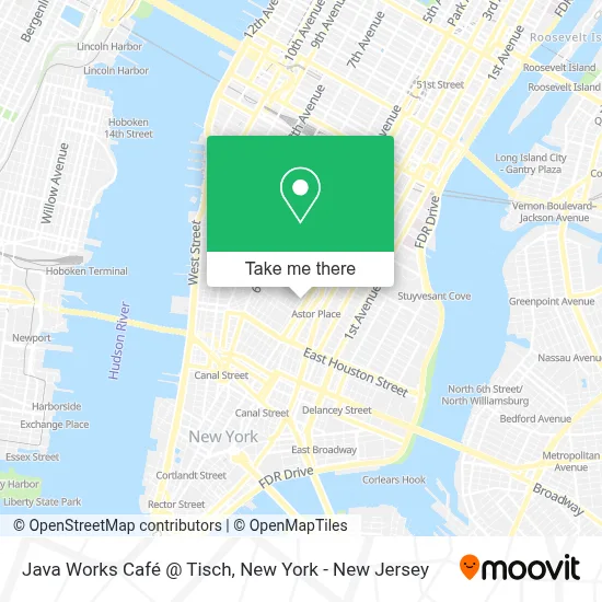
See Java Works Café @ Tisch, Manhattan, on the map
Public Transit to Java Works Café @ Tisch in Manhattan
Wondering how to get to Java Works Café @ Tisch in Manhattan? Moovit helps you find the best way to get to Java Works Café @ Tisch with step-by-step directions from the nearest public transit station.
Moovit provides free maps and live directions to help you navigate through your city. View schedules, routes, timetables, and find out how long does it take to get to Java Works Café @ Tisch in real time.
Looking for the nearest stop or station to Java Works Café @ Tisch? Check out this list of stops closest to your destination: Broadway & Waverly Pl; Broadway/Waverly Pl; 8 St-Nyu; E 8 St/Mercer St; Astor Pl; Broadway & W 3rd St; Broadway-Lafayette St; W 4 St-Wash Sq.
Bus: DOWNTOWN LOCAL, M1, X27, X28.Train: 2, YEL.Subway: 6, M, R, W, N, Q, 4, 6X, B, D, F, FX, A, C, E.
Want to see if there’s another route that gets you there at an earlier time? Moovit helps you find alternative routes or times. Get directions from and directions to Java Works Café @ Tisch easily from the Moovit App or Website.
We make riding to Java Works Café @ Tisch easy, which is why over 1.5 million users, including users in Manhattan, trust Moovit as the best app for public transit. You don’t need to download an individual bus app or train app, Moovit is your all-in-one transit app that helps you find the best bus time or train time available.
For information on prices of subway, bus and train, costs and ride fares to Java Works Café @ Tisch, please check the Moovit app.
Use the app to navigate to popular places including to the airport, hospital, stadium, grocery store, mall, coffee shop, school, college, and university.
Java Works Café @ Tisch Address: 721 Broadway Fl 1 street in Manhattan
- 300 Mercer Georgetown Plaza Apartments,
- Creative Psychotherapy Wise Owl Wellness,
- Nyc Health Psychologist,
- Brad's Nyu,
- 300 Mercer Street,
- Nyc Coach,
- Success Wins Reels,
- Nata Nyc,
- Lazy Sundaes,
- Sushi 295 Mercer,
- Nyu Special Program,
- Nyu Open Arts Program,
- Nyu Department Of Design For Stage and Film,
- Boba Guys,
- NYU Tisch School Of The Arts,
- Nyu Department Of Environmental Studies,
- Sc Physical Therapy & Wellness,
- Tisch School of Arts,
- Super Videos,
- Spinalush
Places Near Java Works Café @ Tisch (Manhattan)
- Mountainside Hospital, Glen Ridge,
- Katz's Deli, Manhattan,
- Hudson Yards, Manhattan,
- 1 Police Plaza, Manhattan,
- 26 Federal Plaza, Manhattan,
- SoHo, Manhattan,
- qqqq, Manhattan,
- 3 Stone St, Manhattan,
- Times Square, Manhattan,
- 111 Centre New York City Supreme Court, Manhattan,
- Bellevue Hospital, Manhattan,
- Pier 83, Manhattan,
- San Gennaro Feast, Manhattan,
- Chinatown, Manhattan,
- Wall Street, Manhattan,
- Rockefeller Center, Manhattan,
- 66 John Street, Manhattan,
- Queens Center Mall, Queens,
- 911 Memorial, Manhattan,
- 376 Hudson Street, Manhattan
How to get to popular places in New York - New Jersey with public transit
Get around Manhattan by public transit!
Traveling around Manhattan has never been so easy. See step by step directions as you travel to any attraction, street or major public transit station. View bus and train schedules, arrival times, service alerts and detailed routes on a map, so you know exactly how to get to anywhere in Manhattan.
When traveling to any destination around Manhattan use Moovit's Live Directions with Get Off Notifications to know exactly where and how far to walk, how long to wait for your line, and how many stops are left. Moovit will alert you when it's time to get off — no need to constantly re-check whether yours is the next stop.
Wondering how to use public transit in Manhattan or how to pay for public transit in Manhattan? Moovit public transit app can help you navigate your way with public transit easily, and at minimum cost. It includes public transit fees, ticket prices, and costs. Looking for a map of Manhattan public transit lines? Moovit public transit app shows all public transit maps in Manhattan with all Bus, Train, Subway, Light Rail, Ferry and Cable Car routes and stops on an interactive map.
New York - New Jersey has 6 transit type(s), including: Bus, Train, Subway, Light Rail, Ferry and Cable Car, operated by several transit agencies, including MTA Subway, Metro-North Railroad, LIRR, PATH, MTA New York City Transit - Express routes, MTA Bus, NJ Transit, NYC Ferry, NICE bus, Bee-Line Bus, NJ Transit Rail, Norwalk Transit District, Hartford Line, River Valley Transit and HART