How to get to Jay Shri Ram Complex by bus?
Click on the bus route to see step by step directions with maps, line arrival times and updated time schedules.
From Sant Tukaram Maharaj Mandir, Pune & Velhe
81 minFrom Mahindra Chakan, Rajgurunagar
59 minFrom Alandi, Rajgurunagar
55 minFrom Mit Alandi Campus, Pune & Velhe
55 minFrom Dudulgaon, Pune & Velhe
58 minFrom Nimgaon Khandoba Temple, Rajgurunagar
110 minFrom Amazon-PNQ3, Rajgurunagar
31 minFrom Nighoje, Pune & Velhe
60 minFrom Capgemini, Pune & Velhe
73 minFrom Shri Gajanan Maharaj Sansthan Bhakta Niwas, Pune & Velhe
64 min
Bus stop near Jay Shri Ram Complex in Rajgurunagar
- Davadmala Ambethan Road, 8 min walk,VIEW
Bus lines to Jay Shri Ram Complex in Rajgurunagar
- 358A, Bhosari,VIEW
What are the closest stations to Jay Shri Ram Complex?
The closest stations to Jay Shri Ram Complex are:
- Davadmala Ambethan Road is 575 meters away, 8 min walk.
Which bus lines stop near Jay Shri Ram Complex?
These bus lines stop near Jay Shri Ram Complex: 314, 329, 358A, 364, 370.
What’s the nearest bus station to Jay Shri Ram Complex in Rajgurunagar?
The nearest bus station to Jay Shri Ram Complex in Rajgurunagar is Davadmala Ambethan Road. It’s a 8 min walk away.
What time is the first bus to Jay Shri Ram Complex in Rajgurunagar?
The 358A is the first bus that goes to Jay Shri Ram Complex in Rajgurunagar. It stops nearby at 5:47 AM.
What time is the last bus to Jay Shri Ram Complex in Rajgurunagar?
The 358A is the last bus that goes to Jay Shri Ram Complex in Rajgurunagar. It stops nearby at 11:13 PM.
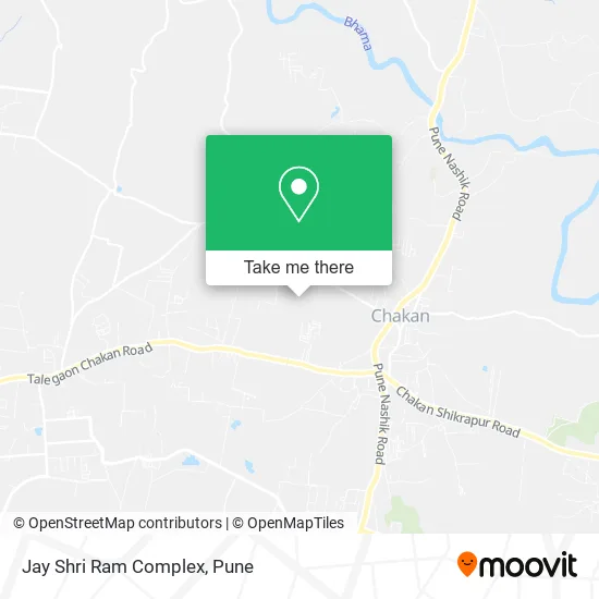
See Jay Shri Ram Complex, Rajgurunagar, on the map
Public Transit to Jay Shri Ram Complex in Rajgurunagar
Wondering how to get to Jay Shri Ram Complex in Rajgurunagar? Moovit helps you find the best way to get to Jay Shri Ram Complex with step-by-step directions from the nearest public transit station.
Moovit provides free maps and live directions to help you navigate through your city. View schedules, routes, timetables, and find out how long does it take to get to Jay Shri Ram Complex in real time.
Looking for the nearest stop or station to Jay Shri Ram Complex? Check out this list of stops closest to your destination: Davadmala Ambethan Road.
Bus: 314, 329, 358A, 364, 370.
Want to see if there’s another route that gets you there at an earlier time? Moovit helps you find alternative routes or times. Get directions from and directions to Jay Shri Ram Complex easily from the Moovit App or Website.
We make riding to Jay Shri Ram Complex easy, which is why over 1.5 million users, including users in Rajgurunagar, trust Moovit as the best app for public transit. You don’t need to download an individual bus app or train app, Moovit is your all-in-one transit app that helps you find the best bus time or train time available.
For information on prices of bus, costs and ride fares to Jay Shri Ram Complex, please check the Moovit app.
Use the app to navigate to popular places including to the airport, hospital, stadium, grocery store, mall, coffee shop, school, college, and university.
Jay Shri Ram Complex Address: खेड 410501 MH street in Rajgurunagar
- Shri Chakreshwar Prasanna,
- Aditi Herbal Beauty Parlour,
- Aditya Provision Stores,
- Kailash General Store,
- Godara Super Market,
- ZP School Kharabwadi,
- Dashrath Provision Stores,
- Chakan 84 Realty Group,
- Shri Samarth Clinic,
- Leesu Enterprises,
- Kaveri Kirana Stores,
- Jillha Parishad Prathamik Shala,
- Gajanan Khanawala,
- Shri Samarth Medical,
- Rising Star Pre School,
- Vaibhav Provision Stores,
- Nikhil Hardware,
- Sukhkarta Complex,
- Swami Samarth Complex,
- Mufti Ladies Shopping
Places Near Jay Shri Ram Complex (Rajgurunagar)
- Cognizant Deccan Campus (CDC), Paud,
- Tulshibaug, Pune & Velhe,
- Laxmi Road, Pune & Velhe,
- Dagadusheth Halwai Ganapati Temple, Pune & Velhe,
- BAPS Shri Swaminarayan Mandir, Pune & Velhe,
- Dagdusheth Halwai Ganpati Mandir, Pune & Velhe,
- Senapati Bapat Road, Pune & Velhe,
- ISKCON Nvcc Temple, Pune & Velhe,
- Westend Mall, Pune & Velhe,
- Ion Digital Zone, Pune & Velhe,
- Sarasbaug, Pune & Velhe,
- Pune Okayama Friendship Garden, Pune & Velhe,
- Vishwakarma Institute Of Technology (Vit), Pune & Velhe,
- Pvr Icon - Pavilion Mall, Pune & Velhe,
- ISKCON Pune, Pune & Velhe,
- Chaturshringi Temple, Pune & Velhe,
- Symbiosis Lavale Bus Stop, Pune & Velhe,
- M G Road, Pune & Velhe,
- Fc Road, Pune & Velhe,
- Swaminarayan Mandir, Pune & Velhe
How to get to popular places in Pune with public transit
Get around Rajgurunagar by public transit!
Traveling around Rajgurunagar has never been so easy. See step by step directions as you travel to any attraction, street or major public transit station. View bus and train schedules, arrival times, service alerts and detailed routes on a map, so you know exactly how to get to anywhere in Rajgurunagar.
When traveling to any destination around Rajgurunagar use Moovit's Live Directions with Get Off Notifications to know exactly where and how far to walk, how long to wait for your line, and how many stops are left. Moovit will alert you when it's time to get off — no need to constantly re-check whether yours is the next stop.
Wondering how to use public transit in Rajgurunagar or how to pay for public transit in Rajgurunagar? Moovit public transit app can help you navigate your way with public transit easily, and at minimum cost. It includes public transit fees, ticket prices, and costs. Looking for a map of Rajgurunagar public transit lines? Moovit public transit app shows all public transit maps in Rajgurunagar with all Bus, Train and Metro routes and stops on an interactive map.
Pune has 3 transit type(s), including: Bus, Train and Metro, operated by several transit agencies, including Pune Metro (Maha Metro), PMPML, PMPML Night Bus Service (Ratrani) and Central Railways (Indian Railways)