Directions to Jaykumar Thumar, Md (Hartford) with public transportation
The following transit lines have routes that pass near Jaykumar Thumar, Md
How to get to Jaykumar Thumar, Md by bus?
Click on the bus route to see step by step directions with maps, line arrival times and updated time schedules.
How to get to Jaykumar Thumar, Md by train?
Click on the train route to see step by step directions with maps, line arrival times and updated time schedules.
Bus stops near Jaykumar Thumar, Md in Hartford
Train station near Jaykumar Thumar, Md in Hartford
- Hartford Union Station, 29 min walk,VIEW
Bus lines to Jaykumar Thumar, Md in Hartford
- 37, 37 - New Britain Ave-Charter Oak Mktpl,VIEW
- 161, 161 - Hartford Hosp-Sigourney St Sta Via Capitol Ave,VIEW
- 31, 31 - Park St-Charter Oak Mktpl,VIEW
- 33, 33w - Park St-Westfarms,VIEW
- 43, 43 - Campfield Ave-Downtown Hartford,VIEW
- 47, 47 - Franklin Ave-Wolcott Hill P&R,VIEW
- 39, 39w - New Britain Av-Westfarms Mall Via Retreat Ave,VIEW
What are the closest stations to Jaykumar Thumar, Md?
The closest stations to Jaykumar Thumar, Md are:
- Jefferson St @ Seymore St is 69 yards away, 1 min walk.
- Park St @ Seymour St is 346 yards away, 5 min walk.
- Maple Ave @ Retreat Ave is 420 yards away, 6 min walk.
- Retreat Ave @ Maple Ave is 431 yards away, 6 min walk.
- Hartford Union Station is 2400 yards away, 29 min walk.
Which bus lines stop near Jaykumar Thumar, Md?
These bus lines stop near Jaykumar Thumar, Md: 161, FLIXBUS 2610, GREYHOUND US0230, GREYHOUND US0235, GREYHOUND US0255S.
Which train lines stop near Jaykumar Thumar, Md?
These train lines stop near Jaykumar Thumar, Md: AMTRAK HARTFORD LINE, HARTFORD LINE, VALLEY FLYER, VERMONTER.
What’s the nearest train station to Jaykumar Thumar, Md in Hartford?
The nearest train station to Jaykumar Thumar, Md in Hartford is Hartford Union Station. It’s a 29 min walk away.
What’s the nearest bus station to Jaykumar Thumar, Md in Hartford?
The nearest bus station to Jaykumar Thumar, Md in Hartford is Jefferson St @ Seymore St. It’s a 1 min walk away.
What time is the first train to Jaykumar Thumar, Md in Hartford?
The NORTHEAST REGIONAL is the first train that goes to Jaykumar Thumar, Md in Hartford. It stops nearby at 4:51 AM.
What time is the last train to Jaykumar Thumar, Md in Hartford?
The NORTHEAST REGIONAL is the last train that goes to Jaykumar Thumar, Md in Hartford. It stops nearby at 11:59 PM.
What time is the first bus to Jaykumar Thumar, Md in Hartford?
The 31 is the first bus that goes to Jaykumar Thumar, Md in Hartford. It stops nearby at 3:56 AM.
What time is the last bus to Jaykumar Thumar, Md in Hartford?
The 37 is the last bus that goes to Jaykumar Thumar, Md in Hartford. It stops nearby at 1:34 AM.
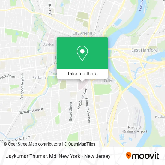
See Jaykumar Thumar, Md, Hartford, on the map
Public Transit to Jaykumar Thumar, Md in Hartford
Wondering how to get to Jaykumar Thumar, Md in Hartford? Moovit helps you find the best way to get to Jaykumar Thumar, Md with step-by-step directions from the nearest public transit station.
Moovit provides free maps and live directions to help you navigate through your city. View schedules, routes, timetables, and find out how long does it take to get to Jaykumar Thumar, Md in real time.
Looking for the nearest stop or station to Jaykumar Thumar, Md? Check out this list of stops closest to your destination: Jefferson St @ Seymore St; Park St @ Seymour St; Maple Ave @ Retreat Ave; Retreat Ave @ Maple Ave; Hartford Union Station.
Bus: 161, FLIXBUS 2610, GREYHOUND US0230, GREYHOUND US0235, GREYHOUND US0255S, 37, 31, 33, 43, 47, 39.Train: AMTRAK HARTFORD LINE, HARTFORD LINE, VALLEY FLYER, VERMONTER, NORTHEAST REGIONAL.
Want to see if there’s another route that gets you there at an earlier time? Moovit helps you find alternative routes or times. Get directions from and directions to Jaykumar Thumar, Md easily from the Moovit App or Website.
We make riding to Jaykumar Thumar, Md easy, which is why over 1.5 million users, including users in Hartford, trust Moovit as the best app for public transit. You don’t need to download an individual bus app or train app, Moovit is your all-in-one transit app that helps you find the best bus time or train time available.
For information on prices of train and bus, costs and ride fares to Jaykumar Thumar, Md, please check the Moovit app.
Use the app to navigate to popular places including to the airport, hospital, stadium, grocery store, mall, coffee shop, school, college, and university.
Jaykumar Thumar, Md Address: 85 Jefferson St Ste 210 street in Hartford
- Lisa Pierce, Aprn,
- Jennifer Bell, Md,
- Green Valley 52,
- Kellie Ford, Aprn,
- Michele Curiel, Aprn,
- Hartford Healthcare Heart & Vascular Institute Cholesterol Clinic at Hartford Hospital,
- Jessica Shippee, Aprn,
- Antonio Fernandez, Md,
- Stephanie Bakaysa, Md,
- Christopher Nold, Md,
- Hartford Hospital Maternal Fetal Medicine,
- Adam Borgida, Md,
- Catherine Hosley, Md,
- Jennifer Park, Md,
- Erica Schuyler, Md,
- Elisa Gianferrari, Md,
- Erica Hammer, Md,
- Deborah Feldman, Md,
- Stephanie Saucier, Md,
- Jessica Hart, Md
Places Near Jaykumar Thumar, Md (Hartford)
- 1 Police Plaza, Manhattan,
- Rockefeller Center, Manhattan,
- 26 Federal Plaza, Manhattan,
- 376 Hudson Street, Manhattan,
- 3 Stone St, Manhattan,
- Katz's Deli, Manhattan,
- SoHo, Manhattan,
- qqqq, Manhattan,
- Queens Center Mall, Queens,
- Bellevue Hospital, Manhattan,
- 66 John Street, Manhattan,
- Hudson Yards, Manhattan,
- Chinatown, Manhattan,
- Wall Street, Manhattan,
- 111 Centre New York City Supreme Court, Manhattan,
- San Gennaro Feast, Manhattan,
- 911 Memorial, Manhattan,
- Times Square, Manhattan,
- Mountainside Hospital, Glen Ridge,
- Pier 83, Manhattan
How to get to popular places in New York - New Jersey with public transit
Get around Hartford by public transit!
Traveling around Hartford has never been so easy. See step by step directions as you travel to any attraction, street or major public transit station. View bus and train schedules, arrival times, service alerts and detailed routes on a map, so you know exactly how to get to anywhere in Hartford.
When traveling to any destination around Hartford use Moovit's Live Directions with Get Off Notifications to know exactly where and how far to walk, how long to wait for your line, and how many stops are left. Moovit will alert you when it's time to get off — no need to constantly re-check whether yours is the next stop.
Wondering how to use public transit in Hartford or how to pay for public transit in Hartford? Moovit public transit app can help you navigate your way with public transit easily, and at minimum cost. It includes public transit fees, ticket prices, and costs. Looking for a map of Hartford public transit lines? Moovit public transit app shows all public transit maps in Hartford with all Bus, Train, Subway, Light Rail, Ferry and Cable Car routes and stops on an interactive map.
New York - New Jersey has 6 transit type(s), including: Bus, Train, Subway, Light Rail, Ferry and Cable Car, operated by several transit agencies, including MTA Subway, Metro-North Railroad, LIRR, PATH, MTA New York City Transit - Express routes, MTA Bus, NJ Transit, NYC Ferry, NICE bus, Bee-Line Bus, NJ Transit Rail, Norwalk Transit District, Hartford Line, River Valley Transit and HART