How to get to Jenaritos by bus?
Click on the bus route to see step by step directions with maps, line arrival times and updated time schedules.
From Happy Skipper, Fort Lauderdale
47 minFrom Butterfly World, Pompano Beach
96 minFrom Tri-Rail-Pompano Beach Station, Pompano Beach
79 minFrom 95 Express Bus Stop, Fort Lauderdale
59 minFrom Tamarac City, Fort Lauderdale
39 minFrom Kamal Singh, Plantation
82 minFrom Intersection : N Andrews Ave & Sample Rd., Pompano Beach
80 minFrom Oakland Park Boulevard & State Road 7, Fort Lauderdale
45 minFrom Tri-Rail-Fort Lauderdale Station, Fort Lauderdale
58 minFrom Sample Rd, Deerfield Beach
84 min
How to get to Jenaritos by train?
Click on the train route to see step by step directions with maps, line arrival times and updated time schedules.
Bus stops near Jenaritos in Fort Lauderdale
Train station near Jenaritos in Fort Lauderdale
- Cypress Creek Station, 62 min walk,VIEW
Bus lines to Jenaritos in Fort Lauderdale
What are the closest stations to Jenaritos?
The closest stations to Jenaritos are:
- Commercial Boulevard/Northeast 6th Avenue is 420 yards away, 6 min walk.
- Dixie Highway/Northeast 42nd Street is 606 yards away, 8 min walk.
- Andrews Avenue/Northwest 43rd Street is 925 yards away, 11 min walk.
- Cypress Creek Station is 5259 yards away, 62 min walk.
Which bus lines stop near Jenaritos?
These bus lines stop near Jenaritos: 50, 55, 60.
Which train line stops near Jenaritos?
TRIRAIL (Southbound To Miami Airport)
What’s the nearest bus station to Jenaritos in Fort Lauderdale?
The nearest bus station to Jenaritos in Fort Lauderdale is Commercial Boulevard/Northeast 6th Avenue. It’s a 6 min walk away.
What time is the first train to Jenaritos in Fort Lauderdale?
The TRIRAIL is the first train that goes to Jenaritos in Fort Lauderdale. It stops nearby at 4:38 AM.
What time is the last train to Jenaritos in Fort Lauderdale?
The TRIRAIL is the last train that goes to Jenaritos in Fort Lauderdale. It stops nearby at 10:43 PM.
What time is the first bus to Jenaritos in Fort Lauderdale?
The 55 is the first bus that goes to Jenaritos in Fort Lauderdale. It stops nearby at 5:14 AM.
What time is the last bus to Jenaritos in Fort Lauderdale?
The 50 is the last bus that goes to Jenaritos in Fort Lauderdale. It stops nearby at 11:31 PM.
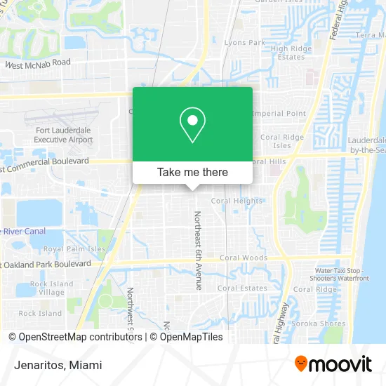
See Jenaritos, Fort Lauderdale, on the map
Public Transit to Jenaritos in Fort Lauderdale
Wondering how to get to Jenaritos in Fort Lauderdale? Moovit helps you find the best way to get to Jenaritos with step-by-step directions from the nearest public transit station.
Moovit provides free maps and live directions to help you navigate through your city. View schedules, routes, timetables, and find out how long does it take to get to Jenaritos in real time.
Looking for the nearest stop or station to Jenaritos? Check out this list of stops closest to your destination: Commercial Boulevard/Northeast 6th Avenue; Dixie Highway/Northeast 42nd Street; Andrews Avenue/Northwest 43rd Street; Cypress Creek Station.
Bus: 50, 55, 60.Train: TRIRAIL.
Want to see if there’s another route that gets you there at an earlier time? Moovit helps you find alternative routes or times. Get directions from and directions to Jenaritos easily from the Moovit App or Website.
We make riding to Jenaritos easy, which is why over 1.7 million users, including users in Fort Lauderdale, trust Moovit as the best app for public transit. You don’t need to download an individual bus app or train app, Moovit is your all-in-one transit app that helps you find the best bus time or train time available.
For information on prices of bus and train, costs and ride fares to Jenaritos, please check the Moovit app.
Use the app to navigate to popular places including to the airport, hospital, stadium, grocery store, mall, coffee shop, school, college, and university.
Jenaritos Address: 285 NE 44th St street in Fort Lauderdale
- Rainforest Management,
- Dillard Warehouse,
- Keenan Window & Door,
- Ardura Lawn Services,
- Oakland Tires And More,
- Resort Services,
- Hotel Soap,
- Peter's Massage Studio,
- Peter Gorobetz Massage Therapy,
- Casa Conde &Amp; Associates,
- Spa Escape Inc,
- Applied Magnetism Contracting Llc,
- Ada Architecture Design Atelier,
- Santos Express,
- Hair4usalonspa,
- Pizza And Brew,
- Lucky Deals,
- Tic Tac Dough,
- Western Union,
- Walgreens #4773
Places Near Jenaritos (Fort Lauderdale)
- Keiser University Flagship Campus, West Palm Beach,
- Miami Freedom Park, Miami,
- Brickell City Centre, Miami,
- Miami VA Hospital, Miami,
- Hard Rock Stadium, Miami Gardens,
- Miami-Dade County Courthouse, Miami,
- Dolphin Mall Bus, Miami,
- Aventura Mall, Miami,
- Wynwood, Miami,
- Sawgrass mall ( FL ), Miami Beach,
- Little Havana, Miami,
- Richard E. Gerstein Justice Building, Miami,
- Dolphin Mall, Miami,
- Aventura Mall, Miami Beach,
- Zoo Miami, Miami,
- Sawgrass Mall, Miami,
- Miami Design District, Miami,
- Marlins Park, Miami,
- Port of Miami Cruise Terminal, Miami,
- Bayside Marketplace, Miami
How to get to popular places in Miami with public transit
Get around Fort Lauderdale by public transit!
Traveling around Fort Lauderdale has never been so easy. See step by step directions as you travel to any attraction, street or major public transit station. View bus and train schedules, arrival times, service alerts and detailed routes on a map, so you know exactly how to get to anywhere in Fort Lauderdale.
When traveling to any destination around Fort Lauderdale use Moovit's Live Directions with Get Off Notifications to know exactly where and how far to walk, how long to wait for your line, and how many stops are left. Moovit will alert you when it's time to get off — no need to constantly re-check whether yours is the next stop.
Wondering how to use public transit in Fort Lauderdale or how to pay for public transit in Fort Lauderdale? Moovit public transit app can help you navigate your way with public transit easily, and at minimum cost. It includes public transit fees, ticket prices, and costs. Looking for a map of Fort Lauderdale public transit lines? Moovit public transit app shows all public transit maps in Fort Lauderdale with all Bus, Train, Light Rail and Ferry routes and stops on an interactive map.
Miami has 4 transit type(s), including: Bus, Train, Light Rail and Ferry, operated by several transit agencies, including Broward County Transit, Miami-Dade Transit, Metrorail, Palm Tran, Tri-Rail, Brightline, MARTY, City of Homestead Trolley, Key West Transit, Treasure Coast Connector, GoLine IRT, Amtrak, Greyhound-us, FlixBus-us and Aventura Express Shuttle Bus