How to get to Jes-Design by bus?
Click on the bus route to see step by step directions with maps, line arrival times and updated time schedules.
How to get to Jes-Design by train?
Click on the train route to see step by step directions with maps, line arrival times and updated time schedules.
From Panorama-Bad Freudenstadt, Vereinbarte Verwaltungsgemeinschaft Freudenstadt
189 minFrom Hotel Palmenwald, Vereinbarte Verwaltungsgemeinschaft Freudenstadt
156 minFrom Klinik Hohenfreudenstadt, Vereinbarte Verwaltungsgemeinschaft Freudenstadt
201 minFrom Krankenhaus Freudenstadt, Vereinbarte Verwaltungsgemeinschaft Freudenstadt
195 minFrom Parkplatz Bauhaus, Verwaltungsgemeinschaft Offenburg
78 min
Bus stops near Jes-Design in Ettenheim
Train stations near Jes-Design in Ettenheim
Bus lines to Jes-Design in Ettenheim
- 50, Rust Schule,VIEW
- 54, Orschweier Hans-Jakob-Schule,VIEW
- 113, Rust Rathaus - Lahr Schlüssel Bstg 2,VIEW
- 114, Ettenheimmünster Sonne - Orschweier,VIEW
- 7200, Ettenheim Heimschule - Kenzingen Bahnhof Kenzingen Bf. Ost,VIEW
- 7200, Ettenheim Heimschule - Forchheim Herrenstraße,VIEW
- 7200, Ettenheim Heimschule - Herbolzheim (Brsg) Bahnhof,VIEW
- 7231, Ringsheim/Europa-Park,VIEW
- 115, Altdorf Grundschule,VIEW
- 51, Ettenheimweiler Schule,VIEW
What are the closest stations to Jes-Design?
The closest stations to Jes-Design are:
- Ettenheim Realschule is 755 meters away, 10 min walk.
- Ettenheim Fürstenfeld is 797 meters away, 11 min walk.
- Ettenheim Gymnasium is 1052 meters away, 14 min walk.
- Orschweier Bahnhof is 2882 meters away, 37 min walk.
- Ringsheim/Europa-Park is 3017 meters away, 39 min walk.
Which bus lines stop near Jes-Design?
These bus lines stop near Jes-Design: 113, 7231.
Which train lines stop near Jes-Design?
These train lines stop near Jes-Design: RB 26, RB26, RE 7, RE7.
What’s the nearest bus station to Jes-Design in Ettenheim?
The nearest bus station to Jes-Design in Ettenheim is Ettenheim Realschule. It’s a 10 min walk away.
What time is the first train to Jes-Design in Ettenheim?
The RE7 is the first train that goes to Jes-Design in Ettenheim. It stops nearby at 4:40 AM.
What time is the last train to Jes-Design in Ettenheim?
The RE7 is the last train that goes to Jes-Design in Ettenheim. It stops nearby at 1:05 AM.
What time is the first bus to Jes-Design in Ettenheim?
The 113 is the first bus that goes to Jes-Design in Ettenheim. It stops nearby at 5:13 AM.
What time is the last bus to Jes-Design in Ettenheim?
The 7231 is the last bus that goes to Jes-Design in Ettenheim. It stops nearby at 10:34 PM.
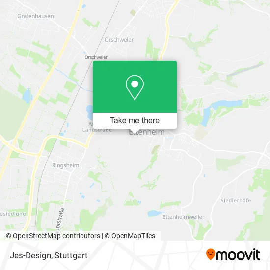
See Jes-Design, Ettenheim, on the map
Public Transit to Jes-Design in Ettenheim
Wondering how to get to Jes-Design in Ettenheim? Moovit helps you find the best way to get to Jes-Design with step-by-step directions from the nearest public transit station.
Moovit provides free maps and live directions to help you navigate through your city. View schedules, routes, timetables, and find out how long does it take to get to Jes-Design in real time.
Looking for the nearest stop or station to Jes-Design? Check out this list of stops closest to your destination: Ettenheim Realschule; Ettenheim Fürstenfeld; Ettenheim Gymnasium; Orschweier Bahnhof; Ringsheim/Europa-Park.
Bus: 113, 7231, 50, 54, 114, 7200, 7200, 7200, 115, 51.Train: RB 26, RB26, RE 7, RE7, RB27, TGD, RE2.
Want to see if there’s another route that gets you there at an earlier time? Moovit helps you find alternative routes or times. Get directions from and directions to Jes-Design easily from the Moovit App or Website.
We make riding to Jes-Design easy, which is why over 1.5 million users, including users in Ettenheim, trust Moovit as the best app for public transit. You don’t need to download an individual bus app or train app, Moovit is your all-in-one transit app that helps you find the best bus time or train time available.
For information on prices of train, bus and light rail, costs and ride fares to Jes-Design, please check the Moovit app.
Use the app to navigate to popular places including to the airport, hospital, stadium, grocery store, mall, coffee shop, school, college, and university.
Jes-Design Address: Im Marbach 4 77955 Ettenheim street in Ettenheim
- Erste Hilfe Beile,
- Maria Cristina Machado da Costa,
- Heilpraktiker Wiegand,
- Ettenheim Hähnlebrunnen,
- Dr. med. Günther Gendrisch,
- Sambuca,
- Ennovaenergia Deutschland,
- Michael Bissman,
- Musikkapelle Kappel,
- Deichmann-Schuhe,
- Monika Schmied,
- Schwab Marita Steuerberaterin,
- Kamba,
- Emil,
- U. Stolz Steuerber,
- Ettenheim Benfelder Str.,
- Seil Frey,
- Rudi Trenkle,
- Jdb-Abc24,
- Dr. Claus Fisch & Jutta Fisch Immobilien
Places Near Jes-Design (Ettenheim)
- Gleis 101/102 (tief), Stuttgart-Mitte,
- Mettingen Eros-Center Puff Laufhaus, Esslingen Am Neckar,
- Klinikum Stuttgart - Katharinenhospital, Stuttgart-Mitte,
- Porsche Museum, Zuffenhausen,
- Mercedes-Benz Museum (Mercedes Museum Stuttgart), Bad Cannstatt,
- Im Wizemann (Halle), Bad Cannstatt,
- Hanns-Martin-Schleyer-Halle, Bad Cannstatt,
- Schleyerhalle, Bad Cannstatt,
- Hanns-Martin-Schleyer-Halle (Stuttgart Hans-Martin-Schleyerhalle), Bad Cannstatt,
- Pariser Platz Stuttgart, Stuttgart-Mitte,
- Mercedes-Benz Museum, Bad Cannstatt,
- Marmorsaal Im Weissenburgpark, Stuttgart-Süd,
- SI-Centrum, Möhringen,
- Gasometer Pforzheim, Pforzheim,
- FlixBus Haltestelle, Stuttgart,
- Wilhelma (U-Bahn Wilhelma), Bad Cannstatt,
- Geilhaus Haus 33a, Reutlingen-Betzingen,
- Waldfriedhof, Degerloch,
- Porsche-Arena, Bad Cannstatt,
- Hauptbahnhof Stuttgart, Stuttgart-Mitte
How to get to popular places in Stuttgart with public transit
Get around Ettenheim by public transit!
Traveling around Ettenheim has never been so easy. See step by step directions as you travel to any attraction, street or major public transit station. View bus and train schedules, arrival times, service alerts and detailed routes on a map, so you know exactly how to get to anywhere in Ettenheim.
When traveling to any destination around Ettenheim use Moovit's Live Directions with Get Off Notifications to know exactly where and how far to walk, how long to wait for your line, and how many stops are left. Moovit will alert you when it's time to get off — no need to constantly re-check whether yours is the next stop.
Wondering how to use public transit in Ettenheim or how to pay for public transit in Ettenheim? Moovit public transit app can help you navigate your way with public transit easily, and at minimum cost. It includes public transit fees, ticket prices, and costs. Looking for a map of Ettenheim public transit lines? Moovit public transit app shows all public transit maps in Ettenheim with all Bus, Train, Subway, Light Rail, Ferry, S-Bahn and Funicular routes and stops on an interactive map.
Stuttgart has 7 transit type(s), including: Bus, Train, Subway, Light Rail, Ferry, S-Bahn and Funicular, operated by several transit agencies, including SSB - Stadtbahn, SSB, SSB - Seilbahn / Zacke, S-Bahn Stuttgart, Rhein-Neckar-Verkehr GmbH (rnv), Karlsruher Verkehrsverbund, DB AG, DB Regiobus BW, Arverio Baden-Württemberg GmbH, DB RegioNetz Verkehrs GmbH Westfrankenbahn, DB Regio AG Baden-Württemberg, Südwestdeutsche Verkehrs-AG, DB Regio AG Mitte Region Hessen, DB and Bodensee-Oberschwaben-Bahn