Directions to Jesinha Modas (Cic) with public transportation
The following transit lines have routes that pass near Jesinha Modas
How to get to Jesinha Modas by bus?
Click on the bus route to see step by step directions with maps, line arrival times and updated time schedules.
From Rua Monsenhor Celso, Centro
50 minFrom Previdência Social - Agência Visconde De Guarapuava, Centro
48 minFrom Mercês, Mercês
63 minFrom Avenida Manoel Ribas 1226, Mercês
60 minFrom Estação Tubo Praça Oswaldo Cruz, Água Verde
44 minFrom Rua Visconde do Rio Branco, Centro
47 minFrom Avenida Sete de Setembro, Centro
42 minFrom Rua Gabriel Frecceiro de Miranda, Xaxim
49 minFrom Rua João Negrão, Rebouças
47 minFrom Universidade Tuiuti do Paraná (UTP), Santo Inácio
76 min
Bus stops near Jesinha Modas in Cic
Bus lines to Jesinha Modas in Cic
What are the closest stations to Jesinha Modas?
The closest stations to Jesinha Modas are:
- R. Davi Xavier da Silva, 691 is 43 meters away, 1 min walk.
- Paróquia Nossa Senhora da Luz is 241 meters away, 4 min walk.
- R. Schirlei Solange Mantovani, 608 is 263 meters away, 4 min walk.
- R. Pedro Gusso, 3382 is 337 meters away, 5 min walk.
Which bus lines stop near Jesinha Modas?
These bus lines stop near Jesinha Modas: 612 PORTÃO / CIC, 654 CAMPO ALEGRE, 674 NOSSA SENHORA DA LUZ.
What’s the nearest bus station to Jesinha Modas in Cic?
The nearest bus station to Jesinha Modas in Cic is R. Davi Xavier da Silva, 691. It’s a 1 min walk away.
What time is the first bus to Jesinha Modas in Cic?
The 654 CAMPO ALEGRE is the first bus that goes to Jesinha Modas in Cic. It stops nearby at 5:07 AM.
What time is the last bus to Jesinha Modas in Cic?
The 674 NOSSA SENHORA DA LUZ is the last bus that goes to Jesinha Modas in Cic. It stops nearby at 12:55 AM.
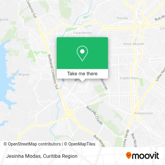
See Jesinha Modas, Cic, on the map
Public Transit to Jesinha Modas in Cic
Wondering how to get to Jesinha Modas in Cic? Moovit helps you find the best way to get to Jesinha Modas with step-by-step directions from the nearest public transit station.
Moovit provides free maps and live directions to help you navigate through your city. View schedules, routes, timetables, and find out how long does it take to get to Jesinha Modas in real time.
Looking for the nearest stop or station to Jesinha Modas? Check out this list of stops closest to your destination: R. Davi Xavier da Silva; Paróquia Nossa Senhora da Luz; R. Schirlei Solange Mantovani; R. Pedro Gusso.
Bus: 612 PORTÃO / CIC, 654 CAMPO ALEGRE, 674 NOSSA SENHORA DA LUZ, 627 BOSCH, 628 CARBOMAFRA.
Want to see if there’s another route that gets you there at an earlier time? Moovit helps you find alternative routes or times. Get directions from and directions to Jesinha Modas easily from the Moovit App or Website.
We make riding to Jesinha Modas easy, which is why over 1.5 million users, including users in Cic, trust Moovit as the best app for public transit. You don’t need to download an individual bus app or train app, Moovit is your all-in-one transit app that helps you find the best bus time or train time available.
For information on prices of bus, costs and ride fares to Jesinha Modas, please check the Moovit app.
Use the app to navigate to popular places including to the airport, hospital, stadium, grocery store, mall, coffee shop, school, college, and university.
Jesinha Modas Address: Rua Santa Bertila, 25 Cidade Industrial de Curitiba Curitiba-PR 81305-260 street in Cic
- La Casa de Bebidas,
- Julio Viero Representante Comercial,
- Simplify Solucoes,
- Igreja Matriz Nossa Senhora da Luz dos Pinhais,
- Hostel Bomfati,
- Asa Tec Informática,
- Rua Davi Xavier da Silva,
- Brasil Pro Sports,
- Clínica Oralmed,
- Projeto Único,
- Ks Aromas,
- Incorporadora Smaylly,
- Curitiba Burger,
- Novo Tempo Manutencao de Máquinas Para Alimentos,
- Praça Enoch Araújo Ramos,
- Panificadora e Confeitaria Dom Antônio,
- Hamilton Pinturas Acabamentos e Papeis de Parede,
- Distribuidora Nazario Ltda,
- Banca da Praca 2,
- Duque Bebidas
Places Near Jesinha Modas (Cic)
- Hospital de Clínicas (HC - UFPR), Centro,
- Hhhhh, Fazendinha,
- Jockey Plaza Shopping Center, Tarumã,
- Hospital do Rocio, Campo,
- Hospital Da Cruz Vermelha, Batel,
- Park Shopping Barigüi, Mossunguê,
- Pontifícia Universidade Católica do Paraná (PUCPR), Prado Velho,
- Shopping Palladium, Portão,
- Arena Da Baixada - Curitiba,
- Campo Largo, Campo,
- Hospital Universitário Evangélico de Curitiba, Bigorrilho,
- Rua Martim Afonso 558, Mercês,
- Hospital Angelina Caron, Campina Grande Do Sul,
- Hospital Nossa Senhora Das Graças, Mercês,
- Hospital Madalena Sofia, Bairro Alto,
- Parque Barigui, Mercês,
- Rua General Mário Tourinho, Campina Do Siqueira,
- Hospital Erasto Gaertner, Jardim Das Américas,
- Shopping Estação, Rebouças,
- Jardim Botânico de Curitiba PR, Centro
How to get to popular places in Curitiba Region with public transit
Get around Cic by public transit!
Traveling around Cic has never been so easy. See step by step directions as you travel to any attraction, street or major public transit station. View bus and train schedules, arrival times, service alerts and detailed routes on a map, so you know exactly how to get to anywhere in Cic.
When traveling to any destination around Cic use Moovit's Live Directions with Get Off Notifications to know exactly where and how far to walk, how long to wait for your line, and how many stops are left. Moovit will alert you when it's time to get off — no need to constantly re-check whether yours is the next stop.
Wondering how to use public transit in Cic or how to pay for public transit in Cic? Moovit public transit app can help you navigate your way with public transit easily, and at minimum cost. It includes public transit fees, ticket prices, and costs. Looking for a map of Cic public transit lines? Moovit public transit app shows all public transit maps in Cic with all Bus and Cable Car routes and stops on an interactive map.
Curitiba Region has 2 transit type(s), including: Bus and Cable Car, operated by several transit agencies, including Sistema Integrado de Mobilidade (URBS), Sistema Integrado de Mobilidade (AMEP), URBS (Cartões bancários e Dinheiro), URBS (Cartões bancários / Cartão URBS), AMEP (Cartões bancários / Cartão MetroCard), AMEP (Cartões bancários / Cartão MetroCard / Dinheiro), Viação Colombo (Dinheiro), TRIAR (Cartão TRIAR / Dinheiro), Empresa Curitiba Cerro Azul (Dinheiro), Expresso Nossa Senhora da Penha (Dinheiro), Empresa Campo Alto Tijucas (Dinheiro), Auto Viação São José (Cartão VEM / Dinheiro), BRT S/A (Cartão VEM / Dinheiro), TransPiedade (Cartão Cidadão / Dinheiro) and Oceânica Sul (Cartão Transporte / Dinheiro)