How to get to Jets Flagship Store by bus?
Click on the bus route to see step by step directions with maps, line arrival times and updated time schedules.
From Times Sq - 42 St (Mta - 42nd St/Times Square SUBWAY Station), Manhattan
31 minFrom JP Morgan Chase Co., Jersey City
59 minFrom Consulate of Guyana, Manhattan
41 minFrom Times Square New York City, Usa, Manhattan
40 minFrom Wollman Rink, Manhattan
65 minFrom W 45th St / 6th Ave, Manhattan
38 minFrom Walter Kerr Theatre, Manhattan
36 minFrom RH Rooftop Restaurant, Manhattan
65 minFrom Central Park, Manhattan
78 minFrom Hotel Riu Plaza New York Times Square, Manhattan
33 min
Bus stops near Jets Flagship Store in East Rutherford
Train stations near Jets Flagship Store in East Rutherford
Bus lines to Jets Flagship Store in East Rutherford
What are the closest stations to Jets Flagship Store?
The closest stations to Jets Flagship Store are:
- Stadium Lot G-17 is 498 yards away, 6 min walk.
- American Dream is 561 yards away, 7 min walk.
- Paterson Plank Rd at Gotham Parkway is 2328 yards away, 28 min walk.
- Rutherford is 2779 yards away, 33 min walk.
- Wood- Ridge is 4186 yards away, 49 min walk.
Which bus line stops near Jets Flagship Store?
160 (Elmwood Park Via Meadowlands & Union City)
What’s the nearest bus station to Jets Flagship Store in East Rutherford?
The nearest bus station to Jets Flagship Store in East Rutherford is Stadium Lot G-17. It’s a 6 min walk away.
What time is the first train to Jets Flagship Store in East Rutherford?
The PJL is the first train that goes to Jets Flagship Store in East Rutherford. It stops nearby at 5:51 AM.
What time is the last train to Jets Flagship Store in East Rutherford?
The PVL is the last train that goes to Jets Flagship Store in East Rutherford. It stops nearby at 12:58 AM.
What time is the first bus to Jets Flagship Store in East Rutherford?
The 163 is the first bus that goes to Jets Flagship Store in East Rutherford. It stops nearby at 4:49 AM.
What time is the last bus to Jets Flagship Store in East Rutherford?
The 85 is the last bus that goes to Jets Flagship Store in East Rutherford. It stops nearby at 1:41 AM.
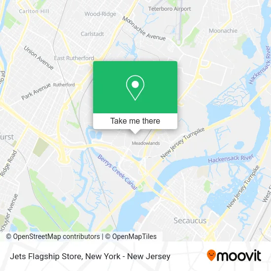
See Jets Flagship Store, East Rutherford, on the map
Public Transit to Jets Flagship Store in East Rutherford
Wondering how to get to Jets Flagship Store in East Rutherford? Moovit helps you find the best way to get to Jets Flagship Store with step-by-step directions from the nearest public transit station.
Moovit provides free maps and live directions to help you navigate through your city. View schedules, routes, timetables, and find out how long does it take to get to Jets Flagship Store in real time.
Looking for the nearest stop or station to Jets Flagship Store? Check out this list of stops closest to your destination: Stadium Lot G-17; American Dream; Paterson Plank Rd at Gotham Parkway; Rutherford; Wood- Ridge.
Bus: 160, 703, 85, 355, 772, 163, 164.Train: MCL, PJL, PVL.
Want to see if there’s another route that gets you there at an earlier time? Moovit helps you find alternative routes or times. Get directions from and directions to Jets Flagship Store easily from the Moovit App or Website.
We make riding to Jets Flagship Store easy, which is why over 1.5 million users, including users in East Rutherford, trust Moovit as the best app for public transit. You don’t need to download an individual bus app or train app, Moovit is your all-in-one transit app that helps you find the best bus time or train time available.
For information on prices of bus and subway, costs and ride fares to Jets Flagship Store, please check the Moovit app.
Use the app to navigate to popular places including to the airport, hospital, stadium, grocery store, mall, coffee shop, school, college, and university.
Location: East Rutherford, New York - New Jersey
- Giants Stadium Aka Metlife Stadium,
- MetLife 50 Club,
- Pepsi Gate,
- My Giants Psls,
- Meadowlands State Fair,
- MetLife Stadium,
- Estádio Meadowlands,
- Buckle Fang,
- Porsche Green Room,
- The Jets Green Room at Metlife Stadium,
- Metlife 50 Club at Metlife Stadium,
- Verizon Corner Suite - MetLife Stadium,
- MetLife Parking Lot G,
- Cushman & Wakefield,
- Verizon Studio MetLife Stadium,
- MetLife Sports Complex,
- Meadowlands Sports Complex,
- Red Bulls New York Stadium,
- Mount Everest Meadowlands Stadium Ski Sale,
- MetLife Stadium (Metlife Stadium Parking Lot)
Places Near Jets Flagship Store (East Rutherford)
- Wall Street, Manhattan,
- 376 Hudson Street, Manhattan,
- Hudson Yards, Manhattan,
- 3 Stone St, Manhattan,
- San Gennaro Feast, Manhattan,
- Bellevue Hospital, Manhattan,
- 911 Memorial, Manhattan,
- Queens Center Mall, Queens,
- 66 John Street, Manhattan,
- Times Square, Manhattan,
- qqqq, Manhattan,
- Rockefeller Center, Manhattan,
- SoHo, Manhattan,
- 26 Federal Plaza, Manhattan,
- 1 Police Plaza, Manhattan,
- Chinatown, Manhattan,
- Mountainside Hospital, Glen Ridge,
- Pier 83, Manhattan,
- Katz's Deli, Manhattan,
- 111 Centre New York City Supreme Court, Manhattan
How to get to popular places in New York - New Jersey with public transit
Get around East Rutherford by public transit!
Traveling around East Rutherford has never been so easy. See step by step directions as you travel to any attraction, street or major public transit station. View bus and train schedules, arrival times, service alerts and detailed routes on a map, so you know exactly how to get to anywhere in East Rutherford.
When traveling to any destination around East Rutherford use Moovit's Live Directions with Get Off Notifications to know exactly where and how far to walk, how long to wait for your line, and how many stops are left. Moovit will alert you when it's time to get off — no need to constantly re-check whether yours is the next stop.
Wondering how to use public transit in East Rutherford or how to pay for public transit in East Rutherford? Moovit public transit app can help you navigate your way with public transit easily, and at minimum cost. It includes public transit fees, ticket prices, and costs. Looking for a map of East Rutherford public transit lines? Moovit public transit app shows all public transit maps in East Rutherford with all Bus, Train, Subway, Light Rail, Ferry and Cable Car routes and stops on an interactive map.
New York - New Jersey has 6 transit type(s), including: Bus, Train, Subway, Light Rail, Ferry and Cable Car, operated by several transit agencies, including MTA Subway, Metro-North Railroad, LIRR, PATH, MTA New York City Transit - Express routes, MTA Bus, NJ Transit, NYC Ferry, NICE bus, Bee-Line Bus, NJ Transit Rail, Norwalk Transit District, Hartford Line, River Valley Transit and HART