How to get to Jf Abatedouro by bus?
Click on the bus route to see step by step directions with maps, line arrival times and updated time schedules.
From UFF - Universidade Federal Fluminense, Niterói
48 minFrom Niteroi-RJ, Niterói
48 minFrom Barreto, Niterói
43 minFrom Alcântara, São Gonçalo
28 minFrom Praia de Itaipu, Niterói
64 minFrom UFF-Campus Gragoatá (Universidade Federal Fluminense-Campus Gragoatá), Niterói
47 minFrom São Gonçalo, São Gonçalo
45 minFrom Linha 533D - Alcântara / Méier, Niterói
47 minFrom Ponto final do 53 - Cala Boca, Maricá
33 minFrom Rua Gavião Peixoto, Niterói
37 min
Bus stops near Jf Abatedouro in Niterói
Bus lines to Jf Abatedouro in Niterói
What are the closest stations to Jf Abatedouro?
The closest stations to Jf Abatedouro are:
- Rua Holanda, 130 is 168 meters away, 3 min walk.
- Rua Sargento Lindomar Costa 29 is 216 meters away, 3 min walk.
- Rodovia Prefeito João Sampaio, 772-824 is 271 meters away, 4 min walk.
Which bus lines stop near Jf Abatedouro?
These bus lines stop near Jf Abatedouro: 17B, 17C, 52, 536R, 771D.
What’s the nearest bus station to Jf Abatedouro in Niterói?
The nearest bus stations to Jf Abatedouro in Niterói are Rua Holanda, 130 and Rua Sargento Lindomar Costa 29. The closest one is a 3 min walk away.
What time is the first bus to Jf Abatedouro in Niterói?
The 17B is the first bus that goes to Jf Abatedouro in Niterói. It stops nearby at 4:26 AM.
What time is the last bus to Jf Abatedouro in Niterói?
The 58 is the last bus that goes to Jf Abatedouro in Niterói. It stops nearby at 12:56 AM.
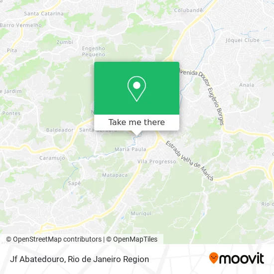
See Jf Abatedouro, Niterói, on the map
Public Transit to Jf Abatedouro in Niterói
Wondering how to get to Jf Abatedouro in Niterói? Moovit helps you find the best way to get to Jf Abatedouro with step-by-step directions from the nearest public transit station.
Moovit provides free maps and live directions to help you navigate through your city. View schedules, routes, timetables, and find out how long does it take to get to Jf Abatedouro in real time.
Looking for the nearest stop or station to Jf Abatedouro? Check out this list of stops closest to your destination: Rua Holanda; Rua Sargento Lindomar Costa 29; Rodovia Prefeito João Sampaio.
Bus: 17B, 17C, 52, 536R, 771D, 17, 58, 35.
Want to see if there’s another route that gets you there at an earlier time? Moovit helps you find alternative routes or times. Get directions from and directions to Jf Abatedouro easily from the Moovit App or Website.
We make riding to Jf Abatedouro easy, which is why over 1.5 million users, including users in Niterói, trust Moovit as the best app for public transit. You don’t need to download an individual bus app or train app, Moovit is your all-in-one transit app that helps you find the best bus time or train time available.
For information on prices of bus, costs and ride fares to Jf Abatedouro, please check the Moovit app.
Use the app to navigate to popular places including to the airport, hospital, stadium, grocery store, mall, coffee shop, school, college, and university.
Jf Abatedouro Address: Avenida França, 42 Maria Paula Niterói-RJ 24325-220 street in Niterói
- Descartaveis Niteroi,
- Geter,
- Maria Paula,
- Só Portões RJ,
- Moreno 's Bar Maria Paula,
- Estrada da Paciência,
- Estrada Velha de Maricá / Estrada da Paciência,
- Antiguidades Só Vanessa,
- Frango Assado do Portuga,
- Condomínio Residencial Lugo,
- bar do caranguejo,
- Condominio Via Mar,
- Rua Expedicionário Mário Nardelli, 319,
- Rodovia Prefeito João Sampaio Próximo ao 732,
- Via Veneto,
- Rua Aurora Ribeiro,
- Condomínio Aldeia Casa Grande,
- Estrada Velha de Maricá,
- Maria Paula,
- Maria Paula
Places Near Jf Abatedouro (Niterói)
- Hospital Pedro Ernesto, Vila Isabel,
- Hospital Municipal Ronaldo Gazolla, Acari,
- Rua Ulysses Guimarães 16, Cidade Nova,
- Niterói, Niterói,
- Shopping Rio Sul, Botafogo,
- Shopping RioSul, Botafogo,
- Praia do Arpoador, Ipanema,
- Rodoviária Novo Rio (Rodoviária do Rio de Janeiro), Santo Cristo,
- Hospital Federal Do Andaraí, Andaraí,
- Rio De Janeiro,
- Feira Livre da Gloria, Glória,
- Avenida Rio Branco, Centro,
- Feirão De Malhas, Duque De Caxias,
- Rua Licínio Cardoso, São Francisco Xavier,
- Shopping Downtown, Barra Da Tijuca,
- Hospital Federal Cardoso Fontes, Jacarepaguá,
- Norte Shopping, Cachambi,
- Museu Do Amanhã, Centro,
- Shopping Nova América, Del Castilho,
- Avenida Venezuela 134, Saúde
How to get to popular places in Rio de Janeiro Region with public transit
Get around Niterói by public transit!
Traveling around Niterói has never been so easy. See step by step directions as you travel to any attraction, street or major public transit station. View bus and train schedules, arrival times, service alerts and detailed routes on a map, so you know exactly how to get to anywhere in Niterói.
When traveling to any destination around Niterói use Moovit's Live Directions with Get Off Notifications to know exactly where and how far to walk, how long to wait for your line, and how many stops are left. Moovit will alert you when it's time to get off — no need to constantly re-check whether yours is the next stop.
Wondering how to use public transit in Niterói or how to pay for public transit in Niterói? Moovit public transit app can help you navigate your way with public transit easily, and at minimum cost. It includes public transit fees, ticket prices, and costs. Looking for a map of Niterói public transit lines? Moovit public transit app shows all public transit maps in Niterói with all Bus, Train, Metro, Light Rail, Ferry, Cable Car, Gondola and Funicular routes and stops on an interactive map.
Rio de Janeiro Region has 8 transit type(s), including: Bus, Train, Metro, Light Rail, Ferry, Cable Car, Gondola and Funicular, operated by several transit agencies, including TrensRJ, Metrô Rio, VLT Carioca, Barcas Rio, BRT MOBI-Rio, Auto Viação Alpha, Auto Viação Tijuca, Gire Transportes, Transurb, Viação Nossa Senhora das Graças, Consórcio INTERSUL, Braso Lisboa (Municipal), Caprichosa Auto Ônibus, Auto Viação Três Amigos and Rodoviária Âncora Matias