How to get to Jf Lanches E Saladas by bus?
Click on the bus route to see step by step directions with maps, line arrival times and updated time schedules.
From Guanabara, Barra Da Tijuca
24 minFrom Praia Da Joatinga, Joá
44 minFrom Praça Afonso Viseu, Alto Da Boa Vista
56 minFrom Hospital Federal Cardoso Fontes, Jacarepaguá
49 minFrom Avenida das Américas, Recreio Dos Bandeirantes
28 minFrom Estrada Dos Tres Rios, Freguesia (Jacarepaguá)
44 minFrom Taquara (Jacarepagua), Taquara
33 minFrom BRT - Estação Asa Branca, Jacarepaguá
38 minFrom Fashion Mall, São Conrado
48 minFrom BRT - Linha Paradora Recreio / Terminal Alvorada, Recreio Dos Bandeirantes
52 min
Bus stops near Jf Lanches E Saladas in Barra Da Tijuca
Bus lines to Jf Lanches E Saladas in Barra Da Tijuca
What are the closest stations to Jf Lanches E Saladas?
The closest stations to Jf Lanches E Saladas are:
- Mercanti is 105 meters away, 2 min walk.
- Alfa Barra II is 403 meters away, 6 min walk.
Which bus lines stop near Jf Lanches E Saladas?
These bus lines stop near Jf Lanches E Saladas: 302, 309, 805, SP 805.
What’s the nearest bus station to Jf Lanches E Saladas in Barra Da Tijuca?
The nearest bus station to Jf Lanches E Saladas in Barra Da Tijuca is Mercanti. It’s a 2 min walk away.
What time is the first bus to Jf Lanches E Saladas in Barra Da Tijuca?
The SN 309 is the first bus that goes to Jf Lanches E Saladas in Barra Da Tijuca. It stops nearby at 3:00 AM.
What time is the last bus to Jf Lanches E Saladas in Barra Da Tijuca?
The 309 is the last bus that goes to Jf Lanches E Saladas in Barra Da Tijuca. It stops nearby at 4:27 AM.
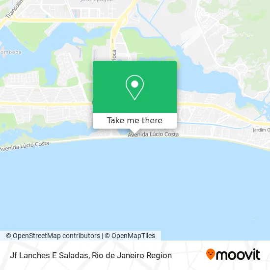
See Jf Lanches E Saladas, Barra Da Tijuca, on the map
Public Transit to Jf Lanches E Saladas in Barra Da Tijuca
Wondering how to get to Jf Lanches E Saladas in Barra Da Tijuca? Moovit helps you find the best way to get to Jf Lanches E Saladas with step-by-step directions from the nearest public transit station.
Moovit provides free maps and live directions to help you navigate through your city. View schedules, routes, timetables, and find out how long does it take to get to Jf Lanches E Saladas in real time.
Looking for the nearest stop or station to Jf Lanches E Saladas? Check out this list of stops closest to your destination: Mercanti; Alfa Barra II.
Bus: 302, 309, 805, SP 805, 552, 691, 692, SV 692, 693.
Want to see if there’s another route that gets you there at an earlier time? Moovit helps you find alternative routes or times. Get directions from and directions to Jf Lanches E Saladas easily from the Moovit App or Website.
We make riding to Jf Lanches E Saladas easy, which is why over 1.5 million users, including users in Barra Da Tijuca, trust Moovit as the best app for public transit. You don’t need to download an individual bus app or train app, Moovit is your all-in-one transit app that helps you find the best bus time or train time available.
For information on prices of bus and metro, costs and ride fares to Jf Lanches E Saladas, please check the Moovit app.
Use the app to navigate to popular places including to the airport, hospital, stadium, grocery store, mall, coffee shop, school, college, and university.
Jf Lanches E Saladas Address: Avenida Lúcio Costa, 6250 Barra da Tijuca Rio de Janeiro-RJ 22630-012 street in Barra Da Tijuca
- Andrea Cakeria,
- Caio Transportes,
- Ammariwear,
- Barraca do Edmilson & Marli,
- Avenida Lúcio Costa 6250,
- Maccherone,
- RHR Rio Hotel Residence,
- Barraca do Chicão,
- Ipiranga (Auto Posto De Abastecimento Estrela Do Oceano),
- Posto Estrela Do Oceano,
- Afmj Servicos de Informatica e Tecnologia,
- Sampa Comercio de Artes,
- PÃO DE AÇÚCAR,
- Condomínio Golden Coast,
- Balada Mix - Barra/ RJ,
- Avenida Lúcio Costa, 5800,
- Praia,
- Onipresente,
- Clinica Dr Orlando Abdo,
- Cla De Luca Beachwear
Places Near Jf Lanches E Saladas (Barra Da Tijuca)
- Museu Do Amanhã, Centro,
- Shopping Nova América, Del Castilho,
- Praia do Arpoador, Ipanema,
- Rio De Janeiro,
- Niterói, Niterói,
- Avenida Venezuela 134, Saúde,
- Shopping RioSul, Botafogo,
- Hospital Municipal Ronaldo Gazolla, Acari,
- Rua Licínio Cardoso, São Francisco Xavier,
- Shopping Rio Sul, Botafogo,
- Shopping Downtown, Barra Da Tijuca,
- Hospital Federal Do Andaraí, Andaraí,
- Feira Livre da Gloria, Glória,
- Hospital Pedro Ernesto, Vila Isabel,
- Feirão De Malhas, Duque De Caxias,
- Avenida Rio Branco, Centro,
- Norte Shopping, Cachambi,
- Rua Ulysses Guimarães 16, Cidade Nova,
- Rodoviária Novo Rio (Rodoviária do Rio de Janeiro), Santo Cristo,
- Hospital Federal Cardoso Fontes, Jacarepaguá
How to get to popular places in Rio de Janeiro Region with public transit
Get around Barra Da Tijuca by public transit!
Traveling around Barra Da Tijuca has never been so easy. See step by step directions as you travel to any attraction, street or major public transit station. View bus and train schedules, arrival times, service alerts and detailed routes on a map, so you know exactly how to get to anywhere in Barra Da Tijuca.
When traveling to any destination around Barra Da Tijuca use Moovit's Live Directions with Get Off Notifications to know exactly where and how far to walk, how long to wait for your line, and how many stops are left. Moovit will alert you when it's time to get off — no need to constantly re-check whether yours is the next stop.
Wondering how to use public transit in Barra Da Tijuca or how to pay for public transit in Barra Da Tijuca? Moovit public transit app can help you navigate your way with public transit easily, and at minimum cost. It includes public transit fees, ticket prices, and costs. Looking for a map of Barra Da Tijuca public transit lines? Moovit public transit app shows all public transit maps in Barra Da Tijuca with all Bus, Train, Metro, Light Rail, Ferry, Cable Car, Gondola and Funicular routes and stops on an interactive map.
Rio de Janeiro Region has 8 transit type(s), including: Bus, Train, Metro, Light Rail, Ferry, Cable Car, Gondola and Funicular, operated by several transit agencies, including TrensRJ, Metrô Rio, VLT Carioca, Barcas Rio, BRT MOBI-Rio, Auto Viação Alpha, Auto Viação Tijuca, Gire Transportes, Transurb, Viação Nossa Senhora das Graças, Consórcio INTERSUL, Braso Lisboa (Municipal), Caprichosa Auto Ônibus, Auto Viação Três Amigos and Rodoviária Âncora Matias