Directions to Jones Falls Park (Baltimore County) with public transportation
The following transit lines have routes that pass near Jones Falls Park
 Bus: 34.
- Light Rail: LIGHT RAILLINK.
How to get to Jones Falls Park by bus?
Click on the bus route to see step by step directions with maps, line arrival times and updated time schedules.
From Clarence M. Mitchell, Jr. Courthouse, Baltimore
65 minFrom Joseph Meyerhoff Symphony Hall, Baltimore
68 minFrom I-695 Exit 29 (Loch Raven Blvd (MD 542)/Cromwell Bridge Rd), Baltimore County
57 minFrom Towson, MD, Baltimore County
49 minFrom Lord Baltimore Hotel, Baltimore
65 minFrom Baltimore City Circuit Court, Baltimore
64 minFrom The Maryland Zoo In Baltimore, Baltimore
52 minFrom Walters Art Museum, Baltimore
65 minFrom Mitchell Court House, Baltimore
65 minFrom Baltimore Arena, Baltimore
68 min
Light Rail stations near Jones Falls Park in Baltimore County
- Cold Spring Lane, 2 min walk,VIEW
Bus stop near Jones Falls Park in Baltimore County
- Falls Rd & Smith Ave Sb, 6 min walk,VIEW
Bus lines to Jones Falls Park in Baltimore County
- 34, Catonsville,VIEW
What are the closest stations to Jones Falls Park?
The closest stations to Jones Falls Park are:
- Cold Spring Lane is 157 yards away, 2 min walk.
- Falls Rd & Smith Ave Sb is 452 yards away, 6 min walk.
Which bus line stops near Jones Falls Park?
34 (Falls Rd Light Rail)
Which light rail line stops near Jones Falls Park?
LIGHT RAILLINK (Northbound)
What’s the nearest light rail station to Jones Falls Park in Baltimore County?
The nearest light rail station to Jones Falls Park in Baltimore County is Cold Spring Lane. It’s a 2 min walk away.
What’s the nearest bus station to Jones Falls Park in Baltimore County?
The nearest bus station to Jones Falls Park in Baltimore County is Falls Rd & Smith Ave Sb. It’s a 6 min walk away.
What time is the first light rail to Jones Falls Park in Baltimore County?
The LIGHT RAILLINK is the first light rail that goes to Jones Falls Park in Baltimore County. It stops nearby at 4:28 AM.
What time is the last light rail to Jones Falls Park in Baltimore County?
The LIGHT RAILLINK is the last light rail that goes to Jones Falls Park in Baltimore County. It stops nearby at 1:09 AM.
What time is the first bus to Jones Falls Park in Baltimore County?
The 34 is the first bus that goes to Jones Falls Park in Baltimore County. It stops nearby at 5:05 AM.
What time is the last bus to Jones Falls Park in Baltimore County?
The 34 is the last bus that goes to Jones Falls Park in Baltimore County. It stops nearby at 12:27 AM.
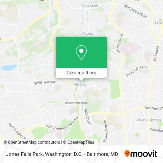
See Jones Falls Park, Baltimore County, on the map
Public Transit to Jones Falls Park in Baltimore County
Wondering how to get to Jones Falls Park in Baltimore County? Moovit helps you find the best way to get to Jones Falls Park with step-by-step directions from the nearest public transit station.
Moovit provides free maps and live directions to help you navigate through your city. View schedules, routes, timetables, and find out how long does it take to get to Jones Falls Park in real time.
Looking for the nearest stop or station to Jones Falls Park? Check out this list of stops closest to your destination: Cold Spring Lane; Falls Rd & Smith Ave Sb.
Bus: 34.Light Rail: LIGHT RAILLINK.
Want to see if there’s another route that gets you there at an earlier time? Moovit helps you find alternative routes or times. Get directions from and directions to Jones Falls Park easily from the Moovit App or Website.
We make riding to Jones Falls Park easy, which is why over 1.7 million users, including users in Baltimore County, trust Moovit as the best app for public transit. You don’t need to download an individual bus app or train app, Moovit is your all-in-one transit app that helps you find the best bus time or train time available.
For information on prices of bus and light rail, costs and ride fares to Jones Falls Park, please check the Moovit app.
Use the app to navigate to popular places including to the airport, hospital, stadium, grocery store, mall, coffee shop, school, college, and university.
Jones Falls Park Address: 1001 Lakeside Dr street in Baltimore County
- Falls Road Light Rail Station,
- Lake Roland,
- Baltimore Museum of Industry,
- STARBUCKS,
- Whole Foods Market,
- Wholefoods Mt. Washington,
- Whole Foods,
- Mt. Washington Light Rail Station,
- FedEx,
- Johns Hopkins University,
- Mount Washington,
- Soundbar,
- Law Office Gustavo Marin Garcia,
- Boys' Latin School of MD (All-Boys Ed Board of Trustees),
- Boys' Latin School of Maryland,
- Sabina-Mattfeldt,
- Mt. Washington Pediatric Hospital,
- Falls Rd and Northern Pkwy,
- I-83 Exit 10 (Northern Pkwy),
- Northern Parkway And Roland Avenue
Places Near Jones Falls Park (Baltimore County)
- Washington DC VA Medical Center, Washington,
- Pennsylvania Ave NW (3rd st and pennsylvania), Washington,
- PG Mall, Prince George's County,
- Amazon Hq2, Arlington County,
- Camden Yards, Baltimore,
- National Theatre, Washington,
- Capital One Arena, Washington,
- Sibley Memorial Hospital, Washington,
- Georgetown, Washington,
- Washington National Cathedral, Washington,
- National Zoo, Washington,
- M&T Bank Stadium, Baltimore,
- Westfield Montgomery Mall, Montgomery County,
- The Anthem, Washington,
- Basilica of the National Shrine, Washington,
- Rock Creek Tennis Center, Washington,
- Museum Of The Bible, Washington,
- National Museum of African American History and Culture, Washington,
- Warner Theatre, Washington,
- Marriott Marquis Washington, DC, Washington
How to get to popular places in Washington, D.C. - Baltimore, MD with public transit
Get around Baltimore County by public transit!
Traveling around Baltimore County has never been so easy. See step by step directions as you travel to any attraction, street or major public transit station. View bus and train schedules, arrival times, service alerts and detailed routes on a map, so you know exactly how to get to anywhere in Baltimore County.
When traveling to any destination around Baltimore County use Moovit's Live Directions with Get Off Notifications to know exactly where and how far to walk, how long to wait for your line, and how many stops are left. Moovit will alert you when it's time to get off — no need to constantly re-check whether yours is the next stop.
Wondering how to use public transit in Baltimore County or how to pay for public transit in Baltimore County? Moovit public transit app can help you navigate your way with public transit easily, and at minimum cost. It includes public transit fees, ticket prices, and costs. Looking for a map of Baltimore County public transit lines? Moovit public transit app shows all public transit maps in Baltimore County with all Bus, Train, Metro, Light Rail and Ferry routes and stops on an interactive map.
Washington, D.C. - Baltimore, MD has 5 transit type(s), including: Bus, Train, Metro, Light Rail and Ferry, operated by several transit agencies, including WMATA, Montgomery County Ride On, Fairfax Connector, TheBus, PRTC, DASH - Alexandria, Arlington Transit (ART), RTA of Central Maryland, MDOT MTA, MDOT MTA Light RailLink, MDOT MTA Commuter Bus, MDOT MTA Local Bus, FXBGO!, Virginia Railway Express (VRE) and MARC