How to get to Jorge Chavez 631 by bus?
Click on the bus route to see step by step directions with maps, line arrival times and updated time schedules.
From AV MATERIALES, Lima
56 minFrom Clínica Montefiori, La Molina
54 minFrom Emancipación, Lima
40 minFrom EsSalud Policlínico Chincha, Lima
31 minFrom Av. Alameda del Corregidor - La molina, La Molina
74 minFrom Carretera Panamericana Sur, Ate
59 minFrom Centro Comercial La Rambla, San Borja
33 minFrom Centro Materno Infantil Rímac, Rimac
50 minFrom Av. Canada con Av. Circunvalación, San Luis
43 min
Bus stops near Jorge Chavez 631 in Miraflores
Metro station near Jorge Chavez 631 in Miraflores
- Cabitos, 53 min walk,VIEW
Bus lines to Jorge Chavez 631 in Miraflores
- 1111, Universitaria (Lima) - San Gabriel (Villa María Del Triunfo),VIEW
- 1087, Alameda Sur (Chorrillos) - 28 De Julio (Jesús María),VIEW
- 1123, Parque Kennedy (Miraflores) - José Gálvez (Villa María Del Triunfo),VIEW
- 301, Amancaes (Rímac) - Plaza Butters (Barranco),VIEW
- 336, 24 de Junio (Rimac) - Pardo (Miraflores),VIEW
- AEL1, Miraflores - Aeropuerto (Callao),VIEW
- 1043, La Molina - S.J.L.,VIEW
- 1065, Valdiviezo (Ate) - Ceres (Ate),VIEW
- 1179, Miramar (Ancón) - Upc (Santiago De Surco),VIEW
- 7613, San Juan De Miraflores - Miraflores,VIEW
- OM19, Chepen (Villa El Salvador),VIEW
- 1097, Av. Santa Rosa (San Juan De Lurigancho) - Las Palmas (Pachacamac) ,VIEW
- 1113, El Triunfo (Villa María Del Triunfo) - Plaza Centro América (Miraflores),VIEW
- 1118, Av. El Triunfo (Villa María Del Triunfo) - Av. Ejercito (Miraflores),VIEW
- 1163, Santa Margarita (Ventanilla) - Jockey Plaza (Surco),VIEW
- 1180, Pamplona Alta (San Juan De Miraflores) - Torre Blanca (Carabayllo),VIEW
- 1182, San Juan de Miraflores - Carabayllo,VIEW
- 1183, Carabayllo - Surco - Carabayllo,VIEW
- 1227, Tiwinza (Callao) - Ceres (Ate),VIEW
- 1275, Oquendo (San Martín De Porres) - Upc (Santiago De Surco),VIEW
What are the closest stations to Jorge Chavez 631?
The closest stations to Jorge Chavez 631 are:
- Fanning is 207 meters away, 3 min walk.
- Jorge Chávez, 294 is 402 meters away, 6 min walk.
- Avenida 28 De Julio is 428 meters away, 6 min walk.
- 28 De Julio is 488 meters away, 7 min walk.
- Berlin is 529 meters away, 7 min walk.
- Hotel Boulevard is 561 meters away, 8 min walk.
- Pardo is 650 meters away, 9 min walk.
- Comandante Espinar is 658 meters away, 9 min walk.
- Cabitos is 4099 meters away, 53 min walk.
Which bus lines stop near Jorge Chavez 631?
These bus lines stop near Jorge Chavez 631: 1043, 1065, 1090, 1111, 1179, 1227, 301.
What’s the nearest bus station to Jorge Chavez 631 in Miraflores?
The nearest bus station to Jorge Chavez 631 in Miraflores is Fanning. It’s a 3 min walk away.
What time is the first metro to Jorge Chavez 631 in Miraflores?
The LINEA 1 is the first metro that goes to Jorge Chavez 631 in Miraflores. It stops nearby at 5:17 AM.
What time is the last metro to Jorge Chavez 631 in Miraflores?
The LINEA 1 is the last metro that goes to Jorge Chavez 631 in Miraflores. It stops nearby at 10:31 PM.
What time is the first bus to Jorge Chavez 631 in Miraflores?
The 1180 is the first bus that goes to Jorge Chavez 631 in Miraflores. It stops nearby at 3:58 AM.
What time is the last bus to Jorge Chavez 631 in Miraflores?
The 1315 is the last bus that goes to Jorge Chavez 631 in Miraflores. It stops nearby at 12:47 AM.
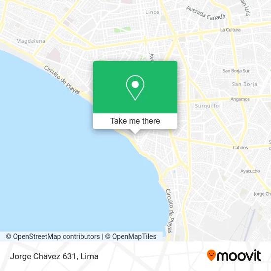
See Jorge Chavez 631, Miraflores, on the map
Public Transit to Jorge Chavez 631 in Miraflores
Wondering how to get to Jorge Chavez 631 in Miraflores? Moovit helps you find the best way to get to Jorge Chavez 631 with step-by-step directions from the nearest public transit station.
Moovit provides free maps and live directions to help you navigate through your city. View schedules, routes, timetables, and find out how long does it take to get to Jorge Chavez 631 in real time.
Looking for the nearest stop or station to Jorge Chavez 631? Check out this list of stops closest to your destination: Fanning; Jorge Chávez; Avenida 28 De Julio; 28 De Julio; Berlin; Hotel Boulevard; Pardo; Comandante Espinar; Cabitos.
Bus: 1043, 1065, 1090, 1111, 1179, 1227, 301, 1087, 1123, 336.Metro: LINEA 1.
Want to see if there’s another route that gets you there at an earlier time? Moovit helps you find alternative routes or times. Get directions from and directions to Jorge Chavez 631 easily from the Moovit App or Website.
We make riding to Jorge Chavez 631 easy, which is why over 1.5 million users, including users in Miraflores, trust Moovit as the best app for public transit. You don’t need to download an individual bus app or train app, Moovit is your all-in-one transit app that helps you find the best bus time or train time available.
For information on prices of bus, costs and ride fares to Jorge Chavez 631, please check the Moovit app.
Use the app to navigate to popular places including to the airport, hospital, stadium, grocery store, mall, coffee shop, school, college, and university.
Location: Miraflores, Lima
- Club Pacifico Sur,
- Frisancho Deza Óscar Leonidas,
- CALLE JORGE CHAVEZ 526 MIRAFLORES,
- MALECÓN CISNEROS CDRA 10,
- Punta Sal,
- tripoli,
- AV JORGE CHAVEZ MIRAFLORES,
- Cerca del Malecón Cisneros,
- Tripoli 345,
- Chancho al Palo,
- Calle Tripoli No 355,
- MARRIOT LARCO MAR,
- CALLE TRIPOLI 345 MIRAFLORES,
- Av Jorge Chavez 375 Dpto 805,
- Calle Tripoli 336,
- Calle Italia 325 Miraflores,
- Malecón Cisneros 428,
- Parque Antonio Raimondi,
- Calle Tripoli 355 Edificio Aquarium,
- Jorge Chavez 535 Miraflores
Places Near Jorge Chavez 631 (Miraflores)
- Centro Comercial Plaza Norte, Independen,
- Av. Abancay, Lima,
- Miraflores, Miraflores,
- Parque de las Leyendas, San Miguel,
- Parque Kennedy, Miraflores,
- Gamarra,
- Real Plaza Puruchuco, Ate,
- Pontificia Universidad Católica del Perú - PUCP, San Miguel,
- Aeropuerto Internacional Jorge Chávez, Ventanilla,
- Jockey Plaza, Santiago D,
- Circuito Mágico Del Agua, Lima,
- Plaza San Miguel, San Miguel,
- Larcomar, Miraflores,
- Paradero Av.Brasil,
- Barranco, Barranco,
- av arequipa, Lima,
- Av. Salaverry, Jesus Mari,
- Mall Del Sur,
- Hospital Edgardo Rebagliati Martins, Jesus Mari,
- Av. La Marina, San Miguel
How to get to popular places in Lima with public transit
Get around Miraflores by public transit!
Traveling around Miraflores has never been so easy. See step by step directions as you travel to any attraction, street or major public transit station. View bus and train schedules, arrival times, service alerts and detailed routes on a map, so you know exactly how to get to anywhere in Miraflores.
When traveling to any destination around Miraflores use Moovit's Live Directions with Get Off Notifications to know exactly where and how far to walk, how long to wait for your line, and how many stops are left. Moovit will alert you when it's time to get off — no need to constantly re-check whether yours is the next stop.
Wondering how to use public transit in Miraflores or how to pay for public transit in Miraflores? Moovit public transit app can help you navigate your way with public transit easily, and at minimum cost. It includes public transit fees, ticket prices, and costs. Looking for a map of Miraflores public transit lines? Moovit public transit app shows all public transit maps in Miraflores with all Bus, Metro and Ferry routes and stops on an interactive map.
Lima has 3 transit type(s), including: Bus, Metro and Ferry, operated by several transit agencies, including Metro de Lima Línea 2 , Metro de Lima, Corredor Rojo, Metropolitano, Metropolitano - Alimentadores, Corredor Morado, Corredor Azul, Rutas Tradicionales, Transportes y Servicios La Esperanza S.A., Las Flores S.A., Virgen de la Asunción S.A., Consorcio HAM, Transportes y Service Canadá S.A., ETUL4SA and ETUCHISA