How to get to Jose Mateus dos Santos Neto by bus?
Click on the bus route to see step by step directions with maps, line arrival times and updated time schedules.
From Aeroporto Santos Dumont, Centro
81 minFrom icarai, Niterói
59 minFrom 760D Niterói X Galeão, Niterói
42 minFrom Leme, Leme
91 minFrom PAM Neves, São Gonçalo
65 minFrom Avenida Almirante Silvio de Noronha 365, Centro
84 minFrom Urca, Urca
99 minFrom Praia Vermelha, Urca
93 minFrom Museu de Arte Contemporânea de Niterói (MAC), Niterói
47 minFrom Rua Ataíde Parreiras 266, Niterói
54 min
Bus stops near Jose Mateus dos Santos Neto in Niterói
Bus lines to Jose Mateus dos Santos Neto in Niterói
What are the closest stations to Jose Mateus dos Santos Neto?
The closest stations to Jose Mateus dos Santos Neto are:
- Avenida Raul De Oliveira Rodrigues 859 Piratininga Niterói - Rj 24350-630 Brasil is 153 meters away, 3 min walk.
- Avenida Doutor Raul De Oliveira Rodrigues, 517 is 157 meters away, 3 min walk.
Which bus lines stop near Jose Mateus dos Santos Neto?
These bus lines stop near Jose Mateus dos Santos Neto: 39A, 770D, OC1, OC2, OC3.
What’s the nearest bus station to Jose Mateus dos Santos Neto in Niterói?
The nearest bus stations to Jose Mateus dos Santos Neto in Niterói are Avenida Raul De Oliveira Rodrigues 859 Piratininga Niterói - Rj 24350-630 Brasil and Avenida Doutor Raul De Oliveira Rodrigues, 517. The closest one is a 3 min walk away.
What time is the first bus to Jose Mateus dos Santos Neto in Niterói?
The 39A is the first bus that goes to Jose Mateus dos Santos Neto in Niterói. It stops nearby at 3:11 AM.
What time is the last bus to Jose Mateus dos Santos Neto in Niterói?
The 39A is the last bus that goes to Jose Mateus dos Santos Neto in Niterói. It stops nearby at 2:47 AM.
What time is the first ferry to Jose Mateus dos Santos Neto in Niterói?
The CHARITAS - PRAÇA XV is the first ferry that goes to Jose Mateus dos Santos Neto in Niterói. It stops nearby at 6:30 AM.
What time is the last ferry to Jose Mateus dos Santos Neto in Niterói?
The CHARITAS - PRAÇA XV is the last ferry that goes to Jose Mateus dos Santos Neto in Niterói. It stops nearby at 9:20 PM.
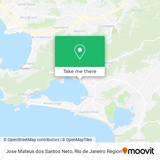
See Jose Mateus dos Santos Neto, Niterói, on the map
Public Transit to Jose Mateus dos Santos Neto in Niterói
Wondering how to get to Jose Mateus dos Santos Neto in Niterói? Moovit helps you find the best way to get to Jose Mateus dos Santos Neto with step-by-step directions from the nearest public transit station.
Moovit provides free maps and live directions to help you navigate through your city. View schedules, routes, timetables, and find out how long does it take to get to Jose Mateus dos Santos Neto in real time.
Looking for the nearest stop or station to Jose Mateus dos Santos Neto? Check out this list of stops closest to your destination: Avenida Raul De Oliveira Rodrigues 859 Piratininga Niterói - Rj 24350-630 Brasil; Avenida Doutor Raul De Oliveira Rodrigues.
Bus: 39A, 770D, OC1, OC2, OC3, 1910D (EXECUTIVO), 55A.
Want to see if there’s another route that gets you there at an earlier time? Moovit helps you find alternative routes or times. Get directions from and directions to Jose Mateus dos Santos Neto easily from the Moovit App or Website.
We make riding to Jose Mateus dos Santos Neto easy, which is why over 1.5 million users, including users in Niterói, trust Moovit as the best app for public transit. You don’t need to download an individual bus app or train app, Moovit is your all-in-one transit app that helps you find the best bus time or train time available.
For information on prices of bus, costs and ride fares to Jose Mateus dos Santos Neto, please check the Moovit app.
Use the app to navigate to popular places including to the airport, hospital, stadium, grocery store, mall, coffee shop, school, college, and university.
Jose Mateus dos Santos Neto Address: Rua Doutor Juvenal Laranja, 17 Piratininga Niterói-RJ 24350-095 street in Niterói
- Rua Juvenal Laranja,
- Estação Plim Plim Creche Escola,
- Avenida Raul de Oliveira Rodrigues, 800,
- Rua Doutor Paulo Gouvêia,
- Distribuidora de Agua Serra dos Orgãos,
- Escola Especial Crescer,
- Shopping Oasis,
- Rua Dr. Dioscoro Maia Vilela, 28,
- Rua Altamiro de Castro, 4,
- Rua Doutor Gérson Gonçalves,
- Sorvetes Moleka,
- Colégio ph Piratininga,
- Colégio e Curso pH,
- Castekinho Creche Escola,
- Rua Raul de Oliveira Rodrigues,
- Piratininga,
- Rua Doutor Salomão Vergueiro da Cruz,
- Rua Rubem Risemberg,
- Colégio Salesiano Região Oceânica,
- Rua Américo Alves da Costa
Places Near Jose Mateus dos Santos Neto (Niterói)
- Rio De Janeiro,
- Hospital Municipal Ronaldo Gazolla, Acari,
- Museu Do Amanhã, Centro,
- Shopping Nova América, Del Castilho,
- Rua Licínio Cardoso, São Francisco Xavier,
- Rua Ulysses Guimarães 16, Cidade Nova,
- Avenida Venezuela 134, Saúde,
- Hospital Federal Do Andaraí, Andaraí,
- Feirão De Malhas, Duque De Caxias,
- Shopping Downtown, Barra Da Tijuca,
- Avenida Rio Branco, Centro,
- Niterói, Niterói,
- Shopping Rio Sul, Botafogo,
- Hospital Federal Cardoso Fontes, Jacarepaguá,
- Hospital Pedro Ernesto, Vila Isabel,
- Rodoviária Novo Rio (Rodoviária do Rio de Janeiro), Santo Cristo,
- Shopping RioSul, Botafogo,
- Feira Livre da Gloria, Glória,
- Norte Shopping, Cachambi,
- Praia do Arpoador, Ipanema
How to get to popular places in Rio de Janeiro Region with public transit
Get around Niterói by public transit!
Traveling around Niterói has never been so easy. See step by step directions as you travel to any attraction, street or major public transit station. View bus and train schedules, arrival times, service alerts and detailed routes on a map, so you know exactly how to get to anywhere in Niterói.
When traveling to any destination around Niterói use Moovit's Live Directions with Get Off Notifications to know exactly where and how far to walk, how long to wait for your line, and how many stops are left. Moovit will alert you when it's time to get off — no need to constantly re-check whether yours is the next stop.
Wondering how to use public transit in Niterói or how to pay for public transit in Niterói? Moovit public transit app can help you navigate your way with public transit easily, and at minimum cost. It includes public transit fees, ticket prices, and costs. Looking for a map of Niterói public transit lines? Moovit public transit app shows all public transit maps in Niterói with all Bus, Train, Metro, Light Rail, Ferry, Cable Car, Gondola and Funicular routes and stops on an interactive map.
Rio de Janeiro Region has 8 transit type(s), including: Bus, Train, Metro, Light Rail, Ferry, Cable Car, Gondola and Funicular, operated by several transit agencies, including TrensRJ, Metrô Rio, VLT Carioca, Barcas Rio, BRT MOBI-Rio, Auto Viação Alpha, Auto Viação Tijuca, Gire Transportes, Transurb, Viação Nossa Senhora das Graças, Consórcio INTERSUL, Braso Lisboa (Municipal), Caprichosa Auto Ônibus, Auto Viação Três Amigos and Rodoviária Âncora Matias