How to get to Jovem Jeans by bus?
Click on the bus route to see step by step directions with maps, line arrival times and updated time schedules.
From Guanabara, Barra Da Tijuca
18 minFrom Rua Humaitá 275, Lagoa
24 minFrom Hospital Paster, Méier
67 minFrom Via Parque, Barra Da Tijuca
43 minFrom Avenida das Américas 1650, Barra Da Tijuca
33 minFrom BRT - Estação Riviera, Barra Da Tijuca
29 minFrom Terminal Rodoviário Américo Ayres, Méier
62 minFrom Tijuca Tênis Clube, Tijuca
51 minFrom Cidade Nova, Cidade Nova
44 minFrom Rua Licínio Cardoso, São Francisco Xavier
56 min
How to get to Jovem Jeans by metro?
Click on the metro route to see step by step directions with maps, line arrival times and updated time schedules.
Bus stops near Jovem Jeans in Rocinha
Metro station near Jovem Jeans in Rocinha
- São Conrado, 7 min walk,VIEW
Bus lines to Jovem Jeans in Rocinha
- 536, Leme,VIEW
- 539, São Conrado,VIEW
- VAN 2101, Circular Via Vidigal / Copacabana / Rocinha,VIEW
- VAN 2102, Circular Via Rocinha / Vidigal,VIEW
- 104, São Conrado,VIEW
- 109, São Conrado (Reversível),VIEW
- LECD129, Central,VIEW
- LECD137, Central,VIEW
- 550, Gávea,VIEW
- SN 550, Cidade de Deus (Feira Livre),VIEW
- 552, Alvorada,VIEW
- 553, Recreio,VIEW
- 554, Piabas (Via Barata Ribeiro / Bartolomeu Mitre),VIEW
- 555, Rio das Pedras,VIEW
- 557, Rio das Pedras (via Floresta / Pinheiro),VIEW
- 558, Cidade De Deus,VIEW
- 565, Tanque (Feira Livre),VIEW
- SN 565, Gávea (Feira Livre),VIEW
- 785D, Charitas,VIEW
- 1785D (EXECUTIVO), Charitas,VIEW
What are the closest stations to Jovem Jeans?
The closest stations to Jovem Jeans are:
- Estrada Da Gávea, 438-448 is 41 meters away, 1 min walk.
- Estrada Da Gávea, 515a is 41 meters away, 1 min walk.
- Mercado Popular Da Rocinha is 425 meters away, 6 min walk.
- São Conrado is 469 meters away, 7 min walk.
- Metrô São Conrado | Largo Da Macumba is 491 meters away, 7 min walk.
- 11° Delegacia De Polícia Da Rocinha is 658 meters away, 9 min walk.
Which bus lines stop near Jovem Jeans?
These bus lines stop near Jovem Jeans: 104, 538, 539, 548, 565, VAN 2101.
Which metro line stops near Jovem Jeans?
L1, L4 (Jardim Oceânico)
What’s the nearest metro station to Jovem Jeans in Rocinha?
The nearest metro station to Jovem Jeans in Rocinha is São Conrado. It’s a 7 min walk away.
What’s the nearest bus station to Jovem Jeans in Rocinha?
The nearest bus stations to Jovem Jeans in Rocinha are Estrada Da Gávea, 438-448 and Estrada Da Gávea, 515a. The closest one is a 1 min walk away.
What time is the first metro to Jovem Jeans in Rocinha?
The L1, L4 is the first metro that goes to Jovem Jeans in Rocinha. It stops nearby at 5:04 AM.
What time is the last metro to Jovem Jeans in Rocinha?
The L1, L4 is the last metro that goes to Jovem Jeans in Rocinha. It stops nearby at 12:38 AM.
What time is the first bus to Jovem Jeans in Rocinha?
The SN 538 is the first bus that goes to Jovem Jeans in Rocinha. It stops nearby at 3:01 AM.
What time is the last bus to Jovem Jeans in Rocinha?
The 309 is the last bus that goes to Jovem Jeans in Rocinha. It stops nearby at 3:37 AM.
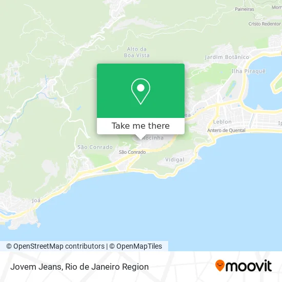
See Jovem Jeans, Rocinha, on the map
Public Transit to Jovem Jeans in Rocinha
Wondering how to get to Jovem Jeans in Rocinha? Moovit helps you find the best way to get to Jovem Jeans with step-by-step directions from the nearest public transit station.
Moovit provides free maps and live directions to help you navigate through your city. View schedules, routes, timetables, and find out how long does it take to get to Jovem Jeans in real time.
Looking for the nearest stop or station to Jovem Jeans? Check out this list of stops closest to your destination: Estrada Da Gávea; Estrada Da Gávea; Mercado Popular Da Rocinha; São Conrado; Metrô São Conrado | Largo Da Macumba; 11° Delegacia De Polícia Da Rocinha.
Bus: 104, 538, 539, 548, 565, VAN 2101, 536, VAN 2102, 109, LECD129, LECD137, 550, 448, SPA 550, SN 554, 2337, SPB 550.Metro: L1, L4.
Want to see if there’s another route that gets you there at an earlier time? Moovit helps you find alternative routes or times. Get directions from and directions to Jovem Jeans easily from the Moovit App or Website.
We make riding to Jovem Jeans easy, which is why over 1.5 million users, including users in Rocinha, trust Moovit as the best app for public transit. You don’t need to download an individual bus app or train app, Moovit is your all-in-one transit app that helps you find the best bus time or train time available.
For information on prices of bus and metro, costs and ride fares to Jovem Jeans, please check the Moovit app.
Use the app to navigate to popular places including to the airport, hospital, stadium, grocery store, mall, coffee shop, school, college, and university.
Jovem Jeans Address: Estrada da Gávea, 523 Rocinha Rio de Janeiro-RJ 22451-271 street in Rocinha
- Passarela Bar,
- Cpi - Clinica Por Imagem,
- UPA Rocinha,
- Praça Da Upa,
- Escola Municipal Luiz Paulo Horta,
- Sanca Beach,
- UPA 24h Rocinha,
- CF Maria Do Socorro,
- Estrada da Gávea 522,
- The Voice Rocinha,
- Liberty Rocinha Multimarcas,
- Creche Pre Escola Comunitaria do 199 Pingo de Gente,
- Curva do S - Rocinha,
- Óticas Zero12,
- Estrada da Gávea / Travessa Escada do Bairro Barcelos,
- C4 Biblioteca Parque da Rocinha,
- Caps Maria Do Socorro - Rocinha,
- Jardim Escolar Abc,
- Eletricista,
- Biel Express
Places Near Jovem Jeans (Rocinha)
- Hospital Federal Do Andaraí, Andaraí,
- Hospital Municipal Ronaldo Gazolla, Acari,
- Rua Licínio Cardoso, São Francisco Xavier,
- Avenida Rio Branco, Centro,
- Praia do Arpoador, Ipanema,
- Hospital Federal Cardoso Fontes, Jacarepaguá,
- Shopping Nova América, Del Castilho,
- Museu Do Amanhã, Centro,
- Rio De Janeiro,
- Niterói, Niterói,
- Hospital Pedro Ernesto, Vila Isabel,
- Norte Shopping, Cachambi,
- Rodoviária Novo Rio (Rodoviária do Rio de Janeiro), Santo Cristo,
- Rua Ulysses Guimarães 16, Cidade Nova,
- Avenida Venezuela 134, Saúde,
- Feira Livre da Gloria, Glória,
- Shopping RioSul, Botafogo,
- Feirão De Malhas, Duque De Caxias,
- Shopping Rio Sul, Botafogo,
- Shopping Downtown, Barra Da Tijuca
How to get to popular places in Rio de Janeiro Region with public transit
Get around Rocinha by public transit!
Traveling around Rocinha has never been so easy. See step by step directions as you travel to any attraction, street or major public transit station. View bus and train schedules, arrival times, service alerts and detailed routes on a map, so you know exactly how to get to anywhere in Rocinha.
When traveling to any destination around Rocinha use Moovit's Live Directions with Get Off Notifications to know exactly where and how far to walk, how long to wait for your line, and how many stops are left. Moovit will alert you when it's time to get off — no need to constantly re-check whether yours is the next stop.
Wondering how to use public transit in Rocinha or how to pay for public transit in Rocinha? Moovit public transit app can help you navigate your way with public transit easily, and at minimum cost. It includes public transit fees, ticket prices, and costs. Looking for a map of Rocinha public transit lines? Moovit public transit app shows all public transit maps in Rocinha with all Bus, Train, Metro, Light Rail, Ferry, Cable Car, Gondola and Funicular routes and stops on an interactive map.
Rio de Janeiro Region has 8 transit type(s), including: Bus, Train, Metro, Light Rail, Ferry, Cable Car, Gondola and Funicular, operated by several transit agencies, including TrensRJ, Metrô Rio, VLT Carioca, Barcas Rio, BRT MOBI-Rio, Auto Viação Alpha, Auto Viação Tijuca, Gire Transportes, Transurb, Viação Nossa Senhora das Graças, Consórcio INTERSUL, Braso Lisboa (Municipal), Caprichosa Auto Ônibus, Auto Viação Três Amigos and Rodoviária Âncora Matias
Public transit lines with stations closest to Jovem Jeans in Rocinha
Metro lines with stations closest to Jovem Jeans in Rocinha
Bus lines with stations closest to Jovem Jeans in Rocinha
Mercado Popular Da Rocinha
 104Terminal Gentileza - São Conrado (Brs 1 - Via Copacabana / Niemeyer)
- 109LECD131 - Terminal Gentileza - São Conrado (Via Santa Bárbara / Jardim Botânico)
- LECD129319 - Central - Terminal Alvorada (via Av. Américas / Túnel Santa Bárbara)
- LECD137SV319 - Terminal Alvorada - Central (via Av. Américas / Praia do Flamengo)
- 550Cidade de Deus - Gávea (via Rio das Pedras)