How to get to Jp Gisele by bus?
Click on the bus route to see step by step directions with maps, line arrival times and updated time schedules.
From Praia da Barra da Tijuca, Barra Da Tijuca
42 minFrom Hospital Federal Cardoso Fontes, Jacarepaguá
46 minFrom Terminal Alvorada - BRT, Barra Da Tijuca
29 minFrom BRT - Estação Benvindo de Novaes, Recreio Dos Bandeirantes
27 minFrom Estrada Intendente Magalhães, Bento Ribeiro
34 minFrom UPA Madureira, Madureira
27 minFrom Realengo, Realengo
38 minFrom Guanabara, Barra Da Tijuca
58 minFrom Estação Ricardo Marinho, Barra Da Tijuca
36 min
Bus stops near Jp Gisele in Jacarepaguá
Bus lines to Jp Gisele in Jacarepaguá
- 35, Alvorada (via Morro do Outeiro - Saída Manaceia),VIEW
- 41, Paulo Da Portela (Expresso),VIEW
- 51, Terminal Recreio (Parador - Noturno),VIEW
- 52, Deodoro (Parador),VIEW
- 407T, Nova Iguaçu,VIEW
- SC460S, Itaguaí,VIEW
- 352, Rio Das Pedras → Riocentro,VIEW
- 613, Vargem Grande,VIEW
- SPA 613, Riocentro,VIEW
- 881, Taquara,VIEW
- 961, Recreio,VIEW
- 348, Riocentro - Candelária (Brs 5 - Via Linha Amarela),VIEW
- 368, Riocentro - Candelária (Brs 5 - Via Maracanã),VIEW
- SN 368, Riocentro - Candelária (BRS 5 - via Maracanã),VIEW
- 611, Riocentro - Nova América / Del Castilho (Via Merck / Linha Amarela - Integração Com Metrô),VIEW
- 810, Taquara - Pontal (Via César Maia),VIEW
- SN 810, Taquara - Pontal (Via Estrada do Guerenguê),VIEW
- SP 810, Taquara - Vargem Grande (Via César Maia),VIEW
- 954, Taquara - Recreio (via Benvindo de Novaes),VIEW
What are the closest stations to Jp Gisele?
The closest stations to Jp Gisele are:
- Asa Branca is 174 meters away, 3 min walk.
- Av. Salvador Allende | Asa Branca is 248 meters away, 4 min walk.
- Avenida Salvador Allende | Asa Branca is 316 meters away, 5 min walk.
- Estrada Dos Bandeirantes | Drogaria Pacheco (Curicica) is 389 meters away, 6 min walk.
Which bus lines stop near Jp Gisele?
These bus lines stop near Jp Gisele: 407T, 41, 51, 52, 881.
What’s the nearest bus station to Jp Gisele in Jacarepaguá?
The nearest bus station to Jp Gisele in Jacarepaguá is Asa Branca. It’s a 3 min walk away.
What time is the first bus to Jp Gisele in Jacarepaguá?
The 368 is the first bus that goes to Jp Gisele in Jacarepaguá. It stops nearby at 3:09 AM.
What time is the last bus to Jp Gisele in Jacarepaguá?
The SN 368 is the last bus that goes to Jp Gisele in Jacarepaguá. It stops nearby at 3:52 AM.
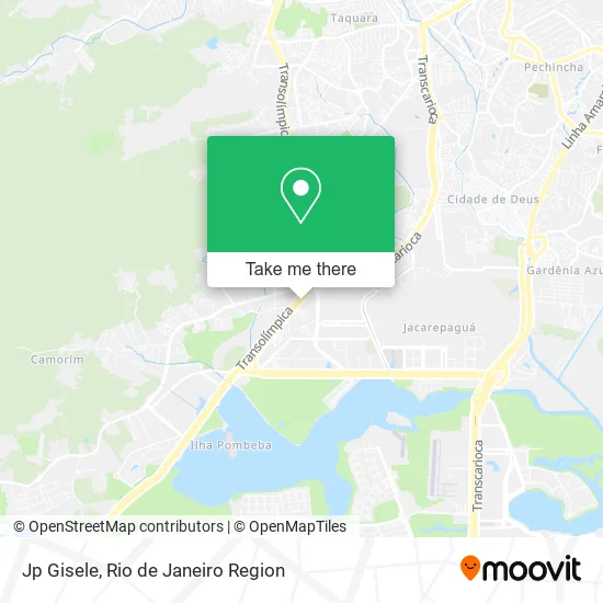
See Jp Gisele, Jacarepaguá, on the map
Public Transit to Jp Gisele in Jacarepaguá
Wondering how to get to Jp Gisele in Jacarepaguá? Moovit helps you find the best way to get to Jp Gisele with step-by-step directions from the nearest public transit station.
Moovit provides free maps and live directions to help you navigate through your city. View schedules, routes, timetables, and find out how long does it take to get to Jp Gisele in real time.
Looking for the nearest stop or station to Jp Gisele? Check out this list of stops closest to your destination: Asa Branca; Av. Salvador Allende | Asa Branca; Avenida Salvador Allende | Asa Branca; Estrada Dos Bandeirantes | Drogaria Pacheco (Curicica).
Bus: 407T, 41, 51, 52, 881, 35, SC460S, 352, 613, SPA 613, 961, 348, 368, SN 368, 611, 810.
Want to see if there’s another route that gets you there at an earlier time? Moovit helps you find alternative routes or times. Get directions from and directions to Jp Gisele easily from the Moovit App or Website.
We make riding to Jp Gisele easy, which is why over 1.5 million users, including users in Jacarepaguá, trust Moovit as the best app for public transit. You don’t need to download an individual bus app or train app, Moovit is your all-in-one transit app that helps you find the best bus time or train time available.
For information on prices of bus, costs and ride fares to Jp Gisele, please check the Moovit app.
Use the app to navigate to popular places including to the airport, hospital, stadium, grocery store, mall, coffee shop, school, college, and university.
Jp Gisele Address: Avenida Salvador Allende, 4716 Jacarepaguá Rio de Janeiro-RJ 22780-160 street in Jacarepaguá
- Andreia Righetti Refeicoes,
- Avenida Salvador Allende / Rua A,
- Distribuidora de Cimento Pioneira 40,
- Floractos Plantas e Vasos,
- Acassia Pereira Coiffeur,
- BRT - Estação Asa Branca,
- A Sua Farmácia E Você (Curicica),
- BRT Transolímpica - Estação Asa Branca,
- Avenida Salvador Allende / Rua do Comércio,
- Rua do Comércio / Rua Nova Asa Branca,
- Avenida Salvador Allende / Rua Nova Asa Branca,
- Motel Girassol,
- Rua Sena / Rua Nova Asa Branca,
- Clinica Odontológica e Radiológica Aliança,
- Rua Asa Branca,
- Estrada dos Bandeirantes 5545,
- Food Emporium Comercio de Alimentos,
- Avenida Salvador Allende 4700,
- Asa Branca Curicica,
- Motel Girassol Ltda
Places Near Jp Gisele (Jacarepaguá)
- Hospital Municipal Ronaldo Gazolla, Acari,
- Avenida Venezuela 134, Saúde,
- Rua Licínio Cardoso, São Francisco Xavier,
- Avenida Rio Branco, Centro,
- Praia do Arpoador, Ipanema,
- Rodoviária Novo Rio (Rodoviária do Rio de Janeiro), Santo Cristo,
- Shopping RioSul, Botafogo,
- Hospital Federal Cardoso Fontes, Jacarepaguá,
- Shopping Downtown, Barra Da Tijuca,
- Feirão De Malhas, Duque De Caxias,
- Rua Ulysses Guimarães 16, Cidade Nova,
- Shopping Nova América, Del Castilho,
- Norte Shopping, Cachambi,
- Rio De Janeiro,
- Shopping Rio Sul, Botafogo,
- Niterói, Niterói,
- Museu Do Amanhã, Centro,
- Hospital Federal Do Andaraí, Andaraí,
- Hospital Pedro Ernesto, Vila Isabel,
- Feira Livre da Gloria, Glória
How to get to popular places in Rio de Janeiro Region with public transit
Get around Jacarepaguá by public transit!
Traveling around Jacarepaguá has never been so easy. See step by step directions as you travel to any attraction, street or major public transit station. View bus and train schedules, arrival times, service alerts and detailed routes on a map, so you know exactly how to get to anywhere in Jacarepaguá.
When traveling to any destination around Jacarepaguá use Moovit's Live Directions with Get Off Notifications to know exactly where and how far to walk, how long to wait for your line, and how many stops are left. Moovit will alert you when it's time to get off — no need to constantly re-check whether yours is the next stop.
Wondering how to use public transit in Jacarepaguá or how to pay for public transit in Jacarepaguá? Moovit public transit app can help you navigate your way with public transit easily, and at minimum cost. It includes public transit fees, ticket prices, and costs. Looking for a map of Jacarepaguá public transit lines? Moovit public transit app shows all public transit maps in Jacarepaguá with all Bus, Train, Metro, Light Rail, Ferry, Cable Car, Gondola and Funicular routes and stops on an interactive map.
Rio de Janeiro Region has 8 transit type(s), including: Bus, Train, Metro, Light Rail, Ferry, Cable Car, Gondola and Funicular, operated by several transit agencies, including TrensRJ, Metrô Rio, VLT Carioca, Barcas Rio, BRT MOBI-Rio, Auto Viação Alpha, Auto Viação Tijuca, Gire Transportes, Transurb, Viação Nossa Senhora das Graças, Consórcio INTERSUL, Braso Lisboa (Municipal), Caprichosa Auto Ônibus, Auto Viação Três Amigos and Rodoviária Âncora Matias