How to get to Jpi by bus?
Click on the bus route to see step by step directions with maps, line arrival times and updated time schedules.
From Estrada da Posse, Campo Grande
34 minFrom Rua Alfredo de Morais, Campo Grande
32 minFrom CS 32 - Vila Militar alistamento, Deodoro
35 minFrom Rua Aracaju, Campo Grande
28 minFrom BRT - Estação Boiuna, Taquara
38 minFrom Avenida Marechal Fontenelle, Campo Dos Afonsos
47 minFrom Estrada do Lameirão Pequeno, Campo Grande
41 minFrom Rua Aurélio de Figueiredo 40, Campo Grande
20 minFrom Linha 458S - Campo Grande / Itaguaí (Via Palmares), Campo Grande
32 minFrom Praça Saiqui, Vila Valqueire
53 min
How to get to Jpi by train?
Click on the train route to see step by step directions with maps, line arrival times and updated time schedules.
Bus stops near Jpi in Bangu
Train station near Jpi in Bangu
- Realengo, 29 min walk,VIEW
Bus lines to Jpi in Bangu
- 369, Bangu - Candelária (Brs 5 - Expresso),VIEW
- SP 389, Vila Aliança - Terminal Deodoro (via Bangu),VIEW
- 397, Terminal Campo Grande - Candelária (Brs 5 - Via Bangu - Parador),VIEW
- SN 397, Terminal Campo Grande - Candelária (via Bangu / Terminal Deodoro),VIEW
- SR 397, Terminal Campo Grande - Candelária (Brs 5 - Expresso - Via Bangu),VIEW
- 731, Campo Grande - Marechal Hermes (via Vila Aliança),VIEW
- SN 731, Campo Grande - Marechal Hermes (via Vila Aliança / Terminal Deodoro),VIEW
- 819, Jardim Bangu - Bangu,VIEW
- 2310, Bangu - Candelária (Brs 5 - Expresso - Via Av. Min. Ary Franco),VIEW
- 812, Carobinha,VIEW
- 424D, Alcântara (Via Porto Velho),VIEW
- 737, Cascadura,VIEW
- 743, Sulacap ↔ Bangu,VIEW
- 788, Campo Grande,VIEW
- 926, Penha,VIEW
- 741, Sulacap ↔ Bangu (Circular),VIEW
What are the closest stations to Jpi?
The closest stations to Jpi are:
- Avenida Ministro Ary Franco, 242 is 53 meters away, 2 min walk.
- Avenida Ministro Ary Franco, 227 is 53 meters away, 2 min walk.
- Rua Sul América, 1878 is 167 meters away, 3 min walk.
- Rua Da Chita, 206 is 272 meters away, 4 min walk.
- Realengo is 2229 meters away, 29 min walk.
Which bus lines stop near Jpi?
These bus lines stop near Jpi: 397, 731, 737, 745, 803.
Which train line stops near Jpi?
RAMAL SANTA CRUZ (Central Do Brasil (Expresso))
What’s the nearest train station to Jpi in Bangu?
The nearest train station to Jpi in Bangu is Realengo. It’s a 29 min walk away.
What’s the nearest bus station to Jpi in Bangu?
The nearest bus stations to Jpi in Bangu are Avenida Ministro Ary Franco, 242 and Avenida Ministro Ary Franco, 227. The closest one is a 2 min walk away.
What time is the first train to Jpi in Bangu?
The RAMAL SANTA CRUZ is the first train that goes to Jpi in Bangu. It stops nearby at 4:25 AM.
What time is the last train to Jpi in Bangu?
The RAMAL SANTA CRUZ is the last train that goes to Jpi in Bangu. It stops nearby at 11:27 PM.
What time is the first bus to Jpi in Bangu?
The 397 is the first bus that goes to Jpi in Bangu. It stops nearby at 3:00 AM.
What time is the last bus to Jpi in Bangu?
The 397 is the last bus that goes to Jpi in Bangu. It stops nearby at 4:00 AM.
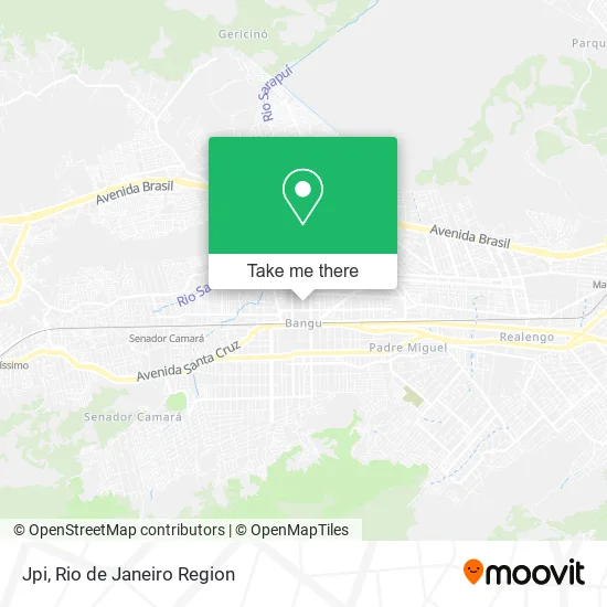
See Jpi, Bangu, on the map
Public Transit to Jpi in Bangu
Wondering how to get to Jpi in Bangu? Moovit helps you find the best way to get to Jpi with step-by-step directions from the nearest public transit station.
Moovit provides free maps and live directions to help you navigate through your city. View schedules, routes, timetables, and find out how long does it take to get to Jpi in real time.
Looking for the nearest stop or station to Jpi? Check out this list of stops closest to your destination: Avenida Ministro Ary Franco; Avenida Ministro Ary Franco; Rua Sul América; Rua Da Chita; Realengo.
Bus: 397, 731, 737, 745, 803, 369, SP 389, SN 397, SR 397, 812, 424D, 743, 788, 926, 741.Train: RAMAL SANTA CRUZ.
Want to see if there’s another route that gets you there at an earlier time? Moovit helps you find alternative routes or times. Get directions from and directions to Jpi easily from the Moovit App or Website.
We make riding to Jpi easy, which is why over 1.5 million users, including users in Bangu, trust Moovit as the best app for public transit. You don’t need to download an individual bus app or train app, Moovit is your all-in-one transit app that helps you find the best bus time or train time available.
For information on prices of bus and train, costs and ride fares to Jpi, please check the Moovit app.
Use the app to navigate to popular places including to the airport, hospital, stadium, grocery store, mall, coffee shop, school, college, and university.
Jpi Address: Avenida Ministro Ari Franco, Bangu Rio de Janeiro-RJ 21862-005 street in Bangu
- Cs Refrigeracao,
- Brilho dos Cabelos Bangu,
- Secretaria Municipal de Obras,
- Estacionamento Ari Franco,
- Farmácia Pague Menos,
- Guimarães, Francisco N,
- Mgcred Bangu,
- CCAA,
- PA Avenida Ministro Ary Franco - Urb Rio de Janeiro / , RJ,
- Banco Bradesco,
- Luan Giovane Silva,
- Lvf Consultoria e Terceirizacao Em Departamento Pessoal,
- Luiz Soares,
- Refrigeracao Friolar,
- Auto Pecas Bangoim,
- Ana Cristina Moreira da Silva,
- MTE - Ministério do trabalho e emprego,
- Michelle Luiza Cortez Gonin,
- Dany Porto,
- Azw Transportes
Places Near Jpi (Bangu)
- Norte Shopping, Cachambi,
- Hospital Federal Cardoso Fontes, Jacarepaguá,
- Hospital Federal Do Andaraí, Andaraí,
- Shopping Downtown, Barra Da Tijuca,
- Hospital Pedro Ernesto, Vila Isabel,
- Niterói, Niterói,
- Museu Do Amanhã, Centro,
- Hospital Municipal Ronaldo Gazolla, Acari,
- Avenida Venezuela 134, Saúde,
- Rua Licínio Cardoso, São Francisco Xavier,
- Feirão De Malhas, Duque De Caxias,
- Shopping Nova América, Del Castilho,
- Rua Ulysses Guimarães 16, Cidade Nova,
- Feira Livre da Gloria, Glória,
- Avenida Rio Branco, Centro,
- Praia do Arpoador, Ipanema,
- Shopping RioSul, Botafogo,
- Rio De Janeiro,
- Shopping Rio Sul, Botafogo,
- Rodoviária Novo Rio (Rodoviária do Rio de Janeiro), Santo Cristo
How to get to popular places in Rio de Janeiro Region with public transit
Get around Bangu by public transit!
Traveling around Bangu has never been so easy. See step by step directions as you travel to any attraction, street or major public transit station. View bus and train schedules, arrival times, service alerts and detailed routes on a map, so you know exactly how to get to anywhere in Bangu.
When traveling to any destination around Bangu use Moovit's Live Directions with Get Off Notifications to know exactly where and how far to walk, how long to wait for your line, and how many stops are left. Moovit will alert you when it's time to get off — no need to constantly re-check whether yours is the next stop.
Wondering how to use public transit in Bangu or how to pay for public transit in Bangu? Moovit public transit app can help you navigate your way with public transit easily, and at minimum cost. It includes public transit fees, ticket prices, and costs. Looking for a map of Bangu public transit lines? Moovit public transit app shows all public transit maps in Bangu with all Bus, Train, Metro, Light Rail, Ferry, Cable Car, Gondola and Funicular routes and stops on an interactive map.
Rio de Janeiro Region has 8 transit type(s), including: Bus, Train, Metro, Light Rail, Ferry, Cable Car, Gondola and Funicular, operated by several transit agencies, including TrensRJ, Metrô Rio, VLT Carioca, Barcas Rio, BRT MOBI-Rio, Auto Viação Alpha, Auto Viação Tijuca, Gire Transportes, Transurb, Viação Nossa Senhora das Graças, Consórcio INTERSUL, Braso Lisboa (Municipal), Caprichosa Auto Ônibus, Auto Viação Três Amigos and Rodoviária Âncora Matias
Public transit lines with stations closest to Jpi in Bangu
Train lines with stations closest to Jpi in Bangu
Bus lines with stations closest to Jpi in Bangu
Avenida Ministro Ary Franco, 242
 369Bangu - Candelária (Brs 5 - Expresso)
- SP 389Vila Aliança - Terminal Deodoro (via Bangu)
- 397Terminal Campo Grande - Candelária (Brs 5 - Via Bangu - Parador)
- SN 397Terminal Campo Grande - Candelária (via Bangu / Terminal Deodoro)
- SR 397Terminal Campo Grande - Candelária (Brs 5 - Expresso - Via Bangu)